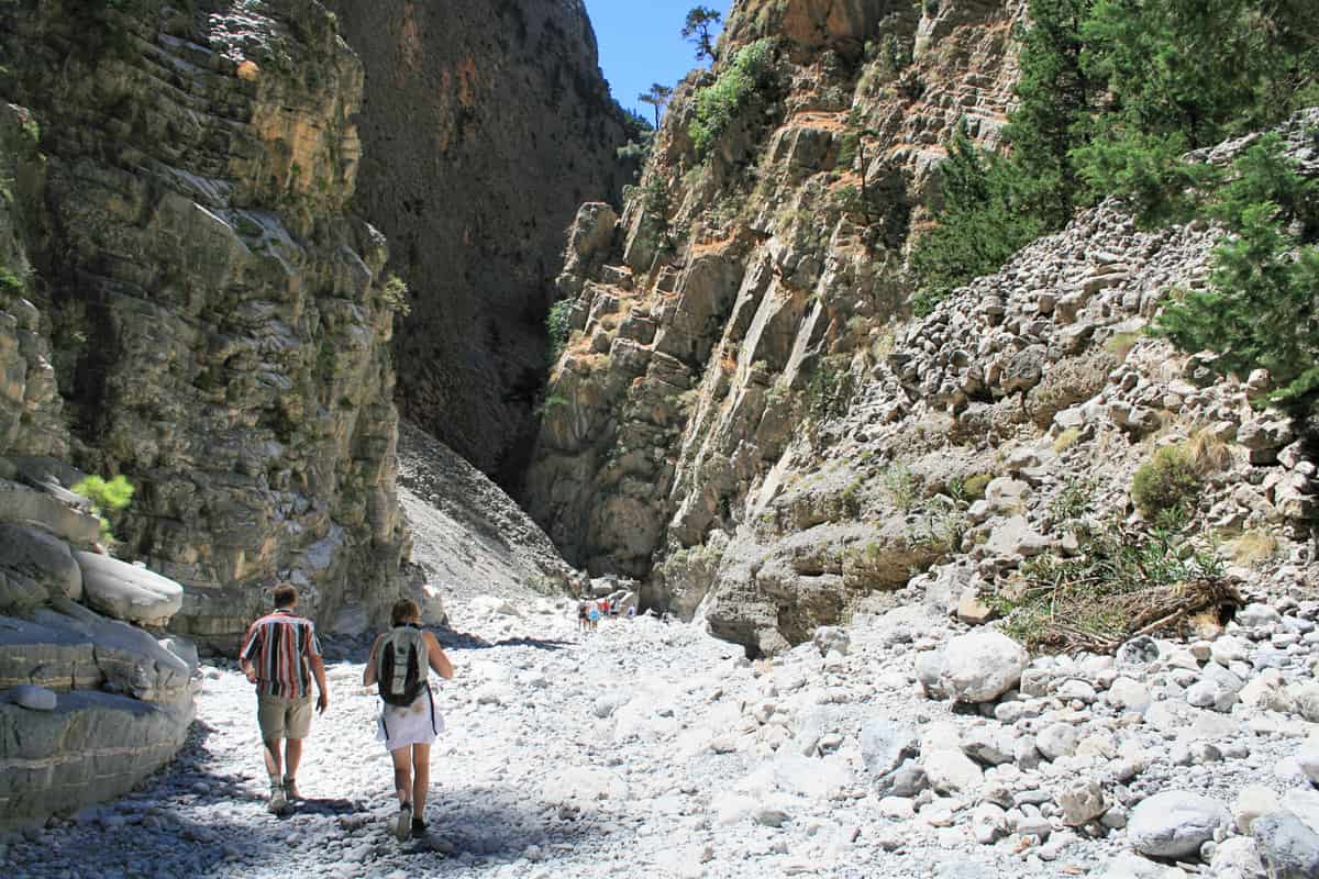
A Samaria Gorge tour walks down the long gorge in the White Mountains of south-west Crete, from the Omalos plateau to the village of Agia Roumeli on the Libyan Sea. This post covers what a Samaria Gorge tour includes, the start at Xyloskalo, the way down, the abandoned village, the Iron Gates, the wildlife, Agia Roumeli, the boat along the coast, the history, how hard the walk is and the best season. More Greece tours are listed on the Greece VIP homepage.
Each section ends with a Samaria Gorge tour that can be booked online.
What does a Samaria Gorge tour cover?
A Samaria Gorge tour covers a 16 km gorge in the White Mountains of south-west Crete, from the northern entrance at 1,250 m down to Agia Roumeli on the Libyan Sea, inside a national park that also holds international protected status.
The gorge sits in the regional unit of Chania. It lies in the White Mountains, called Lefka Ori in Greek, a range that occupies a large part of central West Crete. The range holds over 30 summits above 2,000 m, and its highest point, Pachnes, reaches 2,453 m. The Lefka Ori contain about 50 gorges, and a Samaria Gorge tour visits the best known of them.
Two lengths appear for the gorge, 16 km and 18 km. The gorge itself measures 16 km, from the northern entrance to the shore of the Libyan Sea at Agia Roumeli. The 18 km figure is the distance from the settlement of Omalos, on the northern side of the plateau, to Agia Roumeli. The route inside Samaria National Park is 13 km long. The park exit lies 2 km short of Agia Roumeli, so a Samaria Gorge tour covers 15 km on foot.
The gorge became a national park of Greece in 1962. In 1981 the Gorge of Samaria joined the World Network of Biosphere Reserves under the UNESCO Man and the Biosphere Programme. The park also holds the European Diploma of Protected Areas, listed as the Cretan White Mountains National Park (Samaria). The Council of Europe grants this diploma to protected areas of exceptional European conservation interest, for five years at a time, with renewal possible. Every Samaria Gorge tour crosses land under three layers of protection.
The gorge ranks as a major tourist attraction of Crete. An organised Samaria Gorge tour includes bus transport from the hotel to the entrance near Omalos village. At the far end, a bus connection waits for walkers once the ferry lands at Sougia or Chora Sfakion. The Crete Mediterranean forests ecoregion keeps 35.26% of its area under protection, and Samaria Gorge National Park is one of the protected areas it names, beside the Lefka Ori, Psiloritis and Dikti Mountains.
- Position: The national park lies in the south of the regional unit of Chania.
- Walking distance: A Samaria Gorge tour walks 13 km inside the park and 2 km more to Agia Roumeli.
- Biosphere reserve: UNESCO added the Gorge of Samaria to its biosphere network in 1981.
- European Diploma: The Council of Europe award names the park as Cretan White Mountains National Park (Samaria).
The name Lefka Ori means White Mountains. The peaks owe that name to their pale limestone in summer and autumn and to the snow that covers them until late in spring. In Greek the gorge is Φαράγγι Σαμαριάς, or just Φάραγγας. A Samaria Gorge tour runs below these pale peaks down to the Libyan Sea, through land protected at national, European and UNESCO level.


Where does a Samaria Gorge tour start?
A Samaria Gorge tour starts at Xyloskalo, the northern entrance of the gorge, at a height of 1,250 m on the Omalos plateau in the White Mountains. The village of Omalos lies about 5 km from this entrance and 38 km south of Chania.
Omalos is a small village in western Crete, in the Mousouroi unit of the Chania region. It stands at the north-eastern corner of the Omalos Plateau, which covers 15 square kilometres and is ringed by mountains. The Greek word omalos means even, plain or smooth, and the name refers to the plateau. Three districts meet on it: the Mousouroi unit of Platanias, Sfakia and East Selino. A Samaria Gorge tour crosses this plateau by road before the walk begins.
The plateau has three approaches. One comes from the west, off the Chania–Sougia road, and one from the north at Omalos. The third is the gorge itself, which descends south to Agia Roumeli on the Libyan Sea. A Samaria Gorge tour uses two of them: a road to reach the plateau and the gorge to leave it on foot. Omalos owes its importance mainly to trekking, and an old stone mule track links it with Agia Eirini to the west.
Xyloskalo stands at 1,250 m, the highest point of the walk. Two peaks rise above it: Gingilos at 2,080 m and Volakias at 2,116 m. Legend links them with the throne of Zeus, who in myth was born on Crete. Further west stand Agathopi at 1,768 m and Psilafi at 1,984 m, said to be the racing grounds of Zeus and now used for slalom ski racing. Gingilos and Volakias stand over the first steps of a Samaria Gorge tour.
The plateau was once a lake. Its water is thought to have drained through the Tzani Cave, which lies beside the winding road down towards Chania, about 1.6 km from Omalos. The cave runs about 2.5 km and descends 241 m, and it is in effect a covered gorge. The cooler climate and fertile soil suit potatoes, apples and cereals, and small round stone huts called mitata serve for making graviera cheese.
- Trailhead: A Samaria Gorge tour sets off from Xyloskalo, the northern entrance, at 1,250 m.
- Nearest village: Omalos lies about 5 km from Xyloskalo and 38 km south of Chania.
- Peaks above the start: Gingilos reaches 2,080 m and Volakias reaches 2,116 m.
- Mountain refuge: The Kallergi Refuge, built in 1970 at 1,650 m, lies 5 km from Omalos and holds 45 people.
In the warmer seasons, shepherds bring their flocks up to the madares, the pastures on the slopes of the Lefka Ori. The start of a Samaria Gorge tour lies in farming and herding country. From Xyloskalo the path enters the national park and begins its drop from 1,250 m towards the sea.
What does a Samaria Gorge tour see on the way down?
A Samaria Gorge tour heads down from Xyloskalo at 1,250 m along the course of the small river that cut the gorge between the White Mountains and Mount Volakias. The upper route passes limestone rock, mountain streams and Cretan woodland zones.
The route starts at the northern entrance and loses height all the way to the shore of the Libyan Sea. Along the way the gorge holds streams, and rules from the Chania Forest Protection Service ban swimming in them. The same rules ban camping, overnight stays and lighting fires anywhere in the park. A Samaria Gorge tour crosses the protected area in one continuous walk, with no night stop inside it.
The gorge cuts through the White Mountains, a range of limestone peaks. The stone ranges in colour from light grey to bluish or black. Crete forms part of the Hellenic arc, which the collision of the African and Eurasian plates began to build 11 to 15 million years ago. The high mountains of the island rose 1.5 million years ago. On a Samaria Gorge tour, this limestone forms the walls on both sides of the path.
The trees of the gorge belong to the Crete Mediterranean forests ecoregion, which covers the whole island. In this ecoregion, woodlands of Mediterranean cypress and Cretan maple grow at high elevations. Woodlands of Calabrian pine and Kermes oak grow at mid-elevations, mixed with maquis and phrygana scrub. A Samaria Gorge tour starts high in the mountains and ends at sea level, so the walk drops from the upper plant zones towards the lower ones.
The trailhead of a Samaria Gorge tour sits below the bare high ground. The range carries a second name, Madares, from a Cretan Greek word for high ground that is bald and without plant cover. The tree line on Crete lies at 1,600 to 1,800 m, and above it thorny cushion scrub grows on the highest peaks. The central and southern parts of the range, from 1,800 m upwards, look like a moon landscape and count as a high desert.
- Rock: Limestone peaks of the White Mountains rise on both sides of the descent.
- High woodland: Mediterranean cypress (Cupressus sempervirens) and Cretan maple (Acer sempervirens) form woodlands at high elevations on Crete.
- Middle woodland: Calabrian pine (Pinus brutia) and Kermes oak (Quercus coccifera) form woodlands at mid-elevations.
- Water: Swimming in the streams of the gorge is banned for every Samaria Gorge tour group.
Stone, water and trees make up the first stretch of a Samaria Gorge tour. The Lefka Ori, cut by the gorge, also hold both of the caves in Greece that go deeper than one kilometre, Gourgouthakas and the Cave of the Lion. From the upper gorge the route keeps descending towards Samaria village and, beyond it, the coast at Agia Roumeli.
What is the abandoned village on a Samaria Gorge tour?
A Samaria Gorge tour passes the village of Samariá, which lies inside the gorge in southwest Crete. Its last inhabitants left in 1962, when the national park was created. Both the village and the gorge take their name from the ancient village church, Óssia María.
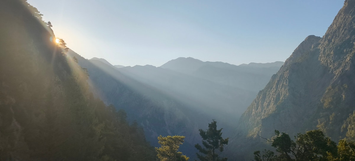
The village of Samariá lies inside the gorge, so a Samaria Gorge tour that follows the gorge down to the Libyan Sea reaches it on the way. The gorge belongs to the Chania regional unit and crosses the Sfakia region of southwest Crete, where every gorge runs north to south and finishes at the sea. It is one of about 50 gorges in the White Mountains, or Lefka Ori, and the best-known of them.
The final residents of Samariá left in 1962, when the village gave way to the new park. In that same year the gorge became a national park of Greece, set up above all as a refuge for the rare kri-kri, the Cretan wild goat. By 1960 under 200 kri-kri were left, and the goat’s status was one of the reasons for creating the park. A Samaria Gorge tour thus passes a village that was emptied to make room for a wildlife refuge.
Today the old village lies within Samaria National Park, which is also a World Biosphere Reserve and appears on the UNESCO World Heritage tentative list for Greece. Park rules from the Chania Forest Protection Service strictly prohibit camping, overnight stays and lighting fires anywhere inside the park. As a result, visitors cannot spend the night in Samariá, and on a Samaria Gorge tour the village is a point on the walk, not a place to stay.
The name Samariá comes from the ancient church of the village, Óssia María. The village and the gorge both owe their names to this church, and the national park carries the same name. In Greek the gorge is called Φαράγγι Σαμαριάς, or just Φάραγγας. English texts spell the name both with the accent, as Samariá, and without it, as Samaria. Every Samaria Gorge tour therefore carries the name of a single village church.
- Location: Samariá lies inside the gorge, in the Chania regional unit of southwest Crete.
- Last residents: The final inhabitants left in 1962, when the national park was created.
- Church: The ancient church of Óssia María gave its name to the village and the gorge.
- Park rules: Camping, overnight stays and fires are strictly prohibited inside the park.
The village of Samariá ties together the name, the park and the goat on a Samaria Gorge tour. The name comes from the church of Óssia María. The park, created in 1962, led the last inhabitants to leave. The kri-kri, with a population below 200 by 1960, was one of the reasons for that park. All three meet at the empty village inside the gorge.
What are the Iron Gates on a Samaria Gorge tour?
A Samaria Gorge tour reaches the Gates, the best-known stretch of the gorge, also called the Iron Gates, though that name is incorrect. Here the gorge narrows to a gap only four metres wide, between walls that rise to almost 300 metres.
The Gates are the best-known stretch of the Samaria Gorge. The spot is also called the Iron Gates, but that name is incorrect, and the correct name is simply the Gates. Here the two sides of the gorge draw together until the gap is only four metres wide. A Samaria Gorge tour on the full route passes through this gap on foot, with rock rising on both sides.
At the Gates, the walls on both sides climb to almost 300 metres, or 980 feet. A Samaria Gorge tour crosses the White Mountains, a range made mainly of limestone in shades from light grey to bluish or black. The range takes its name from the pale limestone of its peaks and the snow that covers them until late spring. It has more than 30 summits above 2,000 metres, and its highest peak, Pachnes, stands at 2,453 metres.
A small river, flowing between the White Mountains and Mt. Volakias, cut the gorge, and streams still run through the park. Swimming in these streams is strictly prohibited under the park rules. The Gates can also be reached from the bottom of the gorge, since a route leads from Agia Roumeli up to the Gates and back. This Samaria Gorge tour option lets walkers see the Gates without starting at the northern entrance.
The Imbros Gorge, which runs parallel to the Samaria Gorge near Hora Sfakion, gives a point of comparison. Imbros is 11 km long, and its narrowest part measures just 1.60 metres. The Gates on a Samaria Gorge tour are wider, at four metres, yet their walls climb to almost 300 metres. Imbros ends at the village of Kommitádes, while the Samaria Gorge ends at the Libyan Sea in Agia Roumeli.
- Width: The sides of the gorge close in to only four metres at the Gates.
- Height: The walls at the Gates climb to almost 300 metres, or 980 feet.
- Name: The stretch is known as the Gates, and the name Iron Gates is incorrect.
- Access: A route leads from Agia Roumeli to the Gates and back.
On a Samaria Gorge tour, the Gates sum up the gorge in two numbers: four metres of width and almost 300 metres of height. The rock belongs to the White Mountains, a limestone range with more than 30 summits above 2,000 metres. Walkers who do not cover the full route can still see the Gates on the way from Agia Roumeli and back.
Which wildlife lives along a Samaria Gorge tour?
A Samaria Gorge tour passes through a refuge of the kri-kri, the Cretan wild goat, for which the national park was chiefly created. The park also shelters the bearded vulture and the Cretan wildcat, and woodlands of cypress, maple and pine grow across Crete.
The kri-kri, also called the agrimi or the Cretan ibex, is a feral goat with the scientific name Capra hircus cretica. Its coat is light brown, with a darker ring of colour around the neck, and its two horns curve backwards. Wild kri-kri are shy animals that keep away from people and rest through the daytime. They jump well and climb cliffs that look sheer. Because of this shy nature, no Samaria Gorge tour can promise a sighting.
The last strongholds of the kri-kri are the high peaks of the White Mountains, a range that hosts 14 other endemic animal species. A key site is the Untrodden, a line of almost vertical cliffs 900 metres high at the head of the Samaria Gorge, where a Samaria Gorge tour begins. Crete now holds only about 2,000 of the animals, and they are classed as vulnerable. Hunters, shrinking grazing land, disease and cross-breeding with ordinary goats all threaten them, and hunting is strictly banned.
Birds of prey share this ground with the goat. The mountains and gorges of Crete shelter the endangered bearded vulture, also known as the lammergeier, and the Sfakia region, which the gorge crosses, is home to vultures and eagles. Year-round residents of Crete include the griffon vulture, golden eagle, peregrine falcon, red-billed chough and chukar partridge. Crete holds the largest island population of griffon vultures in the world, and a Samaria Gorge tour crosses the kind of mountain country these birds use.
Plant life changes with height. Across Crete, woodlands of Mediterranean cypress and Cretan maple grow at high elevations, Calabrian pine and Kermes oak at mid-elevations, and low aromatic shrubland, known as phrygana, lower down. The island has 1,600 plant species, about 10% of them endemic. Rare herbs include the endemic Cretan dittany and the ironwort known as malotira. Trees grow taller in the west of the island, where water is more abundant, and a Samaria Gorge tour runs through that western part.
- Names: On Crete, the male kri-kri is called agrimi, meaning the wild one, and the female sanada.
- Agios Theodoros: In 1935 Theodoros Viglis moved one male and two female kri-kri from the gorge to this islet.
- Origin: Molecular studies trace the kri-kri to the first goats domesticated in the Levant around 8000–7500 BCE.
- Monk seal: The UNESCO tentative-list entry for the park also names the Mediterranean monk seal.
The kri-kri stands at the centre of wildlife on a Samaria Gorge tour. The national park was created in 1962 largely to protect it, and about 2,000 now live on Crete. Bearded and griffon vultures, golden eagles and peregrine falcons live on the island all year round, while cypress, maple and pine woodlands grow at different heights. The goat remains a symbol of the island.
Where does a Samaria Gorge tour end?
A Samaria Gorge tour finishes its walk at Agia Roumeli, a small village in southwest Crete on the shore of the Libyan Sea. The village sits at the mouth of the gorge, and ferry boats carry walkers on from its waterfront to other villages.
At Agia Roumeli the gorge meets the Libyan Sea. The village stands at the end of a 16 km hiking path from the mountainous inland region, the path that a Samaria Gorge tour follows down from the north. The walk inside the national park covers 13 km. The last two kilometres to the village lie beyond the park exit, so walkers reach the houses after they leave the protected area.
No road reaches Agia Roumeli, and the reason lies in the land around it. A small river cut the gorge between the White Mountains (Lefká Óri) and Mount Volakias, and the village sits where that cut meets the coast. The whole area between Chora Sfakion and Agia Roumeli is known as Sfakia. The coastal villages of Sfakia are not joined by a coastal road, so a Samaria Gorge tour leaves the village by sea.
Walkers on a Samaria Gorge tour reach a village laid out along two parallel streets by the water, lined with restaurants and souvenir shops. A hill west of the village carries an old fortress known as Castle Agia Roumeli. On Fournoti beach, close to the village, a plant micro-reserve of about 6.5 hectares shelters the rare shrub Hypericum aciferum. It holds more than a hundred plants of this vulnerable species.
The village has a long past. In ancient times the site carried the name Tarra and was a city-state, and Homer’s Iliad counts it among the Hundred Cities of Greece. A second route also starts here: a path runs from Agia Roumeli up to the Gates and back. The end point of a Samaria Gorge tour is therefore also the start point of a walk that climbs into the gorge from the sea.
- Location: A Samaria Gorge tour ends at Agia Roumeli in southwest Crete, on the Libyan Sea.
- Distance: The village stands two kilometres past the park exit, at the end of a 15 km hike.
- Access: The coastal villages of Sfakia have no coastal road and are reached by ferry boats.
- Landmark: An old fortress called Castle Agia Roumeli crowns the hill west of the houses.
Agia Roumeli marks the change from mountain to sea. The gorge path ends at its shore, and the next stage of a Samaria Gorge tour starts at the water. The village is the meeting point of the footpath and the coastal ferry boats, which link it with Chora Sfakion, Loutro and Sougia along the south coast of Crete.
How does the boat ride end a Samaria Gorge tour?
A Samaria Gorge tour ends with a ferry ride from Agia Roumeli along the south coast of Crete. The boat carries walkers east to Chora Sfakion or west to Sougia, and buses meet them there for the trip back to the north of the island.
Ferries leave Agia Roumeli in two directions. The eastbound boat sails to Chora Sfakion, and the westbound boat sails to Sougia and Paleochora. On an organised Samaria Gorge tour, a bus connection waits for walkers after they leave the ferry in Sougia or Chora Sfakion. Another option is to spend a night in either village or to catch a coach back to Chania. Sougia also has ferry links with Loutro and Chora Sfakion.
Chora Sfakion, a small town on the south coast, serves as the capital of the remote, mountainous region of Sfakia. The town sits near the end of the Imbros Gorge, 74 km south of Chania, and counted 322 inhabitants in the 2021 census. Ferry boats from Agia Roumeli dock at its two small harbours. In summer, these boats bring Samaria Gorge tour walkers to buses bound for the northern coast. Along the harbourfront stand tavernas, two minimarkets, a butcher shop and a bakery.
Loutro lies on the same coast, between Chora Sfakion and Agia Roumeli, and a Samaria Gorge tour on the eastern route passes it. The village is reached only on foot or by sea, and ferries connect it every day with nearby towns and the exit of the gorge. It stands on the site of ancient Phoenix, the port town of ancient Anopolis. Its natural shelter from harsh weather later made it the winter port of the town of Sfakia.
West of the gorge exit, Sougia is a small village on the south coast, 70 km south of Chania, with 95 inhabitants at the 2021 census. A Samaria Gorge tour on the western route lands here. The village offers a beach, walkways, small hotels and taverns. In ancient times it was Syia, a harbour of Elyros, and a mosaic found in its church, a Byzantine-era basilica, is now in the Archaeological Museum of Chania.
- Eastern route: The Samaria Gorge tour ferry sails east to Chora Sfakion, where buses run back to the northern coast.
- Western route: Ferries from Agia Roumeli sail west to Sougia and Paleochora.
- Car-free stop: Loutro has no cars, and drivers park in Chora Sfakion or Paleochora.
- Onward island: From Chora Sfakion, ferries also sail to the island of Gavdos.
The boat ride links the two halves of the trip. A Samaria Gorge tour starts by road near Omalos, follows the gorge on foot down to the Libyan Sea, and returns by ferry and then by bus. Chora Sfakion and Sougia are the two landing places with a bus connection, and both have a road to Chania.
What is the history behind a Samaria Gorge tour?
A Samaria Gorge tour crosses Sfakia, a region of Crete known for its resistance to Venetian and Ottoman rule. In the Second World War, Allied soldiers escaped from its coast in 1941, and the gorge became a national park in 1962.
The route of a Samaria Gorge tour lies in Sfakia, a mountainous area in the southwest of Crete crossed by gorges that run from north to south and end in the sea. The region is seen as one of the rare places in Greece that foreign powers never fully occupied. Chora Sfakion was a centre of resistance against the Venetians and the Ottomans. The White Mountains to the north and the rocky beaches to the south helped local people fight off invaders.
The Cretan revolutionary Daskalogiannis was born in Anopolis, a village near Chora Sfakion, and was captured at Frangokastello in 1771. The revolution of 1821 began at the Church of Panagia Thymiani, near the village of Komitades, and the first revolutionary government of 1821 met at Loutro, in the “chancellery” that now lies in ruins. Accounts of Cretan revolts and rebel assemblies trace back to the mountains of western Crete, the same area a Samaria Gorge tour crosses on foot.
In 1867, Turkish troops came ashore on Crete and set out to push up the Samaria Gorge. The advance failed, but the soldiers burned the town of Agia Roumeli. In 1941, after the Battle of Crete, local people helped Australian and New Zealand soldiers escape from Sfakia by night and suffered heavy reprisals. Earlier, during the German invasion, King George II of Greece had escaped the same way. Chora Sfakion, where a Samaria Gorge tour boat docks, suffered bombing during the battle and the naval evacuation.
The modern chapter began in 1962, when the gorge became a national park of Greece. A key aim was a refuge for the rare kri-kri, the Cretan goat. That same year, the last people still living in Samaria village moved out to make way for the park. The gorge is also a World Biosphere Reserve, and a Samaria Gorge tour today follows a path through this protected land on its way from the mountains to the sea.
- Name: The main theory links the name Sfakia to the ancient Greek word σφαξ, meaning a land chasm or gorge.
- Frangokastello: The Venetians built this fortress east of Chora Sfakion in 1371 to deter pirates and, without success, to control Sfakia.
- Drosoulites: A local legend tells of visions near Frangokastello, seen as troops who died in the war of independence against the Turks.
- Sougia villages: In 1943, during the German occupation, German troops razed Livadas, Moni and Koustogerako as a reprisal for local partisan actions.
Each stage of a Samaria Gorge tour touches this past. The walk runs through the mountains of the old Sfakian resistance and ends at Agia Roumeli, the town Turkish soldiers burned in 1867. The boat can then land at Chora Sfakion, the harbour of the 1941 evacuation. The national park created in 1962 protects the gorge and its rare wildlife today.
How hard is a Samaria Gorge tour?
A Samaria Gorge tour is a long walk that goes downhill from the mountains to the sea. The full hike covers 15 km. It starts at 1,250 meters at the northern entrance and ends on the shore of the Libyan Sea at Agia Roumeli.
The gorge itself is 16 km long. On a Samaria Gorge tour, the walk inside the national park covers 13 km. From the park exit, walkers still have two more kilometers to go before they reach the village of Agia Roumeli, so the full hike comes to 15 km. A figure of 18 km is also quoted for the gorge. That longer number measures the route from the settlement of Omalos, on the north side of the plateau, down to Agia Roumeli.
Height is the second test. The trailhead sits at 1,250 meters, and the path ends at sea level on the Libyan Sea coast. A Samaria Gorge tour therefore loses the full 1,250 meters on foot, spread over the length of the gorge. The descent runs one way only. Walkers do not climb back up, because the walk ends at Agia Roumeli and the trip goes on by boat to Sougia or Hora Sfakion.
The ground adds to the work. A small river cut the gorge between the White Mountains and Mount Volakias, and the park rules refer to streams inside it. Limestone makes up the bulk of the White Mountains, in colors from light gray through bluish tones to black. The gorge runs through Sfakia, an area whose name, by the leading theory, comes from its rugged terrain. Local people there take pride in the dryness and rockiness of their mountains. Every step of the descent crosses this hard, rocky country.
The walk can turn strenuous, above all at the peak of summer, when heat adds to the distance and the descent. For a shorter outing, a route leads from Agia Roumeli to the Gates and back, so it starts and ends at the sea and skips the long drop from the trailhead. The full Samaria Gorge tour, by contrast, covers the whole way from the northern entrance down to the coast.
- Length: The walk inside the park is 13 km, and the path on to Agia Roumeli adds 2 km for 15 km in all.
- Height drop: The route falls from 1,250 meters at the northern entrance to sea level on the Libyan Sea.
- Ground: The gorge runs through the limestone of the White Mountains and the rugged terrain of Sfakia.
- Heat: Strain on walkers rises at the peak of summer.
- Shorter option: A route from Agia Roumeli to the Gates and back skips the full descent from the trailhead.
A Samaria Gorge tour is a test of distance and descent rather than climbing. Walkers cover 15 km and lose 1,250 meters of height on rocky limestone ground, then leave Agia Roumeli by boat instead of walking back up. The effort rises at the peak of summer. For anyone who wants a shorter walk, the route from Agia Roumeli to the Gates and back offers a part of the gorge without the full drop.
When is the best season for a Samaria Gorge tour?
A Samaria Gorge tour fits only inside the park’s open season, which lasts six months and ends on 31 October. The park is closed from 1 November to the end of April, when snow is common on the mountains. High summer brings the hardest walking.
Park rules fix the calendar for every Samaria Gorge tour. Information from the Chania Forest Protection Service sets out the visiting season. Visits to the national park are allowed for six months each year, and the last day of the season is 31 October. The season opens in late spring and runs through the whole summer into autumn. June, July, August and September all sit inside that window, with October as the final month.
The closed half of the year runs from 1 November to the end of April. Those months match the snow season on the Cretan mountains, which runs from November to April, while low ground sees little snow. The higher parts of the island fall into the cold-summer Mediterranean climate class, and peaks above 2,000 meters can have a continental climate. In the White Mountains, home to the gorge, snow covers the peaks until late in spring.
Rain sets the west of Crete apart. Western Crete, the Chania province, receives more rain than the eastern part of the island, and its soil suffers more erosion. Chania also gets more precipitation than any other regional unit of Crete. The gorge lies in that unit, in the south-west of the island, so a Samaria Gorge tour takes place in the wettest corner of Crete. Visits stay inside the six open months, from late spring to the end of October.
Timing inside the open season shapes the walk. Crete has a hot-summer Mediterranean climate, and the gorge walk can be strenuous, above all at the peak of summer. A Samaria Gorge tour in the opening weeks or the closing weeks avoids that peak. The opening weeks bring one more draw: in western Crete, spring flowers linger in the mountains into the first weeks of the season. Later on, the bare off-white limestone of the high peaks takes the place of the winter snow.
- Open season: Visits to the park are allowed for six months, ending on 31 October.
- Closed season: The park stays shut from 1 November to the end of April.
- Snow: Snow is a common sight on the Cretan mountains from November to April.
- Rain: The Chania regional unit gets more precipitation than any other regional unit of Crete.
- Heat: The walk is hardest at the peak of summer, in the middle of the open season.
Six open months frame every Samaria Gorge tour. Snow on the mountains marks the closed months from November to April, and the Chania area takes more rain than the rest of Crete. Inside the open season, the opening and closing weeks avoid the peak of summer, while the first weeks still carry spring flowers in the western mountains.
What do travelers ask about a Samaria Gorge tour?
A Samaria Gorge tour crosses the White Mountains inside the Chania regional unit. The park bans overnight stays. The gorge sits in the south of Chania, and Balos lies in the north-west of the same unit, so the two trips fit on separate days.
Which mountains does a Samaria Gorge tour pass through?
A Samaria Gorge tour passes through the White Mountains, known in Greek as Lefka Ori. The range holds about 50 gorges, and Samaria is the best known of them. Its highest summit, Pachnes, stands at 2,453 meters, the second highest peak on Crete after Mount Ida. More than 30 summits in the range pass 2,000 meters.
Can walkers stay overnight on a Samaria Gorge tour?
No. Park rules ban camping, overnight stays, lighting fires and swimming in the streams of the gorge. A Samaria Gorge tour therefore crosses the park in one visit. Any night stop comes after the walk. From Agia Roumeli, walkers sail to Sougia or Hora Sfakion, and a traveler can spend the night in either village.
Which regional unit of Crete holds the Samaria Gorge tour route?
The gorge lies in the regional unit of Chania, one of four on Crete. The unit covers the westernmost quarter of the island, and its capital is Chania. The national park sits in the south of the unit. A Samaria Gorge tour starts near Omalos, 38 km south of Chania.
Can a Samaria Gorge tour pair with a Balos Lagoon cruise on another day?
Yes. Both trips stay in the Chania regional unit, but on different coasts. The gorge ends on the Libyan Sea in the south. The Balos lagoon lies in north-western Crete, between Gramvousa island and the shore. A Samaria Gorge tour on one day and a Balos Lagoon cruise on another cover both sides of western Crete.
Featured photo: Lapplaender, CC BY-SA 3.0 DE, via Wikimedia Commons.