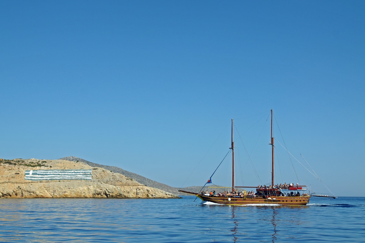
A Kos boat trip leaves the harbour of Kos town, next to the Castle of the Knights, for the small islands around Kos in the Dodecanese, such as Kalymnos, Pserimos and the volcanic island of Nisyros. This post covers what a Kos boat trip includes, the harbours, each island, the history of Kos, the south-west coast and the best season. More Greece tours are listed on the Greece VIP homepage.
Each section ends with a Kos boat trip that can be booked online.
What does a Kos boat trip include?
A Kos boat trip leaves from a harbour on Kos, the third largest island of the Dodecanese, and crosses the south-eastern Aegean Sea to neighbouring Greek islands such as Kalymnos, Pserimos and Nisyros, with a stop ashore on the chosen island.
Kos is a Greek island in the Dodecanese chain, in the south-eastern Aegean Sea. It is the third largest island of the group, after Rhodes and Karpathos, and the second by population after Rhodes, with 37,089 residents at the 2021 census. The island measures 42.1 by 11.5 kilometres, and its coastline runs for 112 kilometres from west to east. Every Kos boat trip starts from this long, narrow island.
The principal town of the island is also called Kos. It is the seat of the municipality, the main port and the main population centre, as well as a tourist and cultural centre with whitewashed buildings, hotels, restaurants and a nightlife strip known as “bar street”. As the main port, the town is the natural starting point for a Kos boat trip. Tourism drives the island economy, with the beaches as the chief draw.
The name Dodecanese means “twelve islands”, yet the group counts 15 larger and 150 smaller Greek islands in the south-eastern Aegean, and people live on 26 of them. It belongs to the wider Southern Sporades and forms the eastern edge of the Sea of Crete. Rhodes has led the area since antiquity, and among the other islands, Kos and Patmos carry the greatest historical weight. A Kos boat trip stays inside this chain, which also includes Kalymnos, Nisyros and the smaller Pserimos.
Kos lies south of Kalymnos and Pserimos and north of Nisyros. Kalymnos is 12 kilometres to the north, and the inhabited islet of Pserimos sits in the sea between the two. Kos was once part of a mountain chain and split from it after earthquakes and subsidence in ancient times. Remnants of those mountains include the islands of Kalymnos and Kappari and the volcano of Nisyros, so a Kos boat trip to these islands links pieces of the same old range.
- Name: The name Kos first appears in Homer’s Iliad and has stayed in continuous use ever since.
- Region: Kos is a municipality in the Kos regional unit, part of the South Aegean region.
- Farming: Grapes, almonds, figs, olives and tomatoes grow on the island, and Cos lettuce takes its name from Kos.
- Nearby islands: A Kos boat trip heads north to Kalymnos and Pserimos or south to Nisyros.
Put together, a Kos boat trip includes three parts: a start at the harbour of Kos town or at Mastihari, a crossing north towards Kalymnos and Pserimos or south towards Nisyros, and time ashore on one of these Greek islands. All of these stops belong to the Dodecanese, and Kalymnos and Nisyros rise from the remains of the same ancient mountain chain as Kos itself.


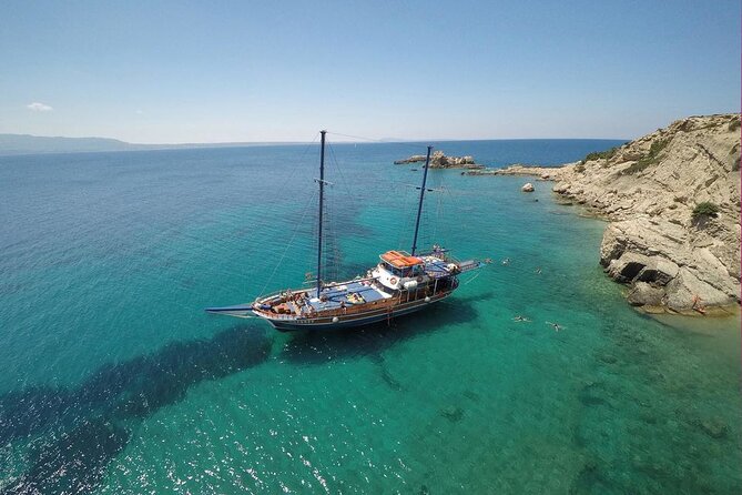

Where does a Kos boat trip leave from?
A Kos boat trip leaves from the main port of the island, Kos town, where a 14th-century fortress of the Knights Hospitaller, called Neratzia, stands at the entrance to the harbour. Mastihari, a fishing village, also has a port with regular boats to Kalymnos.
The harbour of Kos town has a long record. Diodorus Siculus and Strabo both described the town as a well-fortified port, and its position gave it high standing in Aegean trade, while the island itself was rich in famous wines. The Ptolemies used Kos as a naval outpost to watch over the Aegean, and Saint Paul briefly visited Kos, according to Acts 21:1. Each Kos boat trip from this harbour starts in the same port that those ancient writers described.
Beside the harbour stands Neratzia, also written Nerantzia, the castle of the Knights. The Knights Hospitaller built this fortress at the harbour entrance in 1315. During the raids of Yıldırım Bayezid between 1391 and 1396, two towers rose in its south-east and south-west sections. When the island passed to the Ottomans during the conquest of Rhodes in 1522, a qadi, a castellan and guards were sent to Nerantzia, the largest fortified castle on Kos, and the castle was repaired.
During the Orlov revolt, on the night of 5 August 1773, a Russian fleet anchored off the castle and sent a landing party to capture it; the attackers suffered heavy casualties, and the ships left two days later. Just inland lies the ancient market place, once among the largest in the ancient world, set around a yard 50 metres wide and 300 metres long. Its northern side met the city wall towards the harbour entrance, so a Kos boat trip from town starts beside this old trading quarter.
Kos town is not the only start point for a Kos boat trip. Mastihari, a fishing village and resort of 479 people, lies 7 kilometres from Kos International Airport, and its port has boats that leave regularly for Kalymnos. The village has only been inhabited since 1933, when an earthquake struck a nearby village and its residents had to move. On the south coast, Kardamena grew from a small fishing village into a summer resort with watersports facilities.
- Castle: The Knights Hospitaller raised the harbour fortress of Kos town in 1315.
- Antimachia: A second castle, from the Byzantine period, stands at Antimachia.
- Mastihari: A Kos boat trip to Kalymnos can also start from the port of this fishing village.
- Kardamena: The resort stands on the site of ancient Alasarna, mid-way along the south coast.
The choice of harbour shapes a Kos boat trip. Boats from Kos town sail out past the Neratzia fortress at the harbour entrance, while the port of Mastihari gives a regular link to Kalymnos. At the far west, Kefalos sits 43 kilometres from Kos town on a peninsula at the south-west side of the island, and boat trips feature among its facilities for visitors.
What does a Kos boat trip see on Kalymnos?
A Kos boat trip to Kalymnos reaches an island 12 kilometres north of Kos, with Pothia as its capital and main port. Kalymnos is known as the sponge-divers’ island, and Pothia keeps a naval museum on sponge fishing and the island’s sea tradition.
Kalymnos is a Greek island and municipality in the Dodecanese. Kos lies to the south, across the stretch of sea covered by a Kos boat trip, and Leros lies less than 2 kilometres to the north, joined to Kalymnos by a series of islets. The island is 21 kilometres long, 13 kilometres across at its widest and 109 square kilometres in area. With 17,752 residents in 2021, it ranks third in population among the Dodecanese, after Kos and Rhodes.
Pothia, also called Kalymnos Town, is the capital and the major settlement of the island. It sits in the south of Kalymnos on the edge of a bay, close to Chorio, the old capital. Pothia was built in 1850, when pirate raids eased and residents moved closer to the sea, and its population grew fast; during Italian rule, Venetian-style houses went up. With 13,529 residents in 2021 and the main public services, Pothia is also the main port and the natural landing point for a Kos boat trip.
Pothia has two museums. The Archaeological Museum of Kalymnos holds finds from sites across the island, and a naval museum covers sponge fishing and the seafaring tradition of Kalymnos. The Cathedral of the Transfiguration of Jesus Christ, built in the 19th century, holds marble sculpture by the Greek sculptor Giannoulis Chalepas. Near Chora stands Pera Castle, also called the Castle of Chrisocheria, built by the Knights Hospitaller. A Kos boat trip with time ashore can take in these sights.
Kalymnos is billed as the sponge-divers’ island. Sponge diving has long been a common trade there, and sponges were the main source of income, bringing wealth to the island and fame across the Mediterranean. Divers worked the sea-bed from Pserimos as far as North Africa, at first by free diving with a harpoon, and sponges are still taken one by one by hand. In the mid-1980s, a disease in the eastern Mediterranean destroyed a large number of sponges and damaged the trade.
- Telendos: Telendos was part of Kalymnos until a major earthquake in 554, and a channel about 800 metres wide now divides them.
- Sponge Week: A Kos boat trip timed for a week after Easter reaches Kalymnos during Sponge Week, which honours the sponge as “Kalymnian gold”.
- Mihanikos: The island’s folk dance of this name shows how decompression sickness from sponge diving crippled divers.
- Climbing: The island’s limestone rock holds more than 3,000 climbing routes.
Kalymnos holds a long past. In the nineteenth century, the British archaeologist Charles Newton excavated its Hellenistic Temple of Apollo, and a large share of his finds went to the British Museum. The Knights of Rhodes took control in 1310, the Ottomans conquered the island in 1522, Italian sailors occupied it in 1912, and it joined Greece with the rest of the Dodecanese in 1947. A Kos boat trip meets this record in Pera Castle and the museums of Pothia.
What does a Kos boat trip find on Pserimos?
A Kos boat trip heading north finds Pserimos, a small Greek island of the Dodecanese chain that lies between Kos and Kalymnos. It belongs to the municipality of Kalymnos and draws Greek and other European visitors with its beaches and its remote location.
Pserimos, written Ψέριμος in Greek, sits between Kalymnos and Kos in the south-eastern Aegean. The Kos village of Tigaki lies about 10 kilometres west of Kos Town, and Pserimos and the islet of Platy lie about 3.5 kilometres north of it. A Kos boat trip from that stretch of coast therefore makes a short crossing. Pserimos covers 11 square kilometres, enough to rank it among the largest of the lesser islands of the Dodecanese.
Tourism is the main industry on Pserimos. The island has a number of taverns, and part of them also offer accommodation for visitors who stay the night. The Hellenic Statistical Authority recorded 84 inhabitants in the 2021 Greek census. A Kos boat trip that stops here meets that small community at its taverns and on its beaches. Pserimos is one of the populated offshore islands of the Municipality of Kalymnos, alongside Telendos and Kalolimnos.
A daily ferry links Pserimos with Pothia, on Kalymnos, and the island is a destination for cruise boats in the area. About 5 kilometres north-east of Pserimos and its neighbour Platy lies the small islet of Kalolimnos. Sponge divers from Kalymnos harvested sponges from the sea-bed as close as Pserimos and as far as North Africa. A Kos boat trip near Pserimos therefore crosses waters that Kalymnian divers once worked.
- Island chain: Pserimos is part of the Dodecanese, the island chain of the south-eastern Aegean Sea.
- Tigaki: This Kos village, once a fishing port and now a holiday resort, faces Pserimos across about 3.5 kilometres of sea.
- Municipality: The Municipality of Kalymnos, which includes Pserimos, counted 17,752 inhabitants in 2021.
A Kos boat trip to Pserimos reaches a small inhabited island set between two larger neighbours, Kos and Kalymnos. Visitors find beaches and taverns, part of which offer accommodation. A Kos boat trip that goes on from Pserimos reaches Kalymnos, home of the municipality that governs the island, and the daily ferry from Pothia joins both islands on one sea route.
What does a Kos boat trip show at Nisyros?
A Kos boat trip south reaches Nisyros, a roughly round volcanic island of the Dodecanese between Kos and Tilos. It shows an active volcano, a caldera with craters and fumaroles, and Mandraki, the main town and port, home to 660 people.
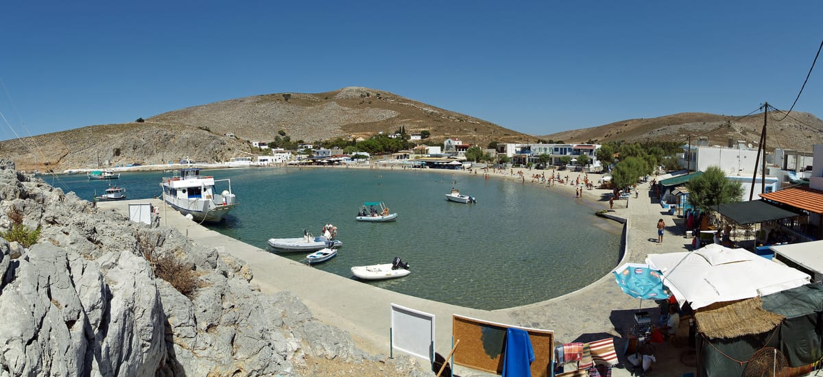
Nisyros lies south of Kos in the Aegean Sea, between Kos and Tilos. The island has a diameter of about 8 kilometres and an area of 41.6 square kilometres. The Municipality of Nisyros also takes in Gyali, with 22 residents, and the uninhabited islets of Pacheia, Pergoussa, Kandelioussa, Agios Antonios and Strongyli. The municipality counted 1,048 inhabitants in 2021. In summer, a Kos boat trip to Nisyros leaves daily from the village of Kardamena, and ships also arrive from Piraeus and Rhodes.
A Kos boat trip to Nisyros lands on a volcano. The island has a caldera 3 to 4 kilometres wide, formed within the past 150,000 years in three separate eruptive stages. The volcano is active but not erupting, and fumaroles are found at the craters. It has had four historical eruptions, each rated 2 on the Volcanic Explosivity Index, and almost all of its eruptions involved phreatic activity. The latest was a steam explosion in 1888, after small ash eruptions in 1871 and 1873.
The volcanic complex reaches beyond the island. It includes the seafloor between Nisyros and Kos, the island of Gyali and a part of Kos, so a Kos boat trip on this route sails above the volcano’s own system. Earthquakes are frequent. After seismic unrest in 1996–1997, an international team of scientists began to monitor the volcano under the EU-sponsored Geowarn project. Nisyros also holds a high-enthalpy geothermal field, with fluid temperatures over 350 °C and a pressure of 18 bar.
Near Mandraki stand ancient walls from the 5th century BC, part of the island’s acropolis. The Knights Hospitaller settled on Nisyros in 1315 and built a castle, and the monastery of Panagia Spiliani, the largest of four on the island, stands beside it at Mandraki. Greek myth links both ends of a Kos boat trip: Poseidon cut off a part of Kos and threw it onto the giant Polybotes, and that piece became Nisyros.
- Villages: Besides Mandraki, Nisyros has the villages of Paloi, Nikia and Emporeios.
- Beaches: The coasts are rocky or pebbled, with sandy beaches mainly in the north-east.
- Geothermal vote: In a 1997 referendum, 87% of the vote on Nisyros went against the PPC plans for the geothermal field.
- Soumada: The traditional product of the island is soumada, a non-alcoholic drink with an almond flavour.
A Kos boat trip to Nisyros lands on an island where tourism is not as heavily developed as on other Greek islands. The terraced slopes once fed a self-sufficient island, and crops still grow there on a smaller scale. Between the harbour at Mandraki, the castle of the Knights and the craters of the caldera, a Kos boat trip sees the island’s history and its geology in one visit.
What is the history behind a Kos boat trip?
The Kos boat trip starts from an island of recorded history. Hippocrates was born on Kos around 460 BC, the Asclepeion served as a healing sanctuary, the Knights Hospitaller built the harbour fortress in 1315, and Kos joined Greece in 1947 after Ottoman and Italian rule.
Kos appears in Homer’s Iliad, where a contingent of Koans fights for the Greeks in the Trojan War. Dorians invaded the island in the 11th century BC and founded a colony with a large group of settlers from Epidaurus, whose Asclepius cult made Kos known for its sanatoria. In 366 BC the capital moved from Astypalaea, near the modern village of Kefalos, to the new town of Kos, laid out on a Hippodamian grid. A Kos boat trip from the town harbour starts in that planned city.
Hippocrates of Kos, known as the Father of Medicine, lived from about 460 to about 370 BC. He is said to have trained at the Asclepeion of Kos, and he took lessons from the Thracian physician Herodicus of Selymbria. He is credited with the Hippocratic Oath. In the town centre stands the Plane Tree of Hippocrates, where tradition places his teaching; scaffolding now supports its limbs. Kos Town also holds the Hippocratic Museum, so a Kos boat trip from the main port begins on his home island.
An Asclepeion was a healing temple dedicated to Asclepius, the first doctor-demigod of Greek myth. Patients slept inside in a practice called incubatio, or temple sleep, and a priest read their dreams to prescribe a cure. Over 300 such temples have been found across ancient Greece, and Kos ranked among the best known. In 240 BC three rulers guaranteed the transformation of the Kos Asclepeion into an asylum, which drew merchants and pilgrims. Rudolf Herzog found its ruins on 9 October 1902, helped by the historian Iacob Zarraftis.
The Knights Hospitaller held Kos while paying rent to the Genoese republic. In 1315 they built the fortress at the entrance to the harbour, and under their rule the island was known as Lango. Corsair raids hit Kos from the 14th century, and the first serious Ottoman attack came in 1455. Kos passed to the Ottomans in 1522, during the conquest of Rhodes, and they repaired the Nerantzia castle. A Kos boat trip leaving the main harbour today passes the walls of the Hospitaller fortress.
- Russian attack: On the night of 5 August 1773, during the Orlov revolt, a Russian landing party failed to take the castle.
- Italian rule: Italy took Kos in 1912 and developed the island’s infrastructure after the earthquake of 23 April 1933.
- Archaeological park: Architect Rodolfo Petracco drew a new town plan and turned the old quarters into an archaeological park.
- Second World War: After the Italian surrender in 1943, German forces won the Battle of Kos and held the island until 1945.
- Union with Greece: The United Kingdom ceded Kos to the Kingdom of Greece in 1947, after the Paris Peace Treaty.
A Kos boat trip starts on an island that keeps physical traces of its long history: the ruins of the Asclepeion, the Plane Tree of Hippocrates, the fortress of the Knights Hospitaller and the archaeological park of the old quarters. An Ottoman census of 1881/82–1893 counted 10,459 Greeks among 12,965 people in the district of Kos. Every Kos boat trip from the main harbour now sets out from a Greek port.
What does a Kos boat trip pass on the south-west coast?
A Kos boat trip along the south-west coast passes Kefalos Bay, also called Kamari Bay, the cliff-top town of Kefalos, the small volcanic islet of Kastri with its church of Agios Nikolaos, and the early Christian Basilica of Agios Stefanos, a ruin at Kamari.
Kefalos is the westernmost town on Kos. It stands on the peninsula of the same name, in the south-west of the island, and is built on rocky high ground with the windmill of Papavasilis towering over it. The 2021 census counted 2,329 people in the town and 2,713 in the wider local community, which includes the beach settlements below and falls under the municipal unit of Irakleides. This cliff-top town overlooks the bay that a Kos boat trip follows.
The Bay of Kamari opens below the old town. Three beach resorts, Kamari, Kampos and Onia, line its curve for about 2 kilometres. A deep-water harbour sits at the western end, under the steep cliffs of Mount Zini, a volcanic dome of rhyolite that took shape in the Quaternary Period. A strip of sand lies between the mountain and the harbour. A Kos boat trip from this harbour can head south to Nisyros, and local fishing boats sell their catch to restaurants nearby.
Inside the bay, the volcanic islet of Kastri holds the little church of Agios Nikolaos. At Kamari, the early Christian Basilica of Agios Stefanos still stands as a ruin, and mosaic floors survive within what is left of its walls and columns. The basilica appears among the attractions of Kefalos, and accounts of Kamari Bay describe it as a Roman Christian church. Both sites lie within the Kamari Bay area, on the stretch of coast covered by a Kos boat trip on this side of the island.
The beach ends at cliffs of ignimbrite, a tough volcanic rock from the Miocene Period, more than ten million years old. Marks of Greek quarrying for building stone remain on it. Past the harbour, in the direction of Mount Zini, stands Mount Latra, a 426-metre peak from the Pliocene Period. To the south rises the volcanic island of Nisyros. Pergoussa and Pachia lie to its west, with Gyali, also written Yiali, and Strongyli in between. A Kos boat trip along Kefalos Bay faces this group of islands.
- Kefalos castle: Only ruins remain of this medieval castle, which dates from the thirteenth century.
- Palatia: The ancient site of Palatia appears on the list of sights around Kefalos.
- Aspri Petra: The cave at Aspri Petra belongs to the same list of local sights.
- Ayios Ioannis: The Monastery of Ayios Ioannis, also known as Thimianos, stands among the religious sites of Kefalos.
- Mikro Limanaki: This beach sits on the northern side of the Kefalos peninsula.
Shops in Kefalos are limited, so people travel to neighbouring Kardamena or to Kos Town at the far end of the island for anything beyond daily needs. By road, Kos Town lies about 40 kilometres from Kamari Bay, following the line of the coast. Compared with Kardamena and the area around Kos Town, Kamari Bay is considered a quieter resort. Its harbour gives a Kos boat trip direct access to the south-west coast.
When is the best season for a Kos boat trip?
A Kos boat trip fits the dry summer months of the island’s hot-summer Mediterranean climate. Sunny, dry weather is the rule then, but the meltemi wind peaks in July and August, so June and September see it less frequently.
The climate of Kos is classed as hot-summer Mediterranean. The same type, coded Csa in the Köppen classification, covers the greater part of the Dodecanese. In this zone, summer brings sunny, dry weather as a rule, and rain arrives in showers or thunderstorms that build from cumuliform clouds. Hot days give way to warm nights. Even heatwaves tend to stay mild by the shore, because sea breezes and the cooler water keep temperatures in check. These conditions favour a Kos boat trip through the summer months.
The meltemi brings strong, dry air down the Aegean from the north. It blows from late spring until mid-September. In Ancient Greek it went by the name etesiai, meaning periodic winds. Its strength builds to an afternoon high and tends to fall away after dark, though at times it keeps blowing for days at a stretch. In the southern Aegean, it arrives as a north-westerly. Meltemi weather is fine and clear as a rule, and the north wind cools the air during a Kos boat trip.
The meltemi poses a danger to sailors. It can arise without warning under a clear sky and blow as hard as Beaufort force 7 or 8. When it does, certain yachts stay in harbour, along with the larger part of the inter-island ferry fleet. Leisure sailors, in contrast, favour its steady strength. Climate accounts for Greece stretch its season from late spring into October and name July and August as the peak months. A Kos boat trip in June or September meets the meltemi less frequently than one in midsummer.
Thanks to the etesians, temperatures over the Aegean, and the spread between day and night, stay below those of the Ionian Sea and the mainland. Winters in the Csa zone are wet, the rain can be persistent, and snow soon disappears. Average winter temperatures in the Dodecanese locally rise above 15.0 °C. The seasons also show on the coast that a Kos boat trip visits: Kamari Bay is a busy resort in the tourist season but thins out in the off-season, when residents withdraw to Kefalos.
- Cause: The etesians arise chiefly from a deep continental low centred over south-west Asia.
- Monsoon label: The wind carries the monsoon name at times, yet it is a dry wind with no winter counterpart blowing the other way.
- Name: The Greek name meltemi is thought to come from the Italian mal tempo, meaning bad weather.
- History: Philip II of Macedon planned his campaigns around the etesians, since fleets from the south made slow progress north against them and failed to reach him.
- Wider reach: Winds of the same kind also blow over the Adriatic and Ionian regions.
Two factors set the season for a Kos boat trip: the summer climate and the meltemi. Summer brings sunny, dry weather, and the sea and its breeze soften the heat. The meltemi blows hardest in the afternoon and can halt sailings, so a morning departure meets a weaker wind than an afternoon one. This timing counts for more in July and August, when the meltemi blows with the highest frequency.
What do travelers ask about a Kos boat trip?
A Kos boat trip raises four practical questions: which island group it explores, which ferries link Kos with Piraeus, Rhodes and nearby islands, which airport serves visitors, and how a stay on Kos pairs with a Symi visit from Rhodes on another holiday.
Which island group does a Kos boat trip explore?
A Kos boat trip explores the Dodecanese, a Greek island group bordered by Crete to the south-west and the Cyclades to the west. Its 15 major islands include Kos, Kalymnos, Nisyros, Patmos, Rhodes and Symi. Since the 2011 reform, the group forms four regional units, Kalymnos, Karpathos-Kasos, Kos and Rhodes, within the South Aegean region.
Which ferries link the island of a Kos boat trip with Piraeus, Rhodes and the other Dodecanese islands?
Kos Town is the main port of the island. Ships reach Nisyros from Piraeus, Rhodes and Kos, with daily summer trips from Kardamena. Boats leave Mastichari regularly for Kalymnos, and Leros lies a short boat ride from Kos and Rhodes. On Rhodes, Kolona Port handles traffic within the Dodecanese.
Which airport serves visitors on a Kos boat trip?
Kos International Airport, named Ippokratis after Hippocrates, stands near the village of Antimachia, 24 kilometres from Kos Town and beside the road from Kos to Kefalos. It opened in 1964 and mainly serves charter airlines, with a peak in summer. A public bus links the terminal with Kos Town, the main port, and with Mastichari, Kardamena and Kefalos.
Can a Kos boat trip pair with a visit to Symi on another holiday?
Yes. Symi, another island of the Dodecanese, lies to the north of Rhodes, about 24 kilometres away. Its main town, also called Symi, has a lower harbour quarter, Yialos, and an upper town, Horio or Ano Symi. Day-trippers swell its numbers from Easter through to Panormitis Day, early in November, and a Symi day trip from Rhodes puts a visitor among them.
Featured photo: kallerna, CC BY-SA 3.0, via Wikimedia Commons.