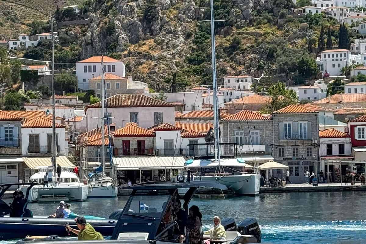
A Hydra boat trip sails around the car-free island of Hydra and its islets, between the Saronic and Argolic gulfs. It is one of the Saronic island trips in Greece on Greece VIP.
This post covers what a Hydra boat trip includes, its harbours and the north coast. It also covers the south coast, the islets and the sea life. The gulfs around Hydra, the best season and common questions come last.
Each section ends with a Hydra boat trip or a nearby cruise that can be booked online.
What does a Hydra boat trip include?
A Hydra boat trip uses a fast ferry, a day-cruise ship, an excursion boat or a yacht. The Saronic line has moved from Soviet-built hydrofoils to Norwegian-built catamarans. Each craft calls at the main harbour on the north coast.
A Hydra boat trip from the small Piraeus harbour of Zea crosses 35 nautical miles. Zea serves yachts and smaller craft rather than the big ferries.
One Greek company brought hydrofoils to the Saronic Gulf and ran 15 by 1981. By 1998 its fleet held 28 small hydrofoils, three larger ones and two catamarans.
The fleet used Soviet designs: the Kometa class first, then the larger Kolkhida class. Two craft were built in Soviet Georgia in 1984. A rule retired Greek hydrofoils at age 30 until 2015.
A Hydra boat trip on the Saronic line changed in 2022. Three new high-speed catamarans, ordered in Norway in 2021, began replacing the ageing hydrofoils.
Day-cruise ships run a Hydra boat trip from Athens, boarding at Flisvos Marina. Visitors on day trips to Hydra can join a daily boat that circles the island.
Hydra’s own shipyards built the sailing craft that made the island rich. In the early 18th century they turned out sachtouri of 15 to 20 tons. In 1821, Hydra’s fleet counted 186 ships of 27,736 tons.
- Hydrofoils: The larger Soviet class seats up to 130 passengers.
- Day cruises: The cruise from Flisvos Marina includes a buffet lunch.
- Old craft: Early 18th-century Hydra built latinadiko of 40 to 50 tons.
Each of these craft calls at the crescent-shaped harbour.



Which harbours does a Hydra boat trip use?
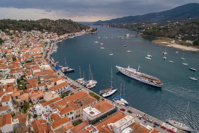
A Hydra boat trip docks in Hydra harbour, a crescent at the head of a closed cove. Bare, rocky mountains surround it. Boats also run to ports on the Peloponnese coast. Metochi, Ermioni and Porto Heli all link to the island by sea.
Bastions with cannons stand on both sides of the harbour entrance. They defended Hydra in wartime and against pirates. The western bastion is called the Periptero.
A Hydra boat trip enters through an entrance only 20 metres wide. Chains once closed it for safety. They still lie rusting below the ramparts.
A breakwater stands in the harbour, facing the town’s commercial heart. The waterfront road runs to the Petalo area, and its paving was finished in 1912.
Private yachts on a Hydra boat trip moor stern-to at a fixed quay. The harbour’s berths take boats under 10 metres and from 10 to 20 metres.
Metochi lies on the Peloponnese coast opposite Hydra. Its tiny pier faces the island and has a ticket office. The coastal road leads to Ermioni, 19 km away.
Ermioni sits in southeastern Argolis and faces Hydra and Dokos. Porto Heli lies further along the same Argolid coast.
- Ancient trade: Ancient Hermione built ships and made porphyra, a red dye.
- Ermioni berths: Yachts tie up stern-to or bows-to behind the outer mole.
- Network: Year-round ferries link Hydra with Methana, Ermioni, Porto Heli, Nafplio and Tyros.
Boats from these ports all end inside the same closed cove.
What does a Hydra boat trip see along the north coast?
A Hydra boat trip along the north coast passes Mandraki bay and the cove of Lenteza. The coast beyond is rocky, with steep cliffs and no large beaches. Above Lenteza stands the monastery of Zourva. The trip reaches the lighthouse on Cape Zourva.
Mandraki bay lies east of Hydra town along a coastal road. Two forts once guarded its capes, and one still stands out. The bay is open to swell.
East of Mandraki, a Hydra boat trip passes a tiny beach of white pebbles. Steep vertical cliffs tower above it, and only boats reach it.
A Hydra boat trip can land at Lenteza, a rocky cove on the northeastern side. From there, a paved path with steps climbs 700 metres.
The convent of the Nativity of the Virgin at Zourva lies 1,100 metres uphill from Lenteza. Its sacred icon was found in a cave in 1776.
The convent stands on the bare rocky plateau of Upper Zourva, below Mount Ompori. The Zoodochos Pigi area of Zourva held an important prehistoric settlement.
Cape Zourva’s lighthouse is hard to reach by land, so a Hydra boat trip shows it best. The stone tower, built in 1883, stands 10 metres high.
- Light: Since 1989, three white flashes every 20 seconds reach 17 nautical miles.
- History: Wrecked in World War II, the lighthouse reopened in 1946.
- Harbour site: Hydra harbour sits near the middle of the north coast.
Westward, a Hydra boat trip faces steep northern shores below a single mountain range.
What does a Hydra boat trip see on the south coast?
A Hydra boat trip on the south coast passes steep slopes below Mount Eros. At 592 metres, Eros is the island’s highest peak. Pebble bays such as Klimaki and Limnioniza open between capes. Chapels and monasteries stand above them.
Locals know Mount Eros as “Ere.” An old encyclopedia links that name to an Albanian word for wind. Pyrgos, a second summit, reaches 557 metres.
On the south-west shore, a Hydra boat trip reaches the bay of Agios Nikolaos. The white chapel of Agios Nikolaos stands high above its fine-pebble beach.
Further east, the pine-covered peninsula of Nisiza holds two pebble beaches. Its cove once served as the port of Episkopi, an ancient settlement of Hydra.
Klimaki lies below the peaks of Eros and Pyrgos. A Hydra boat trip finds a large pebble beach there. The chapel of Agioi Taxiarches stands nearby.
East of Klimaki come the cape of Chounta tou Riga and the bay of Riga. Limnioniza follows, rated the south coast’s finest beach by the municipality.
An islet in Limnioniza bay holds Early Helladic traces. Past Chounta Zeza, a Hydra boat trip meets a steep, wild south-east coast up to Cape Zourva.
- Holy Trinity: Antonio Economou, a priest, founded this monastery in 1704.
- Agia Matrona: This convent lies about 1,000 metres south of Holy Trinity.
- Zourva chapels: Agia Paraskevi, Prophet Elijah and Saint George date from the 18th century.
These chapels stand near the Zourva monastery. A Hydra boat trip that circles the island completes the loop at Cape Zourva.
Which islets does a Hydra boat trip pass?
A Hydra boat trip to the west passes Dokos, a rocky island next to Hydra. Smaller islets such as Petasi, Trikeri, Kivotos and Alexandros lie nearby. Off Dokos rests a wreck from 2700–2200 BC, one of the oldest ever found.
The American archaeologist Peter Throckmorton found the wreck in 1975. Its cargo of clay vases lies 15 to 30 metres deep, off the coast of Dokos.
From 1989 to 1992, the Hellenic Institute of Marine Archaeology excavated it under George Papathanasopoulos. Divers uncovered over 500 clay vases and more than 15,000 finds.
It was Greece’s first full-scale excavation of an ancient shipwreck. Scholars link it to a trade route from south Euboea to the Saronic and Argolic gulfs.
A Hydra boat trip also shows Dokos, which rises to 308 metres. From Skintos cove, a summit trail passes a Byzantine-Venetian castle and a stone lighthouse.
Trikeri lies midway between Hydra and Spetses, south of Dokos. Its name comes from three peaks, the highest at 159 metres. Its ancient name was Trikrana.
A Hydra boat trip toward Dokos passes Petasi, near Cape Bali. It is the largest of Hydra’s small islets, about 1,300 metres long and 500 metres wide.
- Stavronisi: This islet lies about 5 kilometres south of Hydra.
- Kivotos: Also called Panagia, this islet faces Molos beach on Hydra.
- Alexandros: Also called Platonisi, this islet lies off Hydra’s southern tip.
Beyond Trikeri to the west, Spetses lies at the entrance of the Argolic Gulf. Separate day trips to Spetses reach it.
What sea life does a Hydra boat trip meet?
A Hydra boat trip crosses the Argo-Saronic Gulf, where MOm has studied the monk seal’s return. Bays such as Limnioniza on the south coast suit spearfishing. Hydra’s own fleet once sailed for sponges as far as North Africa.
MOm is the Greek society for the study and protection of the monk seal. Its program also targeted fishermen and residents where seal activity was detected.
On the south coast, a Hydra boat trip passes Spilia tis Fokias. The name means “Seal’s Cave.” It lies between Klimaki and Cape Chounta tou Riga.
A Hydra boat trip to Limnioniza reaches a bay the municipality lists for scuba diving. Off the west coast, the seabed drops steeply, leaving scarce anchorages.
From 1863, Hydra’s sponge trade recovered from a slump. Each year upwards of one hundred vessels sailed from Hydra to the North African coast for sponges.
They returned with 60 to 70 tonnes of sponges, out of a Greek yearly catch of 150 tonnes. Greek divers adopted the hard-hat suit from 1865.
The suit brought the bends, which left divers disabled and walking with sticks. A Greek law of 1910 set inspection and depth rules for divers.
- Egypt ban: Egypt forbade fishing along its coast in 1932.
- Processing: Sponges were cleaned, bleached, trimmed and packed on the island.
- Conference: A London university held a sponge conference on Hydra in 2018.
A Hydra boat trip links the seal’s return with a sponge trade that ended in the 1960s.
What does a Hydra boat trip see across the Argolic and Saronic gulfs?
The Argolic Gulf, reached on a Hydra boat trip, runs about 50 km by 30 km. It reaches 800 m deep. On its shore, the Franchthi Cave sheltered people for about 35,000 years. Kranidi hosted the Greek legislature in 1823.
Ermioni’s site has been inhabited without a break since at least the time of Homer. A Hydra boat trip passes its coast on the way west.
A Hydra boat trip toward Porto Heli nears Halieis, an ancient port at the Argolic Gulf’s mouth. Around 460 BC, it became subject to Sparta.
Kranidi, seat of Ermionida, stands 92 m above sea level, about 4 km from the coast. Its local language was Arvanitika, now spoken only by elders.
Obsidian from Melos reached the Franchthi Cave as early as 13,000 BC. Between about 7,900 and 7,500 BC, tuna formed a major part of the diet.
Psili, Platia and Rompi, the gulf’s three largest islets, lie beside the Argolis coast. Cape Tourkovigla and Cape Agios Emilianos frame the gulf’s entrance.
The Inachos river enters the gulf near Nea Kios. That Argolis shore is visited on day trips to Nafplio.
- Mouth: The gulf’s entrance spans 16 nautical miles between two capes.
- Sea level: It has risen about 120 m since Franchthi’s occupation.
- Masis: This Homeric-era city stood near today’s village of Koilada.
A Hydra boat trip toward Spetses meets the gulf’s mouth, where Spetses sits.
When is the best season for a Hydra boat trip?
The best Hydra boat trip season runs from June to September. The island’s station logged one rain day or none in each of those months. September’s mean temperature was 25.9 °C. Rain returned in October, with 76.2 mm.
A National Observatory of Athens station sits on Hydra, 2 m above sea level. Its last annual summary totals 563.6 mm of rain on 57 days.
July was the hottest month, with a 30.2 °C mean and a 34.3 °C mean daily maximum. The year’s peak, 38.4 °C, came on 25 July.
For a Hydra boat trip, September brought just six days at or above 32 °C. July logged 27 such days, August 15 and June 14.
The four wettest months ran from October to January. November topped them with 131.8 mm of rain. The wettest single day, 13 January, brought 70.8 mm.
The station logged south-southeast as the dominant wind from October to April. November brought the top gust, 78.9 km/h, and the highest mean speed, 8.7 km/h.
A Hydra boat trip meets a summer wind shift. The station’s dominant direction turned west in June and July, southwest in August and south-southwest in September.
- Spetses: The dominant summer wind there blew from the northwest.
- Summer gusts: Monthly peaks stayed between 32.2 and 35.4 km/h.
- Coldest: The low of 6.4 °C came on 22 February.
Hydra’s wind averaged 2.4 km/h in June and July.
What do travelers ask about a Hydra boat trip?
On a Hydra boat trip, the Hydra Port Authority patrols the island’s coastline all year. The Coast Guard answers on 108, and 112 works across the EU. Small pets travel in secure cages. A sunken Bronze Age town lies off the Argolid coast.
Can a pet join a Hydra boat trip on a passenger ship?
Article 17 of Law 4830/2021 allows small companion animals on passenger ships. Each animal travels in a secure transport cage with its owner or keeper. Assistance and therapy dogs on a leash need no cage or muzzle, whatever their size.
Do dogs and cats need vaccines before a Hydra boat trip?
Article 17 of Law 4830/2021 requires rabies vaccination before dogs and cats move within Greece. An unvaccinated animal cannot travel unless a certified vet confirms serious health reasons. A puppy or kitten can receive the vaccine from 12 weeks old.
Is scuba diving allowed on a Hydra boat trip?
Law 4688/2020 allows recreational diving freely across Greece. It bans diving in underwater archaeological areas the Ministry of Culture designates. Scuba diving is also banned in ship transit and anchorage areas. Local port authorities can ban diving for safety reasons.
Who patrols the sea on a Hydra boat trip?
The Hydra Port Authority runs scheduled and extra patrols around the island’s whole coastline, all year. One December patrol inspected the Kritami waters and saw no pollution. Its records show no case of sea pollution from the Kritami waste dump.
Which emergency number works on a Hydra boat trip?
The Coast Guard answers on 108. Its tasks include coordinating search and rescue across Greece’s sea area of responsibility. When callers to the European number 112 do not know their location, the operator identifies it.
Can a Hydra boat trip pass a sunken ancient town?
Yes, off Lambayanna Beach, just outside Kiladha Bay on the Argolid coast. A team led by Julien Beck found an Early Bronze Age town there. It covers 1.2 hectares under 1 to 3 metres of water, with a wall and three large towers.