A Chania hiking tour walks the gorges, mountain paths and coastal trails of western Crete. It is one of the hiking day trips in Greece on Greece VIP.
This post covers what a Chania hiking tour includes, the gorges beyond Samaria and the E4 path. It also covers the White Mountains, plants and animals, and the coastal paths. Safety, the best season and common questions come last.
Each section ends with a Chania hiking tour or a nearby walk that can be booked online.
What does a Chania hiking tour include?
A Chania hiking tour falls into three types: gorge walks, mountain day hikes and coastal paths. Aradena and Tripiti end at beaches where boats call. Marked routes carry signs on trees and rocks. Day kits cover water, food and navigation.
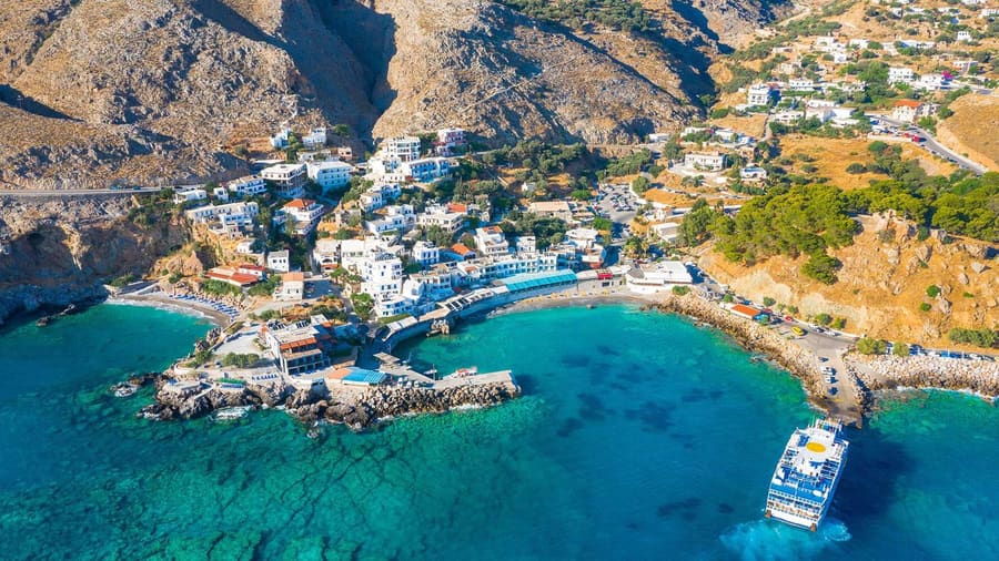
Aradena gorge ends at Marmara beach on the south coast. Small ferries link Marmara with Loutro every day, so a Chania hiking tour can leave by boat.
Tripiti gorge has no road to its entrance. Saint Nicholas chapel stands near its beach. There, walkers meet a boat or follow the E4 west to Sougia.
Mountain day hikes on a Chania hiking tour climb to White Mountains refuges. Volika refuge, built in 1958, sits above Kambi village at 1,450 metres.
A coastal Chania hiking tour reaches ancient Lissos from Sougia through the Lissos gorge. Lissos coins showed a dolphin, a quiver and the caps of the Dioscuri.
Cretan paths off the E4 carry red marks as a rule, and blue marks appear rarely. The Mountaineering Club of Chania signed ten Green Routes.
Each Green Route uses its own sign, easy to read in both directions. Signs sit on trees, stable stones, rocks or chestnut posts beside the path.
- Navigation: The Ten Essentials list opens with map, compass, altimeter and GPS.
- Food: The list adds one spare day of no-cook food.
- Water: Reliable Cretan springs above 600 metres dry up by late July.
The Ten Essentials list first appeared in print in 1974. On a Chania hiking tour, trekking boots with ankle support join the kit.


Which gorges does a Chania hiking tour walk besides Samaria?
A Chania hiking tour can walk Imbros, Aradena, Agia Irini, Tripiti, Theriso or Kallikratis. Theriso and Imbros rate 1 out of 10 for difficulty. Klados rates 7 and needs canyoning gear. Agia Irini lies inside the Natura 2000 network.
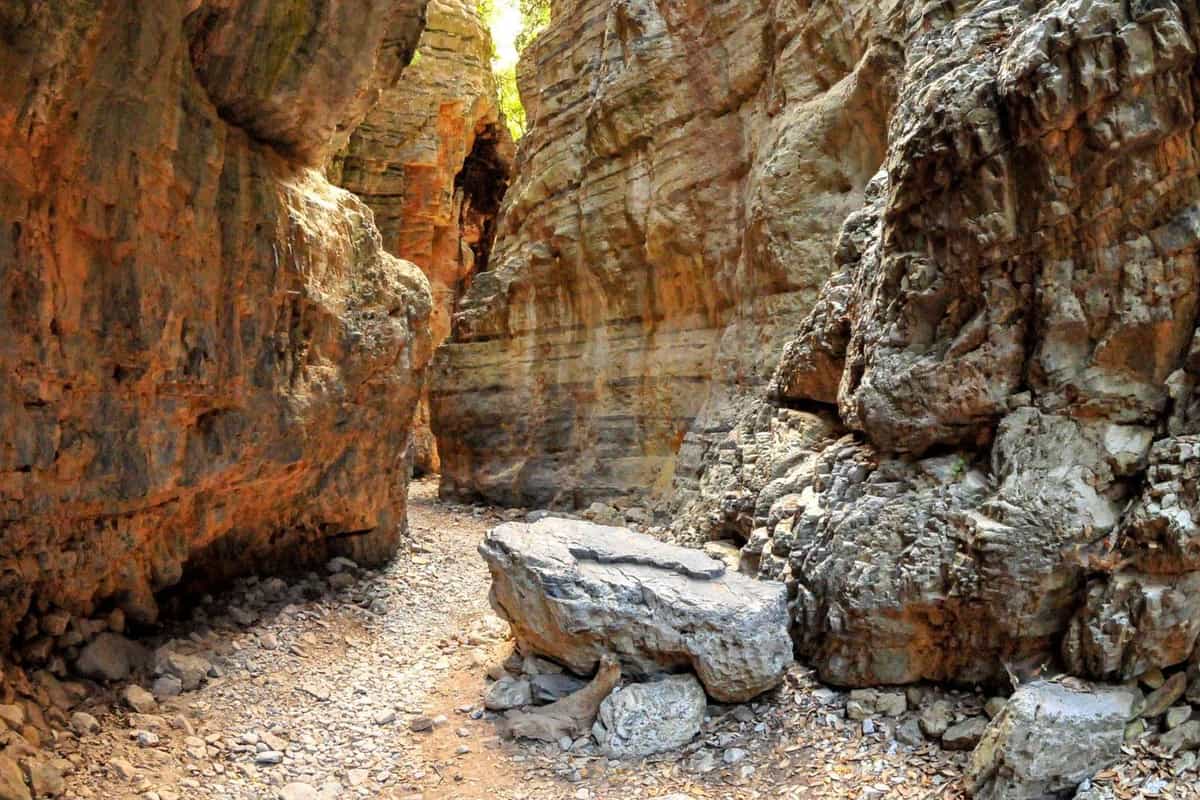
A Chania hiking tour through Imbros squeezes through Stenada, its narrowest section. The gorge also holds the Xepitira arch and a Venetian water cistern at Mesofarango.
Aradena gorge rises from Drakolakki cave’s underground stream, at the foot of Mount Thodoris. A 70-metre iron bridge, opened in 1986, spans it 138 metres above the floor.
A Chania hiking tour that skips the Samaria gorge hike can walk Agia Irini, 7.5 km long. The path drops 580 metres and exits 5 km north of Sougia.
In 1866, about 1,000 women and children escaped the Ottomans through the gorge. The Ministry of Agriculture also lists Agia Irini as a wildlife reserve.
Tripiti gorge runs 9 km and drops 2,080 metres to Tripiti beach on the south coast. Its upper bed needs canyoning gear, with rappels up to 40 metres.
A Chania hiking tour to Theriso walks a 6 km gorge up to the village at 580 metres. Eleftherios Venizelos declared a revolt there in 1905.
- Kallikratis: The 6.5 km gorge drops 510 metres from Kallikratis plateau to Patsianos.
- Klados: Its 5 km canyon drops 1,650 metres from Kokkinovari.
- Imbros: A German plane crashed here, and its debris sits in Askifou’s war museum.
A Chania hiking tour through Kallikratis follows the E4. German forces executed around 30 civilians there in October 1943.
Which E4 sections does a Chania hiking tour follow?
A Chania hiking tour follows E4 sections on the Sfakia coast and the Lefka Ori. The Cretan E4 runs 320 km from Kissamos to Kato Zakros. Ten of its sections lie in the Chania area. Mountain refuges line its high route.
Cartographer Giorgis N. Petrakis made the first organised mapping and signage of the whole Cretan E4. The Cretan line ends at Kato Zakros, on the east coast.
At Sougia, the E4 splits in two. The northern branch is alpine, and the southern one hugs a rough, cliff-lined coast. The two rejoin near Frangokastello.
The Mountaineering Club of Chania lists ten E4 sections. The high route from Omalos to Askifou runs 35 km past Kallergi, Svourichti and Tavri refuges.
On the Sfakia coast, the E4 runs 20 km from Agia Roumeli to Chora Sfakion. A Chania hiking tour there passes Saint Paul’s church and Glyka Nera beach.
A Chania hiking tour on the section from Sougia crosses the bed of Tripiti gorge. It climbs to 550 metres before a steep drop into Agia Roumeli.
The alpine branch reaches Katsiveli shelter at 1,980 metres. From there, the E4 crosses Livada and Niato plateaus to Tavri refuge, then drops through cypresses to Ammoudari.
- Tavri refuge: It stands at 1,200 metres, opened in 1992 and sleeps 45 people.
- Svourichti refuge: Built in 1994 at 2,080 metres, it sleeps twenty people.
- Fanari: Its north side ranks among the riskiest passages in Crete.
The European Ramblers Association, founded in 1969, set up the E4 as one of its European paths.
What does a Chania hiking tour see in the White Mountains?
A Chania hiking tour in the White Mountains crosses a bare high desert of stone cones and dolines. Club refuges at Kallergi and Svourichti shelter walkers. Winter snow, metres deep, lasts until midsummer. Shepherds still use stone huts called mitata.
The high desert covers ground above 2,000 metres at the heart of the range. Dozens of conical peaks rise there, each called a soros, meaning pile.
A Chania hiking tour passes summits such as Trochares, at 2,401 metres, and Mesa Soros, at 2,397 metres. Pachnes, an ultra peak, has a prominence of 2,038 metres.
Funnel-shaped sinkholes called dolines form at the base of these peaks. Five of Greece’s ten deepest explored caves lie here, and Sterne reaches 722 metres down.
The Hellenic Mountaineering Club of Chania runs the Kallergi refuge and keeps a staff member there. Stoves and a fireplace give heat, while a generator supplies power.
On a Chania hiking tour in winter, snow metres deep covers the high desert. On the peaks, that snow lasts until midsummer, and shepherds use the Madara road from Anopoli.
The word mitato comes from the Latin metor, meaning to pitch camp. Shepherd custom fixed 23 April as the date after which flocks went up to summer pastures.
- Thodori Korfi: This summit of the range reaches 2,377 metres.
- Cold: The range’s lowest recorded temperature, -33 °C, came on 13 February 2004.
- Rain: Yearly rainfall in the range runs well over 2,000 millimetres.
On a Chania hiking tour, water is scarce at middle and low altitudes in dry summers.
Which plants and animals does a Chania hiking tour meet?
A Chania hiking tour meets about 950 plant species in the White Mountains, with 110 Cretan endemics. Bearded and griffon vultures nest on the cliffs. The Cretan shrew lives at about 1,200 metres. Crete also has four endemic butterflies.
The White Mountains rank among the three richest plant areas in Greece. About 25 species and subspecies grow here and nowhere else, such as Bupleurum kakiskalae.
On a Chania hiking tour above 1,500 metres, Anchusa cespitosa forms hard mats up to 50 centimetres wide. Its bright blue flowers open from April to July.
A Chania hiking tour scans the cliffs for the bearded vulture, whose wings span 2.8 metres. By 1995 only four pairs survived in Greece, all on Crete.
Griffon vulture wings span about 2.6 metres across. A survey from 1996 to 2002 estimated 379 griffons on Crete, in about 23 colonies a year.
The Cretan wild cat was thought extinct until a live animal was caught in 1996. Small groups were believed to survive in the White Mountains.
A Chania hiking tour on high ground crosses the home of the Cretan shrew, Greece’s only endemic mammal. Introduced shrews pushed it off the lower ground.
- Cretan Festoon: Its caterpillars feed on the three Aristolochia plants of Crete.
- Cretan Argus: This endemic butterfly lives at 950 to 2,150 metres.
- Cretan Grayling: It ranks among the four butterflies found only on Crete.
A Chania hiking tour crosses ground with 32 mammals, 11 reptiles, three amphibians and about 200 bird species.
Which coastal paths does a Chania hiking tour follow?
A Chania hiking tour follows the E4 coastal path west of Chora Sfakion, past springs and marble rocks. On Akrotiri, a stepped path drops to Katholiko. A track runs up Rodopou to Diktynna, and the Cretan E4 starts at Kissamos.
A Chania hiking tour reaches Glyka Nera, or Sweetwater beach, 4 kilometres west of Chora Sfakion. Fresh water gushes through its pebbles and chills the sea.
Marmara, meaning marbles, lies 5 kilometres west of Loutro beside coloured rocks and sea caves. On the way, Finikas bay once produced purple dye from murex snails.
On Akrotiri, a Chania hiking tour takes a stepped, cobbled path from Gouverneto down the Avlaki gorge. The gorge runs 2 kilometres and drops 280 metres.
Further down the path, the cave of Saint John the Hermit runs 151 metres deep. The stepped, cobbled path then continues down to Katholiko.
On Rodopou, a roughly 23-kilometre dirt track links Rodopos with Menies, site of Diktynna. Low cars are not advised, so high vehicles like those on jeep safaris across Crete suit it.
A Chania hiking tour from Kissamos follows the E4 for 22 kilometres to Sfinari. It climbs through Kato Palekastro and Grigoriana to Polyrrhenia, whose acropolis overlooks the shore.
- Katholiko: Pirate raids drove its monks to Gouverneto in the 16th and 17th centuries.
- Fjord: The gorge ends at a rocky fjord with the monks’ harbour ruins.
- Old road: Remnants of a paved road to Polyrrhenia survive on the peninsula.
A Chania hiking tour from Sfinari takes the seaside E4 through Livadia and Chrysoskalitissa to Elafonisi.
How safe is a Chania hiking tour?
A Chania hiking tour is safe when walkers respect fire bans, gorge closures and trail marks. Fire crews and volunteers rescue hurt hikers in the White Mountains. Forests close on very high fire-risk days. Rockfall has shut gorges before.
The Hellenic Rescue Team has worked since 1978 and has over 3,000 volunteers. It is the only Greek member of the International Mountain Rescue Federation.
Chania also has its own volunteer rescue service. Its members search for missing people in the White Mountains. They also fight wildfires and attend accidents.
In 2022, a Belgian walker hurt her leg near Katsiveli refuge in the White Mountains. Twelve firefighters in four vehicles went out to reach her.
On category 4 days, Chania orders have barred people and vehicles from Natura areas and forests. A Chania hiking tour then keeps out of those zones.
On a category 5 day in August 2021, all forest roads into the White Mountains closed. Trails from Sougia to Agia Roumeli and Paleochora to Elafonisi shut too.
In August 2023, a magnitude 4.9 earthquake hit Chania. Falling rocks badly hurt a Spanish hiker in Samaria. Authorities then briefly closed Samaria and other White Mountains gorges.
- Fog: Dense fog once left a rescue team’s GPS without signal.
- Trail state: Parts of the E4 are overgrown and unmarked.
- Field fires: Burning fields is banned during the fire season.
Firefighters once carried a hurt 65-year-old out of Agia Irini gorge on a terrain stretcher.
When is the best season for a Chania hiking tour?
March, April and October suit a Chania hiking tour best. The south coast stays mild then, and April days last over 12.5 hours. Orchids flower from late March, and Omalos tulips from April. Askyfou has logged record winter rain.
The National Observatory of Athens runs a station at Palaiochora, on the south coast. Its mean daily high reaches 18.0°C in March and 20.7°C in April.
Rain there falls from 47.9 mm in March to just 19.9 mm in April. October brings a 25.0°C mean high and 38.9 mm of rain.
July has the highest mean daily high there, at 33.1°C, with 0.2 mm of rain. Such heat suits boat trips to Balos more than long climbs.
The Askyfou plateau lies at 730 meters. From 1 to 26 February 2019, its station logged 1,202 mm of rain. That set a European record for an inhabited place.
Agia Irini gorge opened officially for walkers in 1996. It stays open all year round, so a Chania hiking tour can walk it in winter.
In its typical form, Tulipa bakeri grows only on the Omalos plain in western Crete. It flowers from April on plateaus at 700 to 1,300 meters.
- Orchids: Ophrys cretica flowers from late March to early April.
- April daylight: Chania days grow from 12.5 to over 13.5 hours.
- October daylight: Chania days shrink from 11.8 to 10.7 hours.
December is the wettest month for a Chania hiking tour, with 114.0 mm at Palaiochora.
What do travelers ask about a Chania hiking tour?
Travelers on a Chania hiking tour ask about buses, camping, fires, refuges, dogs and helicopters. Regional buses reach Chora Sfakion and Omalos. Greek law bans camping outside organized campsites. Fire alerts close forests on high-risk days.
Which buses reach the trailheads of a Chania hiking tour?
The regional KTEL bus runs from Chania to Chora Sfakion and to Omalos. Its popular routes also link Chania with Sougia and Paleochora. Anopoli and Agia Irini appear on its destination list. The Agia Irini gorge starts near that village.
Is wild camping legal on a Chania hiking tour?
No. Greek Law 392/1976 bans free camping nationwide outside organized campsites. The ban covers forests, beaches and archaeological sites, day and night. Since Law 4055/2012, prosecutors pursue free camping without a complaint. Penalties include detention of up to six months.
How is a forest fire reported on a Chania hiking tour?
In August 2021, a government text alert went out to citizens. It asked them to report any smoke or fire at once. That week, forests and national parks closed across Greece. On such days, a Chania hiking tour stays out of the forests.
How does a Chania hiking tour book a mountain refuge?
Refuge huts need advance booking, above all on the alpine route. The Greek Mountaineering Club of Chania built four shelters in the White Mountains. Club rules reserve them for mountaineering and ski trips. The club office stands at Stratigou Tzanakaki 90 in Chania.
Can dogs stay in a refuge on a Chania hiking tour?
No. The club’s refuge rules bar dogs, hunting guns and game. Climbing shoes stay outside, and slippers wait in the lobbies. Food stays out of the dormitories. Alcohol and gambling are banned, and smoking is allowed only in the lobbies.
Do helicopters fly rescues on a Chania hiking tour?
Yes. In August 2023, a helicopter flew a hurt Spanish hiker to a Chania hospital. In one search for a missing runner, a helicopter came from Italy with an alpine pilot. It flew from Agia Roumeli and lowered rescuers by rope.