
A Crete jeep safari leaves the coast for the dirt tracks of the Cretan interior, climbing into the White Mountains, the Ida range and the Dikti mountains, through gorges and shepherd villages and down to the beaches of the south coast. This post covers what a Crete jeep safari includes, the starting points, the mountains, the gorges, the mountain villages, the plateaus and caves, the south coast and the best season. It is one of the best tours in Greece on Greece VIP.
Each section ends with a Crete jeep safari that can be booked online.
What does a Crete jeep safari include?
A Crete jeep safari includes a drive in a four-wheel-drive jeep over unpaved tracks through the mountain interior of Crete, with stops in villages and at viewpoints. The tour comes as an escorted convoy, a private jeep or a route with a village lunch.
Crete is Greece’s largest island, and its interior is mountain country. A high range runs from west to east and splits into six groups: the Idi range, the White Mountains, Dikti, Kedros, Thrypti and the Asterousia mountains. Between the peaks lie the Amari valley and the plateaus of Lasithi, Omalos and Nidha. A Crete jeep safari crosses this interior on dirt roads instead of the north-coast highway.
Off-roading means driving on unpaved surfaces such as dirt, gravel, riverbeds and rocks. It spans casual drives in regular vehicles and competitive events with customised vehicles. Off-road vehicles carry features built for rough ground, among them suspension lifts, off-road tyres, skid plates and strengthened drivetrains. A four-wheel-drive jeep brings that idea to the island, and the tour leader sets the route through the mountains.
Three kinds of Crete jeep safari exist. The escorted convoy follows a pattern known from desert driving: a group leader at the front and a single file of vehicles behind, a method meant to keep drivers from getting lost. The private jeep gives one party a vehicle of its own and a route set with the tour leader. The third kind adds a village lunch, so the drive includes a mountain meal.
- Terrain: The route runs over dirt, gravel and rock tracks instead of paved roads.
- Vehicle: A four-wheel-drive jeep with off-road tyres and a strengthened drivetrain carries the party.
- Convoy: One tour leader drives at the front of a Crete jeep safari, and the other jeeps follow.
- Village lunch: A Crete jeep safari with a village lunch stops for a meal in a mountain community.
A Crete jeep safari therefore combines the mountain interior with a vehicle built for rough ground. A Lasithi Plateau tour differs from a rough-road safari, because it centres on one fertile plain, the largest plateau on Crete, instead of a route that crosses ranges and tracks. The next sections name the towns where a Crete jeep safari starts and the mountains it crosses.


Where does a Crete jeep safari start?
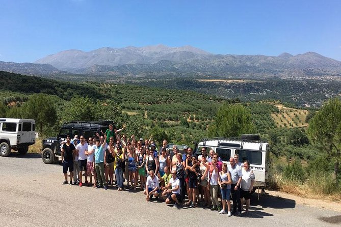
A Crete jeep safari starts in the main towns and resorts of the island: Heraklion, Hersonissos, Chania, Rethymno, Agios Nikolaos and Ierapetra. Each sits on a coast, and each lies at a different distance from the high ground that the jeeps climb.
Heraklion is the fourth largest city in Greece and the administrative capital of Crete, with 179,302 residents in 2021. The island’s biggest airport lies about 5 kilometres east of the centre, and the port runs ferries to Santorini, Mykonos and Piraeus. Hersonissos, a resort on the north coast, lies about 25 kilometres east of Heraklion. A Crete jeep safari from either place starts at the coast and heads for the hills.
Chania lies on the north-west coast, about 70 kilometres west of Rethymno and 145 kilometres west of Heraklion. The ancient city-state of Cydonia once held land from Chania Bay to the foot of the White Mountains. Rethymno, the capital of its regional unit, has more than 35,000 residents and one of the best-preserved old towns on Crete. A Crete jeep safari from Chania looks to the White Mountains, and one from Rethymno to Mount Ida, which stands in the Rethymno regional unit.
Agios Nikolaos is a coastal town east of Heraklion and the capital of the Lasithi regional unit. It serves as a hub for the twenty or so small villages and farms of that part of Lasithi. Ierapetra, on the south-east coast, is the fourth largest city on Crete and the only town on the southern coast. The island narrows to as little as 12 kilometres close to Ierapetra, so a Crete jeep safari from there starts at the narrowest part of Crete.
- Heraklion: The largest city of Crete holds the biggest airport and a ferry port.
- Hersonissos: The north-coast resort lies about 25 kilometres east of Heraklion.
- Chania and Rethymno: Both north-coast towns keep old quarters shaped by Venice.
- Agios Nikolaos: The capital of Lasithi lies on the coast east of Heraklion.
- Ierapetra: The only town on the southern coast faces the Libyan Sea.
Heraklion and Hersonissos belong to the Heraklion regional unit, Chania and Rethymno have regional units of their own, and Agios Nikolaos and Ierapetra belong to Lasithi. A Crete jeep safari therefore starts in one of four regional units. Each unit holds mountains of its own, and the next section names the three ranges that these jeep routes cross.
Which mountains does a Crete jeep safari cross?
A Crete jeep safari crosses three ranges: the White Mountains in the west, Mount Ida in the centre and the Dikti mountains in the east. Their peaks reach 2,453, 2,456 and 2,148 metres, and each range has its own rock, roads and plateaus.
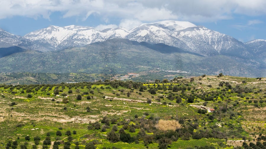
The White Mountains, or Lefka Ori, take up a large part of the centre of West Crete. The rock is limestone in light grey, bluish and black tones, and the highest summit, Pachnes, reaches 2,453 metres. The central and southern parts above 1,800 metres look like a moon landscape. Main roads climb from the north to Omalos and to Chora Sfakion through the Askifou plateau, while other approaches start at Sougia, Paleochora and Plakias.
Mount Ida, or Psiloritis, is the highest mountain on Crete at 2,456 metres. It stands in the Rethymno regional unit, on the water divide between the slopes that drain to the Libyan Sea and the northern basin facing the Aegean. On the Nida plateau east of the summit, shepherd huts built of local stones serve for shelter and cheesemaking. A Crete jeep safari on Ida passes the Vromonero plateau and the access road through the Halasia Gorge.
Dikti, also called the Lasithian Mountains, rises in eastern Crete in the Lasithi regional unit and reaches west into the Heraklion regional unit. Spathi, the highest point, stands at 2,148 metres, with Afentis Christos at 2,141 metres close behind. The main massif forms a horseshoe around the Selakano valley, which is forested with Cretan maples, holm oaks, cypresses, kermes oaks and pines. A Crete jeep safari in the east meets this wooded country.
- White Mountains: Pachnes, at 2,453 metres, is the second highest peak on Crete.
- Mount Ida: The highest mountain on Crete, at 2,456 metres, lies on a water divide.
- Dikti: Spathi, at 2,148 metres, crowns the horseshoe around the Selakano valley.
The three ranges give a Crete jeep safari three settings: pale limestone and bare high ground in the west, stone huts and a water divide at Ida, and a wooded horseshoe in the east. They top the list of six mountain groups on the island by height, ahead of Kedros, Thrypti and the Asterousia mountains.
Which gorges does a Crete jeep safari reach?
A Crete jeep safari reaches the Imbros Gorge near Hora Sfakion and the Kourtaliotiko Gorge in the southwest. In the east, a road leads towards the Ha Gorge and ends where walking begins. Each gorge has its own entrance and track.
The Crete jeep safari route to the Imbros Gorge begins at the village of Imbros, at 780 metres on the southern end of the fertile Askyfou plain. Before a road existed, the mule trail through the gorge was the only link between Chania and Hora Sfakion, and remains of it can still be seen. The gorge ends at Kommitades, where a taxi returns walkers to a vehicle left at Imbros.
The Kourtaliotiko Gorge, also called the Asomatos Gorge, lies where the Kourtaliotiko River flows south between the mountains of Kouroupa and Xiron. A road runs through it from Koxare at the northern end to Asomatos, then west to Plakias, so a Crete jeep safari can follow the gorge floor. About 20 metres inside the northern entrance, wind funnelled through high caves makes sounds like hands clapping.
The Ha Gorge cuts into the west slope of the Thrypti range in eastern Crete. The road approach runs 110 km along the national highway from Iraklio to Agios Nikolaos, then through Ierapetra and Episkopi. A diversion road of 10 km leads from Episkopi to Thripti, the site of a church. Beyond that point, a Crete jeep safari gives way to walking, because access to the gorge is on foot only.
- Imbros Gorge: Thousands of British soldiers left through it in World War II.
- Kourtaliotiko Gorge: The clapping sounds are called the kourtala, which gave the gorge its Greek name.
- Ha Gorge: The entrance lies at 370 metres, and the rocky walls rise up to 300 metres.
The three gorges show how tracks differ across the island: a mule trail in the south, a road through a canyon in the southwest and a road that ends at a footpath in the east. Near the Ha Gorge, digs found Late Neolithic occupation at Monastiraki Katalimata, and the Late Minoan IIIC site of Halasmenos lies near its mouth, so a Crete jeep safari passes ancient sites too.
Which mountain villages does a Crete jeep safari visit?
A Crete jeep safari visits Anogia on the northern slopes of Psiloritis and Kritsa above Agios Nikolaos. Anogia is known for Cretan music and its record in the Resistance, while Kritsa keeps old customs and a weaving tradition alive.
Anogia lies in the northern reaches of Psiloritis at 700 to 790 metres. A legend tells of a shepherd from Axos who found an icon of Saint John the Baptist on the mountain slopes and took it home. The icon vanished and was found in the same place again, so a church was built there. A Crete jeep safari stop in Anogia can include that church, which holds Byzantine wall paintings from the 11th century.
Music is the best-known craft that a Crete jeep safari meets in Anogia.Nikos Xylouris (1936 to 1980) was a singer, Cretan lyra player and composer, and Antonis Xylouris, known as Psarantonis, is also a lyra player and composer. Each July, the Yakinthia festival at 1,200 metres on the Nida plateau celebrates Cretan folk tradition. The village was also the core of the Resistance in Crete, and about 800 houses became rubble on 13 August 1944.
Kritsa sits at 375 metres on the rock hill of Kastellos, among olive groves, 10 km from Agios Nikolaos. Old Cretan customs and traditions are kept alive there, and the village counts as a leading centre of weaving. Local olive producers formed an agricultural co-operative in 1927 and opened an olive oil factory in 1937. Before the village entrance, a Crete jeep safari passes the Byzantine church of Panagia Kera, with frescoes of the 13th and 14th centuries.
- Lato: The ruins of ancient Lato, a powerful Dorian town, lie 3 km north of Kritsa.
- Katharo: A climb from Kritsa leads to the plateau of Katharo, with a view of Mirabello Bay.
- Residents: About 2,200 people live in Kritsa, and the Anogia municipality counts 2,240 in 2021.
Life in these highland villages was hard. The people of old Anogia were mainly shepherds and goatherds, and barren soil and harsh winters kept them in poverty. Kritsa took part in all the revolutions of Crete and was destroyed repeatedly. A Crete jeep safari that visits both villages meets a living craft and a living memory, shaped by herding, olive growing and revolt.
Which plateaus and caves does a Crete jeep safari pass?
A Crete jeep safari passes the Nida plateau between the peaks of Mount Ida, the Idaean Cave on the mountain’s slopes and the Omalos plateau in the White Mountains. Each upland is grazing country with its own caves and myths.
The Nida plateau lies between the east and west peaks of Mount Ida, at 1,400 metres. Nobody cultivates it, and flocks use it as grazing ground, while in winter it serves for downhill skiing. The village of Anogia lies about 22 km away, so a Crete jeep safari joins the two. Zominthos, another plateau on the northern foothills of the mountain, holds the highest-altitude Minoan villa ever found.
On the slopes of Mount Ida lies the Idaion Antron, the Idaean Cave, where legend says the god Zeus was born. Other legends place his birthplace in Psychro Cave on the Lasithi Plateau. A Crete jeep safari stop at the Idaean Cave recalls its ancient role, as the cave of the Goddess and as a place of initiations. It possibly served as an oracle, a theory tied to the tripod on the coins of nearby Axos.
At Xyloskalo on the Omalos plateau, two peaks rise, Gingilos at 2,080 metres and Volakias at 2,116 metres, and legend links them with the throne of Zeus. A Crete jeep safari across Omalos also passes pastures called madares, where shepherds bring flocks in the warm seasons. The Tzani Cave is named after Tzanis Markos, a chieftain nicknamed Fobos, meaning fear, who made it his lair in the early years of the Turkish invasion.
- E4 route: A branch of the E4 walking route to the Timios Stavros summit starts west of the Nida plateau.
- Kamares Cave: Ancient worshippers used it as a sanctuary, and Kamares ware pottery is named after it.
- Vromonero: This plateau beneath Skinakas peak holds a holly and maple grove with endemic and endangered species.
Revolt runs through the story of Omalos. The Turks rarely managed to penetrate the plateau, and its name is said to come from a revolutionary song. Hatzimichalis Giannaris (1833 to 1916) wished to be buried there, and a church dedicated to him stands by the Tzani Cave. In World War II, the plateau served as an airfield, which adds a modern chapter to what a Crete jeep safari finds there.
What does a Crete jeep safari see on the south coast?
A Crete jeep safari on the south coast faces the Libyan Sea and reaches Preveli, where a lagoon and a palm forest lie below a Greek Orthodox monastery. The same coast also holds the Asterousia Mountains, the Mesara Plain and Bronze Age sites.
The water south of the island is the Libyan Sea. Ancient geographers used that name for the part of the Mediterranean between Cyrene and Alexandria, and the stretch south of Crete is now also called the South Cretan Sea. A Crete jeep safari that drops to the shore meets this sea. Approaches to the White Mountains also begin on the south side, from Sougia and Paleochora in the west and from Plakias and Frangokastello along the coast.
Preveli lies on the south coast in the Rethymno region and is known for its monastery. The Monastery of Preveli has two main building complexes. The lower one, St. John the Baptist, is in ruins, and the upper one, St. John the Theologian, is still in use. The record names its founder as a feudal lord called Prevelis, in the Middle Ages, when Venice held Crete.
The upper monastery holds religious relics and icons, and its heavily restored buildings are open to the public. In 1821 Abbot Melchissedek Tsouderos led rebels in the Greek War of Independence, and the monastery was destroyed and later rebuilt. It organised rebellions again in 1866 and 1878. Those risings helped contribute to the island’s eventual independence and its political union with Greece.
Below the monastery, at the mouth of the Kourtaliótiko gorge, lies Preveli beach and lagoon, known locally as Palm Beach. Behind the beach stands an extensive glade of Phoenix theophrasti, the Cretan date palm. A heart-shaped rock on the sand is called the stone of lovers. A fire on 22 August 2010 destroyed a large share of the palm grove, and by 2011 the trees had grown back on their own.
- Asterousia Mountains and Mesara Plain: Both belong to the southern coastline that borders the Libyan Sea.
- Bronze Age sites: Kommos, Hagia Triada and Phaistos mark this area as a centre of ancient settlement.
- Islands: Gavdos, Gavdopoula, Koufonisi and Chrysi lie in the Libyan Sea besides Crete.
Preveli ties the pieces of a Crete jeep safari together with its monastery, lagoon and palm forest. A local legend says that Odysseus, the King of Ithaca, stayed in the wider area after the Trojan War, on his way home from Troy. The south also records more sunny days and higher average temperatures through the year than the rest of the island.
When is the best season for a Crete jeep safari?
A Crete jeep safari runs in a climate that is mainly hot-summer Mediterranean, with a fairly mild winter on the coast and snow on the mountains from November to April. Each season therefore changes the route, from snowy peaks to hot summer days and warm autumn weather.
Crete straddles two climatic zones, the Mediterranean and the semi-arid, and falls mainly within the Mediterranean one. The climate is primarily hot-summer Mediterranean, while parts of the south and east are hot semi-arid. Higher elevations belong to the cold-summer Mediterranean category. Mountain peaks above 2,000 metres can show a continental climate. A Crete jeep safari that climbs from the coast to the peaks crosses more than one climate.
The air can be quite humid, depending on the distance from the sea. Average annual temperatures reach up to 22.0 °C at Tris Ekklisies and Psari Forada in the south. Swallows are found throughout Crete in summer. In the White Mountains the limestone looks off-white during summer and fall, so a summer Crete jeep safari sees the pale peaks that gave the range its name.
Snow lies on the White Mountains until late in spring, and snowfall on the mountains is common from November to April. Low-lying areas see snow rarely. Western Crete, in the Chania province, receives more rain than the east, and its soil suffers more erosion. Rain also changes the ground life, since toads and frogs show themselves after it falls and edible snails cluster to wait for it.
- Summer: Cicadas, known locally as tzitzikia, grow louder and more frequent on hot summer days.
- Autumn: Crete holds the record for the highest temperatures ever recorded in Europe in October and November among W.M.O. stations.
- Winter: The winter is fairly mild, and snow stays on the mountains.
- Spring: The peaks of the White Mountains stay covered in snow until late in spring.
- Wildflowers: Camomile, daisy, gladiolus, hyacinth, iris, poppy, cyclamen and tulip grow beside more than 200 species of wild orchid.
The record names no single best month, so the choice follows the target. Snow-free peaks belong to summer and fall. Orchids and wildflowers grow on the island’s slopes. The warm days of October and November belong to the south coast. Each target changes how a Crete jeep safari is planned.
What do travelers ask about a Crete jeep safari?
A Crete jeep safari raises questions about wildlife, snakes, beaches, plants and wartime history, and the island’s own record answers them. Crete has no animals dangerous to humans, and its mountains, gorges and south coast hold birds, herbs, trees and sites from 1941.
Which wildlife does a Crete jeep safari pass?
On a Crete jeep safari, the mountains and gorges are refuges for the endangered lammergeier, and Crete holds the largest island population of griffon vultures in the world. The golden eagle, Bonelli’s eagle and Eleonora’s falcon are also recorded. Tortoises can be seen throughout the island.
Are there dangerous animals on a Crete jeep safari?
No animal on Crete is dangerous to humans. Four species of snake live there, and none harms people. The only venomous one, the nocturnal cat snake, delivers a weak venom at the back of its mouth to paralyse geckos and small lizards. Ancient Greeks credited Hercules with clearing the island of bears and wolves.
Does a Crete jeep safari reach a beach?
A Crete jeep safari finds its beach at Preveli on the south coast. A river runs through the gorge behind it, with a palm forest, and the sand meets clear waters. The beach is regularly served by tourist boats from the nearby resort of Plakias.
What plants does a Crete jeep safari pass?
Herbs include common sage, rosemary, thyme and oregano, and the endemic Cretan dittany is rare. Common trees are the chestnut, cypress, oak, olive, pine, plane and tamarisk. The edible prickly pear is among the cacti. Trees tend to be taller in the west, where water is more abundant.
Does a Crete jeep safari pass sites from the Second World War?
Preveli Monastery sheltered British, Australian and New Zealand troops in the Battle of Crete in 1941. A group of Australian soldiers was rescued by submarine at Preveli Beach, and German forces then destroyed the lower monastery. Australian former soldiers helped finance monuments there. The White Mountains also hid rebels during the German Occupation.
Featured photo: dronepicr, CC BY 2.0, via Wikimedia Commons.