
A Thassos boat trip sails the coast of the northernmost Greek island in the Aegean, stopping to swim at beaches and coves below pine-covered slopes, from Limenas and Golden Beach to Marble Beach, Aliki and the rock pool of Giola. This post covers what a Thassos boat trip includes, the island, each stop along the coast, the islets, sea life, food and wine, the ferries, the history, the types of trip, how Thassos compares with Halkidiki and the best season. It is one of the boat trips in Greece on Greece VIP.
Each section ends with a Thassos boat trip or island tour that can be booked online.
What does a Thassos boat trip include?
A Thassos boat trip is a day on the water, sailing around the island or along one coast. The route passes beaches, coves and pine-covered slopes, and the boat anchors offshore so passengers can swim. The coast offers sandy and pebbled shores beside secluded coves.
The island is ringed by a coastal road, so the same beaches can be seen from the water and from the land. A Thassos boat trip that circles the island keeps the whole shoreline in view, while a route that follows one coast spends the day in a single part of the island. Landmarks appear in a slow sequence: pine woods, beaches and small harbours. The deck sits low over the water, and the island fills the view for the whole of the crossing.
Stops for swimming shape the day. A Thassos boat trip that sails a full circle gives passengers time in the water at sandy bays on the east coast and at marble coves in the south. Between swims, the boat keeps close to the shore, and the deck is the best place to watch the island slide past. A Thassos boat trip that keeps to one coast leaves the rest of the island for another day.
Sailing gives a different reading of the island than a road journey does. From the sea, the wooded slopes fall towards the water, and the outline of the coast is clear in both directions. A Thassos boat trip therefore suits travellers who want to see the whole island without changing hotels. The vessel stays in sheltered water for much of the route, and passengers can move between the shaded and sunny parts of the deck.
- Swimming stops: The boat anchors in bays and coves, and passengers swim from the deck.
- Coastal views: A Thassos boat trip passes beaches that are hard to reach by road.
- Time ashore: Longer routes include a short walk in a port town before the return leg.
A Mount Athos cruise along the monastic peninsula of the mainland is a related option for travellers who plan a wider tour of the region. A Thassos boat trip remains the simplest way to see the island from the water, with the north coast, the sandy east and the marble south all within reach of one day on deck.


What is Thasos island on a Thassos boat trip?
A Thassos boat trip circles the northernmost major Greek island, the twelfth largest by area, with 380 square kilometres and a population of 13,104 at the 2021 census. It forms a separate regional unit in the Eastern Macedonia and Thrace region.
The island lies about seven kilometres from the northern mainland and has a rounded shape, rising from the shore towards the centre. Pine forest covers much of the eastern slopes, and the interior holds villages that were first built away from the coast, with stairways that once linked them to small harbours below. A Thassos boat trip passes these slopes and the old landing places that served them.
A Thassos boat trip shows an island that still lives from the land as well as from the sea. The main farm products are honey, almonds, walnuts, olives, olive oil and wine, and fishing and the herding of sheep and goats continue alongside tourism. Agriculture and stockbreeding were the old mainstay, and the population moved down to the shoreline as tourism grew. The island was part of the Kavala Prefecture until a reform of local government in 2011 gave it the status of a regional unit.
From the water, the island appears as one green mass with a rocky crown, and the coast is easy to follow from the deck. A Thassos boat trip can trace the shoreline for the full length of the coast or cut across open water between two bays. Wind decides the side of the island that a skipper chooses on the day.
- Highest point: Mount Ypsario reaches 1,205 metres.
- Forest cover: Pine forest covers much of the eastern slopes of the island.
- Position: The island sits in the northern Aegean Sea, close to the mainland coast.
The island is compact enough to be understood in a single day on the water. Mountains, pine woods, inland villages and a working shoreline lie close together, and the shape of the coast is easy to read from the deck. A Thassos boat trip therefore turns a short crossing into a full picture of the island.
What does a Thassos boat trip see at Limenas?
A Thassos boat trip calls at Limenas, the capital and main town of the island, whose full name is Limenas Thasou, or Port of Thasos. The town stands on the northeast corner, and finds from the ancient city are kept in the Archaeological Museum of Thasos.
The modern town was built west of the ancient one, and ruins of the old city lie beside the streets. The ancient agora is in the town itself, while the acropolis and the ancient theatre stand above the town. A Thassos boat trip that arrives here passes the city walls and the hill before the boat ties up at the quay.
The ancient city was rich, and its coins carried the wine god Dionysos and bunches of grapes. Digs in 1887 by Theodore and Mabel Bent uncovered an arch of Caracalla and a statue of the empress Sabina. The Gate of Silenus, built around 500 BC, is another monument above the town, and a Thassos boat trip passes close to it. The town holds 3,331 residents at the 2021 census, and a walk between the agora and the theatre fills the time ashore.
In antiquity the capital had two harbours, one on each side of the headland, and the town is still called simply the port. The waterfront has served shipping for the whole of that time. The quay itself is a working place, with small boats tied along the edge. A Thassos boat trip gives a clear view of the waterfront, where the houses stand in rows above the quay.
- Ancient agora: The market square of the classical city lies beside the modern streets.
- Acropolis and theatre: Both stand above the town and are reached on foot.
- Old walls: Stretches of the ancient circuit survive around the old town.
Limenas is the one place on the island where the ancient and the modern town overlap. Visitors step from a working quay into streets that follow the lines of the classical city. A Thassos boat trip that calls here opens the island’s long history in a single stop, and the walk from the deck to the ruins is short.
What does a Thassos boat trip see at Golden Beach?
A Thassos boat trip reaches Golden Beach, the long shore on the east side of the island that is known in Greek as Skala Panagia. Its water stays shallow near the edge, and the villages of Panagia and Potamia sit above it.
Golden Beach is the English name of the coastal resort that belongs to the village of Panagia. Panagia stands inland at an elevation of 300 metres, and its neighbour Potamia lies in a valley at the foot of the island’s highest mountain. Pine and sweet chestnut forests surround Potamia on the south and east. The church of the Assumption stands in Panagia. A Thassos boat trip gives a view of both villages from the water, with the mountain behind them.
The beach itself is a long strip of sand on the eastern side of the island, and the water is warm and shallow for a good distance from the shore. Sun loungers and water sports are part of the scene, and the sand gives the place its English name. The sand is soft underfoot, and the bay is easy to reach from the road. A Thassos boat trip that anchors off the beach lets passengers swim in clear water over a pale seabed.
Potamia was the birthplace of the sculptor Polygnotos Vagis, and the name of the village comes from the streams that run through it. Walks from Potamia lead up towards the high ground, and the forest path is used by hikers who climb to the summit. A Thassos boat trip that stops here leaves time for a short climb into the village, where the streams and the trees keep the air cool.
- Golden sand: The shore is a long strip of sand on the eastern side of the island.
- Shallow water: The sea stays warm and shallow for a distance from the edge.
- Village backdrop: Panagia and Potamia stand on the slope above the beach.
- Local museum: Potamia keeps the work of the sculptor Polygnotos Vagis.
Golden Beach combines an easy anchorage with a view of two inland villages and the island’s high ground. Passengers who swim here see the coast from a different angle than drivers on the coastal road. A Thassos boat trip that includes this stop leaves the mountain, the chestnut woods and the long sand in one frame.
What does a Thassos boat trip see at Marble Beach?
A Thassos boat trip can anchor at Marble Beach, the bay in the north of the island that is also called Saliara or Marmara beach. The shore is made of white pebbles. Pines grow close to the water, and the water deepens away from the pebbles.
Saliara takes its other name from a marble factory that stands nearby, and the white pebbles on the shore match the colour of the stone. The bay sits in the northern part of Thasos, where dense pine trees reach down to the waterline. Boats, cars and walkers can all reach the beach, though the last stretch of road is unsurfaced. A Thassos boat trip arrives at the easiest end of the route.
Quarrying is the only mining work left on the island in recent decades, and marble has shaped the local economy for a long time. A Thassos boat trip sees the result in the white shore and in the pale seabed. The wine, nuts and marble of Thasos were known far from the island in antiquity, and the island stayed a major source of marble until the Slavic invasions of the late sixth and seventh centuries interrupted the trade. Byzantine builders later took stone from the quarries again.
The beach is small, and the water deepens away from the pebbles into a clear blue. Boats approach from the northern coast, and the bay is easy to spot from the sea because of the pale stone under the surface. A Thassos boat trip that stops here gives passengers a chance to swim above white stone. Pines shade the back of the bay, and the pebbles continue under the water for a short distance. The light on the white stone changes through the day.
- Colour of the water: The sea turns bright over the pale stone of the seabed.
- Shade: Pine trees at the back of the bay give cover from the sun.
- Arrival by sea: Boats come into the bay from the northern coast.
Marble Beach shows how closely the island’s landscape and its trade are tied together. The same stone that covers the shore was cut, loaded and shipped for centuries, and the marks of that work are still part of the coast. A Thassos boat trip that includes this bay adds a quarry landscape to a day of swimming.
What does a Thassos boat trip see at Aliki?
A Thassos boat trip can round the peninsula of Aliki at the southern end of the island, where two natural coves open on either side of a narrow neck of land. The whole peninsula is solid white marble.
The coves are the reason for the name: salt stays in the hollows left by quarrying when the water level drops, and these natural salt pans gave the place the name Aliki, a toponym recorded from the late Byzantine era. Quarrying started in the Archaic period and continued for fourteen centuries, and workers cut the stone back from the coast on three sides of the headland, so a Thassos boat trip can pass close to the worked faces.
Ships came close to the shore and loaded the blocks, and in Roman and Early Christian times the bright, coarse-grained marble of Aliki travelled as far as Rome, where it was used in public buildings, temples, private houses and monuments. The tip of the peninsula was cut away almost to the level of the sea, yet the stone was not exhausted: tall faces, wide steps of marble and huge blocks still stand around the edge of the worked zone.
A sanctuary stood at the back of the eastern cove from the seventh century BC, soon after settlers from Paros reached the island. Two rectangular buildings, each with two rooms and a colonnade at the entrance, are visible today, and every building held a large room with a central hearth for ritual meals after sacrifices. Worship continued into the early Christian period, when basilicas rose on the same ground. A Thassos boat trip passes the cove where the sanctuary stood.
- Two coves: A Thassos boat trip passes two natural bays that open on either side of the narrow neck of land.
- Sailors’ wishes: Carved prayers for safe voyages survive on the bases and architraves of the sanctuary buildings.
- Old houses: The western cove holds 25 small buildings with stone roofs, built before 1850.
- Source of marble: The stone known as Thasian marble came from Aliki.
Aliki packs the island’s maritime story into one small headland. Marble was cut at the water’s edge, loaded onto ships and sent to Rome, while sailors left their prayers on the stone they came to buy. A Thassos boat trip that rounds this peninsula shows the quarry, the sanctuary and the salt pans in a single sweep, with the Dioscuri still watching over the cove.
What does a Thassos boat trip see on the south coast?
A Thassos boat trip on the south coast reaches Giola, a natural pool cut into rock beside the open sea near Astrida, and follows a shoreline of small coves. The rock there rises to 8 metres, and the water inside the basin stays warmer than the sea outside.
Giola carries the name Tear of Aphrodite. Island tradition holds that Zeus shaped the basin so the goddess was able to bathe in clear water, and the story keeps the spot tied to the myths of the island. The pool sits at the edge of the sea, so a Thassos boat trip that stops there leaves only a short swim between the open water and the rock basin.
The shoreline beside the pool folds into small inlets that break the run of rock. A Thassos boat trip can hold position in these pockets of calm water, while the road above the coast stays high on the hillside and well back from the landing points. Pine and olive trees line that road, and the coastal route of the island follows the water for long stretches.
Divers drop from the lip of the rock into deep water, and swimmers enter the basin from the lower side where the stone slopes. Because the basin holds its heat, the water inside suits a long swim better than the open sea. From the deck, the pool reads as a dark opening in the rock face, and the basin lies within a short swim of open water, so a Thassos boat trip can reach it without a long approach.
- Access: a 2-kilometre dirt track leaves the main coastal road, and the last 300 metres are walked.
- Neighbouring bay: Astrida beach lies next to the pool and gives sand in place of rock.
- Water margin: the seabed stays clear close to the shore along this stretch of coast, which suits a swim from the deck of a Thassos boat trip.
The pool anchors a southern route. A Thassos boat trip that works this coast can link the rock basin with the quieter inlets around it, giving passengers water to swim in and stone to study from a distance. Light shifts on the rock face through the afternoon, and the south coast rewards a slow pass, so the day ends with the boat turning back along the shore.
What does a Thassos boat trip see at the Archangel Michael monastery?
A Thassos boat trip that turns toward the monastery sees a walled religious house on the lip of a cliff above the Aegean. The Monastery of Archangel Michael is the largest and best known monastery on Thasos, and pilgrims travel to it through the year.
The house began with an ascetic named Luke, who built a small chapel on the site after the archangel called him there. A spring of holy water rose inside that chapel, and the spring drew the first worshippers to the cliff. The chapel stood alone at that stage, and the community that a Thassos boat trip sees today formed around it later.
The relic kept at the site is the Holy Nail, the nail that entered the right hand of the crucified Christ. Emperor Nikephoros Botaneiates had given that nail to the Monastery of Filotheou on Mount Athos, and in time it came to the chapel on the cliff. The monastery was founded afterwards as a dependency of Filotheou. That link places the house inside the monastic world of Mount Athos, a world that starts at the horizon of a Thassos boat trip.
A Thassos boat trip shows the building from an angle that the land route cannot match. From the water the walls sit high above the waterline, and the whole outline of the complex reads in one view against the sky. Passengers who stay on deck see the cliff face first and the monastery above it, and the shape of the headland frames the site for the whole pass.
- Community: nuns live at the site, and the house counts as a women’s monastery.
- Dedication: the archangel honoured here serves as the patron saint of the islanders.
- Position: the monastery stands 35 kilometres west of Limenas, the capital of the island.
From the deck the monastery gives a southbound run a landmark with a history behind it. A Thassos boat trip that passes the cliff adds a stop where worship, stonework and sea views meet in one place, and the climb of the headland marks the turn of the route. The house keeps its purpose, and the quiet over the site shows it.
Which islets does a Thassos boat trip pass?
A Thassos boat trip passes Thasopoula, the rocky islet that sits in the Thracian Sea off Thasos, and comes within sight of Koinyra and Xironisi, the two islets of the protected zone around the island. Thasopoula holds no residents and rises to 111 metres at its highest point.
The Thracian Sea forms the northernmost part of the Aegean Sea, and Thasopoula lies roughly midway across the channel that separates Thasos from the mainland coast, off the mouth of the Nestos river. The islet stands 15 nautical miles from Kavala, so it sits inside the shipping lane that runs between the island and the northern shore. Its surface covers 0.716 square kilometres.
Bird colonies give the islet its character. Gulls, cormorants and herons gather on and around Thasopoula, and the same ground carries a cover of Mediterranean maquis vegetation. A Thassos boat trip that keeps a distance from the shore can watch the birds without pushing them off their nests, which matters on a rock that offers them little shelter. Herons work the waterline while gulls ride the updraughts above the ridge.
Another islet, Krambousa, lies across the coast of Skala Potamia on the other side of the island. Thick vegetation covers it from the waterline upward and makes a full circuit of the shore impossible on foot. A wild vegetable known locally as krambi grows there, and the small church of Saint Daniel stands at the top of the hill, where islanders gather on the saint’s day each year. The islet sits on the eastern side, so a Thassos boat trip that circles the island passes it too.
- Protected name: Koinyra and Xironisi belong to the Natura 2000 site that takes its name from Mount Ypsario and the coastal strip.
- Designation: the two islets form part of a zone listed under the Birds Directive.
- Wildlife list: the site record lists the protected birds, plants and habitats of the zone.
Islets of this size carry little, and the rocks off Thasos hold wildlife rather than settlements. A Thassos boat trip that includes them adds open water and birdlife to a route of beaches and cliffs, and the view back toward the main island gives the day its scale. The channel stays busy, so the islets belong to a working sea as well as to a protected one.
What does a Thassos boat trip see at Potos and Limenaria?
A Thassos boat trip along the south-west coast comes to Limenaria and Potos, two seaside settlements set below the hills, with the inland village of Theologos standing above them. Limenaria is the second largest town on the island and lies 38 kilometres from the capital.
Limenaria takes its name from the small coves that break the coast beside it, and the settlement counts 2,428 residents. A beach strand of 1.2 kilometres runs along the front, with pebbly bays and further coves just to the west near Trypiti, and the water in front of the town looks across to Mount Athos on the far side of the northern Aegean. From the sea, a Thassos boat trip sees the town as a line of roofs above the beach.
Mining shaped the town long before tourism. Friedrich Speidel held concessions for zinc and lead ore and began work around 1903, and the company put up a large administrative residence above the harbour that islanders call the Palataki, or Speidel Castle. The building was designed by the Italian architect Pietro Arigoni, and it stands today in a largely abandoned state as a marker of that period, visible from the water on a Thassos boat trip.
Potos lies along the south side of the island as a resort village with a sandy beach and a busy evening trade in bars and tavernas. Theologos stands inland at 220 metres above the sea, 50 kilometres from the capital and 10 kilometres from Potos, and it served as the administrative and commercial centre of the island under Ottoman rule. Its stone houses, watermills and arched bridge from 1917 keep the older character of the place, and the hills above give a Thassos boat trip its backdrop.
- Mining output: iron ore mining resumed between 1954 and 1964 and yielded around 3 million tonnes.
- Village size: Theologos counts 1,548 residents.
- Old record: Ottoman registers list Theologos under the name Tologo in 1519.
The two villages give the coast a working history, and the water in front of them gives the day its rest. A Thassos boat trip that reaches this corner of the island can pass the harbour works and the coves in one run. The south-west quarter closes the route with towns built for trade that now live on visitors.
What sea life does a Thassos boat trip see?
A Thassos boat trip crosses water that carries Posidonia seagrass meadows, the fish that shelter in them, and birds that nest on the coast and the islets. Thasos forms part of Natura 2000 site GR1150012, part of the European network of protected areas.
Posidonia oceanica, known as Neptune grass or Mediterranean tapeweed, is a seagrass found only in the Mediterranean. It grows on the seabed from 1 metre down to 35 metres, forming meadows that bind sand and rock with a mat of roots and rhizomes. The plant is a flowering species rather than a seaweed, so it carries flowers, fruit and seeds like a land plant, and snorkellers meet the meadow as a band of long, ribbon-like leaves lying below the surface on a Thassos boat trip.
The meadows support a crowded community of small animals, from the algae and bacteria that coat the leaves to the molluscs and crustaceans that feed on them. Posidonia also takes up carbon at a high rate and acts as a marker of clean water, because the plant declines where pollution rises. Fish gather along the edges of the beds, where the cover of the leaves meets open sand, and snorkellers on a Thassos boat trip meet that same edge, where small fish stay close to the leaves.
Birds and mammals complete the picture. Thasos ranks as a leading European nesting site for the Shag and the Lanner Falcon, and Griffon Vultures, once resident, now visit the area without breeding. The northern part of the Thracian Sea gives the endangered Black Sea harbor porpoise a habitat. From a deck the birds are the easiest sign of life, since they work the cliffs and the updraughts above them, and a Thassos boat trip can count more than one species on the wing in a single pass.
- Growth pace: horizontal rhizomes of Posidonia extend between 1 and 6 centimetres a year.
- Anchor scars: anchors cut into the meadows, and the damaged ground recovers slowly.
- Beach finds: dead leaves wash ashore and roll into balls of fibre on the sand.
For anyone with a mask, the shallows around Thasos offer a view that shorelines elsewhere have lost. A Thassos boat trip can stop over sand or rock, and the seagrass, the fish and the birds belong to the same system that the protected zone watches. A slow drift with the engine off gives a Thassos boat trip the best chance to see it.
Which food and wine does a Thassos boat trip serve?
A Thassos boat trip puts island produce on the table: Throumba olives, olive oil from Thasos, local honey, and wine that carries the name of the island. Thasos olive oil is certified as a protected geographical indication, and the Throumba olive holds protected designation of origin status.
Honey counts among the main agricultural products of the island, alongside almonds and walnuts, and Thasos honey takes its aromatic quality from the rich flora of the island. Producers keep hives among the pines and the thyme, and the varieties that reach the table include flower honey and pine honey, with thyme honey held as a local favourite among the islanders.
The olive side of the table rests on the Throumba, a local variety with protected designation of origin status, while olive oil from the island carries a separate protected geographical indication. Both products stand at the centre of a long tradition of cultivation and pressing, and a museum on the island records the history of the crop with tools, machines and photographs. Bread, oil and olives make the simplest opening to a meal on a Thassos boat trip.
Wine has the longest record here. Thasian wine was famous in antiquity and stood on the short list of Greek wines that writers praised, and vineyards on the island supplied the market at Athens. Thasian coins carried the wine god Dionysos and bunches of grapes, and an island law on the quality and trade of wine, dated to 480-470 BC, survives in the archaeological museum. Fishing still employs islanders, so grilled fish comes off the same water the boat crosses.
- Cellar: wine remains one of the agricultural products of Thasos.
- Herd: sheep and goats are raised on the island, and grilled meat on board comes from that stock.
- Fish: fresh fish goes straight from the boats to the kitchens along the coast.
Aboard a boat, food and wine give the day a second subject. A Thassos boat trip can serve the island on a plate: olives from the groves, oil from the press, honey from the hives and fish from the water below the hull. Matched with a glass of Thasian wine, that menu gives a Thassos boat trip its last course and carries a tradition reaching back to the ancient city.
How does a Thassos boat trip begin from the mainland?
A Thassos boat trip starts at one of two mainland ports in eastern Macedonia. Ferries sail from Keramoti to Limenas, the island capital in the northeast corner, and from Kavala to Skala Prinou on the northwest coast. Roads and flights bring travelers to both harbours.
Keramoti is a town in the Kavala regional unit of East Macedonia and Thrace, and its quay sits close to Kavala International Airport. Aircraft land at Chrysoupoli, 27 km from the city of Kavala, so the transfer between the terminal and the water stays short. A Thassos boat trip booked from this side suits travelers who arrive by air and board a ferry on the same day, with luggage kept near the berth.
The other departure point is Kavala, a mainland city with a working port and a long maritime record. Sailings from there reach Skala Prinou, the second largest ferry port on the island, which receives regular routes from the mainland city. Travelers who begin a Thassos boat trip at this harbour dock in the northwest, beside the road that runs inland and along the western shore towards the villages.
Limenas, also known as Thasos town, is the capital and main port, standing about 31 km or 17 nautical miles south of Kavala. Its ferry berth lies inside the built-up area, so arrivals step off close to the waterfront streets and the small harbour. A Thassos boat trip that starts at Limenas puts passengers ashore in the middle of town, within walking distance of the quay and the main street.
- Air arrivals: Kavala International Airport carries the code KVA, stands at Chrysoupoli and has a runway of 3,000 m.
- Residents: The Keramoti municipal unit counted 4,381 people at the 2021 census, while the settlement counted 1,715.
- Island towns: Limenas recorded 3,350 residents in the same count and the community of Prinos recorded 1,330.
- Inland link: The village of Prinos lies 17.4 km southwest of Limenas and 21.8 km north of Limenaria.
Two mainland ports face the island across the northern Aegean, and each delivers passengers to a different shore. Keramoti keeps company with the airport, while Kavala serves the longer crossing to the northwest. A Thassos boat trip therefore starts with a simple choice of harbour, and the hours that follow run along the island coast from one headland to the next, with the mainland behind the stern.
What history does a Thassos boat trip pass?
A Thassos boat trip passes a shoreline layered with Greek, Phoenician and later occupations. Parian settlers founded a colony around 650 BC. Gold mines built the city’s wealth, and stamped Thasian amphorae carried wine across the Mediterranean. Byzantine, Ottoman and Egyptian rulers followed before union with Greece.
Phoenician traders reached Thasos while following its gold mines, and they founded a temple to Melqart that the Greeks later linked with Heracles. Herodotus visited the sanctuary and reported that the richest mines lay on the east side, facing Samothrace. A Thassos boat trip along that coast passes slopes where ancient crews cut ore from the rock, above the water line. The capital had two harbours in antiquity.
Thasian power reached the mainland, where the city owned mines worth more than those on the island, with yearly revenues between 200 and 300 Attic talents. Wine left the island in jars produced in Thasian workshops or in workshops of the Thasian peraea, a pattern recorded at Pistiros. Handles carried stamps naming the workshop, so a Thassos boat trip passes ground tied to an early export trade that reached far beyond the Aegean.
Byzantine rule began in 395, and marble quarrying continued until Slavic raids disrupted the island. The Genoese Gattilusi family held Thasos around 1434 and handed it to the Ottoman Empire in 1455. Sultan Mahmud II gave the island to Muhammad Ali of Egypt as a personal fiefdom in 1813. On 20 October 1912 the Greek navy annexed Thasos, closing more than 350 years of Ottoman Turkish rule.
- Wine and coins: Thasian coinage bore images of the wine god Dionysos and of grape bunches.
- Ottoman name: Ottoman Turkish speakers knew the island as Taşöz.
- Fighting men: An Ottoman register of 1831 listed 1,821 Greek males fit to fight, leaving out women, orphans and children.
- Russian fleet: A Russian fleet occupied the island between 1770 and 1774.
Each layer of occupation left something along the water: Phoenician mine workings, Greek walls, a Byzantine church, an Ottoman register and an Egyptian grant. A Thassos boat trip crosses this record at the surface, with the land holding the ruins and the strait holding the route. The island has stayed Greek since union, and the shoreline keeps the older marks in view for passengers who look landward.
Which types of Thassos boat trip exist?
A Thassos boat trip comes in a range of shapes. Full-island cruises circle the whole coast on the water, half-island trips cover the northern or the southern shore, and private boats follow a route set by the passengers. Sunset outings and fishing trips make up the rest.
Thasos covers 380.097 km² and ranks as the northernmost major Greek island and the 12th largest by area. Its outline is near-round, without deep bays or long peninsulas, so a circuit keeps close to land and stays near shelter. A Thassos boat trip of this kind traces the entire rim, while a half-island route takes either the northern or the southern stretch of coast. Passengers who book a Thassos boat trip for the full circuit see the island from every side in one outing.
Inland the ground rises to Ypsario at 1,205 m, and pine forest covers much of the eastern slopes. Private craft suit passengers who want their own timetable, since the skipper follows instructions rather than a fixed plan. A private Thassos boat trip also allows a stop for lunch at a chosen bay before the return leg along the coast, and small groups hire these boats for their own outing on the water.
Fishing outings put passengers on working water beside crews who know the grounds, and evening departures leave harbour in the late afternoon light. Shore villages grew where inland families moved down to the coast as tourism developed, which is why paired settlements such as Maries and Skala Maries exist. A Thassos boat trip that calls at one of these places arrives at the lower half of the pair.
- Administration: Thasos forms a separate regional unit of East Macedonia and Thrace with a single municipality.
- Census figure: The 2021 census recorded 13,104 residents in that municipality.
- Density: The same count works out at 34 residents for each square kilometre.
Cruises, half-island runs, private charters, sunset sailings and fishing trips each answer a different wish, and the island’s compact outline keeps the distances modest. Groups that want the widest view choose the full circuit, while families and small parties lean towards a shorter half-island route. A Thassos boat trip can be matched to the hours available on the day, with the return to port before dusk.
How does a Thassos boat trip compare with a Halkidiki boat tour?
A Thassos boat trip works around one island, while a Halkidiki boat tour follows a mainland peninsula divided into three legs. Kassandra, Sithonia and the Athos peninsula reach into the northwestern Aegean, and the monastic headland at the far end limits access. Routes there touch a longer coastline.
Chalkidiki, also written Halkidiki, forms a large peninsula in the northwestern Aegean Sea that resembles a hand with three fingers, separated by the Toronean Gulf and the Singitic Gulf. Polygyros serves as the capital town, and Nea Moudania and Nea Kallikrateia stand among the largest settlements. A Thassos boat trip keeps to the rim of one island, while a Halkidiki route works along a mainland coast with three separate ends.
The western side of Chalkidiki meets the Thermaic Gulf, the eastern side faces the Strymonian Gulf and the Ierissos Gulf, and the regional unit of Thessaloniki borders it to the north. The Cholomontas mountains rise inland, and rivers run south from those slopes to the sea. Travelers weighing a Thassos boat trip against a Halkidiki boat tour compare island water with a mainland circuit.
The Athos peninsula stretches 50 km into the Aegean at a width of between 7 and 12 km and covers 335.6 km². The third leg of Chalkidiki passes a coastline of monasteries and differs from the open island circuit of a Thassos boat trip in both the distance covered and the views of the land.
- Kassandra: The western leg is the first of the three peninsulas on the road from Thessaloniki.
- Sithonia: The middle leg rises to Mount Itamos.
- Athos: The eastern leg reaches 2,033 m inside monastic territory.
- Islands: Ammouliani and Diaporos lie in the Singitic Gulf, and the uninhabited Kelyfos lies in the Toronean Gulf.
Northern Greece offers both choices within a short drive of each other, and the difference lies in the shape of the land. An island circuit suits passengers who want a compact route with a return to the same port, while the Chalkidiki legs favour longer passages and varied scenery. A Thassos boat trip remains the shorter and simpler of the two options, with a single coast to learn.
When is the best season for a Thassos boat trip?
A Thassos boat trip runs best in the warm months, when the northern Aegean is calm and the sea holds summer heat. Thasos has a hot-summer Mediterranean climate with mild winters and hot summers. June and September give mild air and quieter harbours than the peak weeks.
Thasos has a hot-summer Mediterranean climate, classed as Csa, with mild winters and hot summers. Mean daily maximums reach 28.3 °C in June, 31.2 °C in July, 32.1 °C in August and 27.1 °C in September. Rain falls mostly in the cooler months, and the figures come from the National Observatory of Athens. A Thassos boat trip in high summer meets dry, settled weather and long hours of daylight.
Aegean surface water warms to between 19 °C and 24 °C in summer, while winter readings fall from 8 °C in the north to 13 °C in the very south. Swimmers on a Thassos boat trip meet the warmer end of that range in the mild months that sit either side of the peak season. The sea keeps heat from the long summer days well after the light changes.
Etesian winds blow across the Aegean from late spring until the middle of September, at their strongest in the afternoon and able to reach force 7 to 8 on the Beaufort scale. In the northern Aegean they arrive from the northeast to the north. Sailings on a Thassos boat trip work best in the calmer hours of the day, when the surface settles.
- Rainfall by month: June averages 57.5 mm, July 17.5 mm and August 15.6 mm.
- Night temperatures: Mean daily minimums sit at 19.1 °C in June, 21.6 °C in July and 18.4 °C in September.
- Winter contrast: December brings 142.3 mm of rain and January a mean daily maximum of 10.5 °C.
Warm water, long days and light rain favour the middle of the year, and the winds decide how comfortable a crossing feels. Late spring and early autumn balance mild air against a quieter coast, while high summer delivers the warmest sea. A Thassos boat trip planned around the wind rather than the calendar gains the calmest water and the clearest skies of the season.
What do travelers ask about a Thassos boat trip?
A Thassos boat trip raises practical questions about children, swimming stops, seasickness and the wider region. The answers below cover family suitability, time in the water, wind on the crossing, pairing the outing with Kavala and joining a cruise of Mount Athos.
Is a Thassos boat trip suitable for children?
Family outings work well on the Keramoti route, which offers the shortest crossing to the island. Keramoti is a mainland town, so boarding is quick and the boat stays near the coast for much of the way. A Thassos boat trip taken with children keeps to sheltered water close to shore.
Does a Thassos boat trip include swimming stops?
Stops in the water follow the route and the weather of the day. The near-round outline of the island, without deep bays or long peninsulas, keeps a sheltered anchorage within easy reach. Passengers who want a long break in the sea check the plan before booking, and travelers weighing other island routes look at a Skiathos boat trip.
Can seasickness affect a Thassos boat trip?
Wind, rather than distance, causes trouble on this coast. Etesian winds can arrive in clear weather without warning, and ferries stay in port when the gusts reach force 7 to 8 on the Beaufort scale. A Thassos boat trip timed for calm hours suits passengers who feel motion on open water.
Can a Thassos boat trip be combined with a visit to Kavala?
Kavala was first captured by the Ottoman Empire in 1387 and stayed under Ottoman rule for centuries, and the Kamares aqueduct above the city dates from the 16th century. Frequent ferry itineraries link the city with the islands of the Northern Aegean Sea. A Thassos boat trip that begins in Kavala allows a day in the old town.
Can a Thassos boat trip include a cruise of Mount Athos?
Mount Athos forms an autonomous region of Greece governed by its monastic community, and women are not permitted to enter that territory. Monastic life on the peninsula dates back at least to the ninth century, in the Byzantine era. A Thassos boat trip that adds a sail along the coast shows the monasteries from the water.
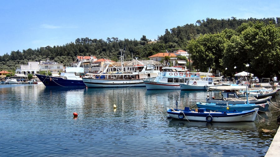
Featured photo: Jean Housen, CC BY-SA 4.0, via Wikimedia Commons.