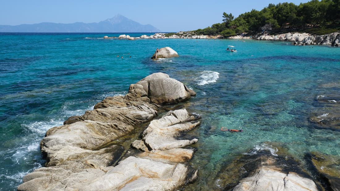
A Halkidiki boat tour sails the clear gulfs between the three peninsulas of Halkidiki in northern Greece, from the pine-backed coves of Kassandra and Sithonia to the islets off Vourvourou and the island of Ammouliani near Mount Athos. This post covers what a Halkidiki boat tour includes, the departure ports, the three peninsulas from the sea, the Kassandra and Sithonia coasts, the Potidea canal, Kelyfos, Diaporos and Vourvourou, Ammouliani and the Drenia islets, Porto Koufo and Toroni, the Athos coast, the Xerxes canal, ancient Stagira, sea life, the boats, tours from Thessaloniki, the seafaring history and the best season. It is one of the Greece tours on Greece VIP.
Each section ends with a Halkidiki boat tour that can be booked online.
What does a Halkidiki boat tour include?
A Halkidiki boat tour is a sea trip along the coast of Halkidiki, the peninsula south-east of Thessaloniki. The route follows one or more of its three fingers, with stops for swimming. The types are day cruises, island trips, private boats, sailing trips and sunset cruises.
Halkidiki is a peninsula and regional unit of Greece, in coastal Macedonia. It reaches into the north-western Aegean Sea and has the shape of a hand with three fingers, which Greek speakers also call legs. Polygyros is the capital and lies in the centre, while Nea Moudania is the largest town. A Halkidiki boat tour makes use of this outline, since three fingers leave a long shoreline with gulfs between them.
Tourism shaped the coast that a Halkidiki boat tour sails past. People from Thessaloniki began to spend summer holidays in the coastal villages in the late 1950s and rented rooms in local houses. Visitors from Austria and Germany followed in the 1960s, and the big tourist boom came in the 1970s. By the 1980s tourism had taken over from agriculture as the main industry of the region.
The day cruise is the basic format of a Halkidiki boat tour. It follows a set route along one coast, calls at a bay for a swim and returns to the harbour of departure. The island trip is a variation that crosses open water to the islands off the coasts. Halkidiki has inhabited islands in the Singitic Gulf and an uninhabited island in the Toronean Gulf, and island trips are built around such stops.
A private boat is hired for one group, which agrees the route with the captain. A sailing trip moves under sail and follows the wind along the shore. A sunset cruise sails in the last light of the day and stays close to the coast. Each of these Halkidiki boat tours uses the same harbours and the same gulfs, but the pace and the privacy differ from one type to the next.
- Day cruises: A set route along one coast, with a swim stop in a bay.
- Island trips: Crossings to the islands that lie off the coasts of the peninsula.
- Private boats: A private Halkidiki boat tour runs for one group on a route set with the captain.
- Sailing and sunset cruises: Trips under sail and late-day trips that stay close to the shore.
One route sits apart from the other Halkidiki boat tours. The Mount Athos cruise follows the monastery coast of the easternmost finger and keeps offshore from the monastic land. The remaining Halkidiki boat tours stay with beaches, islands and bays. That split gives travellers a clear choice between a coast of monasteries and a coast of swimming stops.



Where does a Halkidiki boat tour leave from?
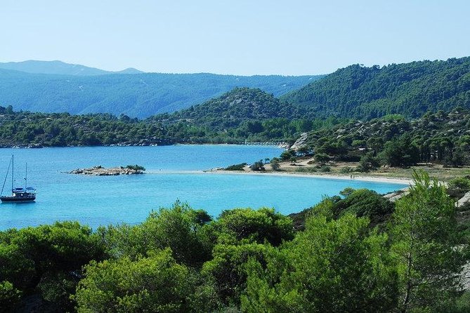
A Halkidiki boat tour leaves from coastal villages on all three fingers of the peninsula. Nea Fokaia lies on Kassandra, while Nikiti, Neos Marmaras, Ormos Panagias and Vourvourou lie on Sithonia. Ouranoupoli sits at the start of the Athos peninsula.
Nikiti is a village on the Chalkidiki peninsula, 100 kilometres south-east of Thessaloniki, and the seat of the Sithonia municipality. The old village stands on a hill, set back from the sea, while the newer part of the town lies on the seashore. A marina was built on the beach front after 2010, and a Halkidiki boat tour from Nikiti can start from this marina.
Neos Marmaras is a town on the Sithonia peninsula, 125 kilometres from Thessaloniki. It sits on three shoreline hills, below the mountains Itamos and Dragoudeli. Refugees from Marmara Island founded it in 1925, after the exchange of populations with Turkey. The main industries are tourism, agriculture and fishing, so fishing boats already work the bay. The waterfront fills with cafes and restaurants in the summer months, and a Halkidiki boat tour leaves a busy shore behind it.
Ormos Panagias is a coastal village of Sithonia, between Kassandra and the Athos peninsula. One view treats it as the port of Agios Nikolaos, which lies a short distance away. Vourvourou is a village near Agios Nikolaos on the eastern side of Sithonia, between Ormos Panagia and Sarti. The area has sandy beaches, small rock islands and caves, so a Halkidiki boat tour on this stretch of the east coast passes beaches, islets and caves close to the shore.
Ouranoupoli, a name that means Sky City, is both an ancient city and a modern village in the municipality of Aristotelis. It is the last settlement before the border of the monastic state, at the north-west end of the Athos peninsula. A single asphalt road links the village to Thessaloniki, about 140 kilometres away. The main port also serves the summer cruises for tourists, so a Halkidiki boat tour from Ouranoupoli starts at the far end of the peninsula.
- Nikiti: The seat of the Sithonia municipality, with a marina on its beach front.
- Neos Marmaras: A town on three shoreline hills, with tourism and fishing as main industries.
- Ormos Panagias: A coastal village of Sithonia, seen as the port of Agios Nikolaos.
- Vourvourou: A village on the eastern side of Sithonia, close to rock islands and caves.
- Ouranoupoli: The village at the start of the Athos peninsula, with a main port.
Nea Fokaia belongs to the Kassandra municipal unit, a group of communities that also includes Afytos, Fourka, Kalandra, Kallithea, Kassandreia, Kassandrino and Kryopigi. The departure village sets the first coast of the route, which is why one Halkidiki boat tour looks different from the west, the middle and the east of the region.
What does a Halkidiki boat tour show of the three peninsulas?
A Halkidiki boat tour shows the three peninsulas as three separate coastlines. Kassandra rises to 350 metres in the west, Sithonia to 817 metres in the middle and Athos to 2,033 metres in the east. Two gulfs, the Toronean and the Singitic, separate them.
From the sea, the shape of Halkidiki is easy to read. The three peninsulas run side by side into the Aegean, from west to east: Kassandra, Sithonia and Athos. The Toronean Gulf separates Kassandra from Sithonia, and the Singitic Gulf separates Sithonia from Athos. Outside them, the Thermaic Gulf bounds the region on the west, while the Strymonian and Ierissos gulfs lie on the east. A Halkidiki boat tour that crosses a gulf sees the flanks of two peninsulas at once.
Kassandra is the westernmost finger, and its ancient name was Pallene. Its highest peak stands at 350 metres, the lowest summit of the three fingers. The eastern coastal strip from Kallithea down to Pefkochori is built up with resorts, so a Halkidiki boat tour along that side passes the resort strip. A forest fire in August 2006 burned the central and southern parts of the peninsula, and the forests recovered again after ten years.
Sithonia, also called Longos, is the middle finger. Mount Itamos, at 817 metres, and the peak of Dragoudelis stand in the centre, and the land around them is covered with vineyards, forests, grasslands and shrubland. Beaches line both sides: Ai Giannis, Kalogria, Elia and Lagomandra on the west coast, Livrochios, Karidi, Kavourotripes and Platanitsi on the east coast. A Halkidiki boat tour sees these beaches with the wooded slopes rising behind them.
Athos is the easternmost finger, a special polity within Greece known for its monasteries. Its highest peak, at 2,033 metres, is far above the peaks of the other two fingers. The Strymonian and Ierissos gulfs lie beyond its eastern shore, separated by the Brostomnitsa peninsula. A Halkidiki boat tour that stays on the Athos side of the region looks out over a different gulf than a trip on Kassandra, which faces the Thermaic Gulf.
- Kassandra: The westernmost finger, with a highest peak of 350 metres and a resort strip on the east.
- Sithonia: The middle finger, with Mount Itamos at 817 metres, forests, vineyards and beaches.
- Athos: The easternmost finger, with a highest peak of 2,033 metres.
- Gulfs: The Toronean and Singitic gulfs divide the three fingers from each other.
The three peninsulas differ in height, in cover and in shore. Kassandra carries resorts along its eastern strip, Sithonia carries vineyards, forests and long lines of beaches, and Athos carries the tallest peak of the region. A Halkidiki boat tour that crosses both gulfs shows all three profiles from the water, and each profile sets the character of the coast beneath it.
What does a Halkidiki boat tour see along the Kassandra coast?
A Halkidiki boat tour along the Kassandra coast passes the westernmost of the three peninsulas of Chalkidiki, called Pallene in antiquity. Its eastern shore faces the Toronean Gulf and holds a line of villages from Afytos in the north to Paliouri in the south.
A Halkidiki boat tour on this side of the region follows a peninsula whose highest peak reaches 350 m. The Toronean Gulf separates Kassandra from Sithonia, and the Thermaic Gulf bounds Chalkidiki on the west. Tradition says the peninsula once bore the name Phlegra and witnessed the conflict between the gods and the earthborn Gigantes. Strabo named five cities of Pallene at the turn of the eras: Cassandreia, Aphytis, Mende, Scione and Sane.
A Halkidiki boat tour along the eastern shore reaches Afytos on the northeastern coast, 6 km northeast of Kassandreia. Stone-built houses line its narrow streets, and viewpoints look out over the Toroneos Gulf. The village carries the name of ancient Aphytis, an important town of Pallene whose fleet took part in the Persian Wars. Kallithea lies farther along the eastern coast. Refugees from Asia Minor founded it in 1925, and its name joins the Greek words for beauty and view.
Kallithea holds an excavated sanctuary of Dionysus and the Nymphs, with a rock-cut staircase and a cave used for ritual. The remains of a large Doric temple of the 4th century BC belong to a sanctuary of Ammon Zeus, a god that joins Zeus with the Egyptian Amun. In Polychrono, the modern village stands on the site of ancient Neapolis, which the Romans rebuilt in a nearby place.
Pefkochori means “pine village” after the pines of the nearby mountains, and a Halkidiki boat tour passes it 3 km southeast of Chaniotis. Agia Paraskevi sits 4 km south of Pefkochori, and Paliouri lies 5 km east of Agia Paraskevi. On the southern coast, Nea Skioni began in 1918 where fishermen’s huts stood. It takes its name from ancient Scione, founded around 700 BCE by settlers from Achaea.
- Municipality: The 2011 reform merged Kassandra and Pallini into one municipality of 334.280 km2.
- Resort strip: A Halkidiki boat tour sees resorts along the eastern coastal strip from Kallithea down to Pefkochori.
- Kassandreia: The seat of the municipality sits in the centre of the peninsula and was called Valta before 1955.
- Forest fire: A fire on 22 August 2006 burned the central and southern parts of the peninsula, and the forests largely recovered within 10 years.
Herodotus reports that the Toronean Gulf was known for its fish, and the harbour of Torone was called the deaf harbour because the water stays quiet and calm. A swimming race of 25 km has crossed the gulf every July since 1971. It starts at Kallithea on the Kassandra side and finishes at Nikiti on Sithonia. A Halkidiki boat tour on the gulf links the Kassandra shore with the Sithonia shore.
What is the Potidea canal on a Halkidiki boat tour?
A Halkidiki boat tour at Nea Poteidaia meets the canal cut across the narrow neck of the Kassandra peninsula. The cut turns the peninsula into an artificial island, and the town beside it stands on the site of ancient Potidaea, a colony founded by Corinth around 600 BC.
Ancient Potidaea stood on the isthmus of Pallene, which Strabo gives as 900 m wide at its narrowest. Strabo also describes the isthmus as cut through, so a canal existed at one point in antiquity. Herodotus mentions the canal at Athos but not one here. A Halkidiki boat tour at the Potidea canal therefore passes a waterway older than the modern town, which lies 33 km south-west of Polygyros.
Sources disagree on the date of the cut that a Halkidiki boat tour passes. One account says Cassander widened the isthmus into a canal between the 4th and 1st centuries BC. Another says it opened before 168 BC, to ease navigation and boost trade. The excavators of the southern wall read the Roman voyage around the promontory in 169 BC, after the Romans abandoned their siege of Cassandreia, as a sign that no canal existed yet. After the revolt of 1821, a new cutting was made.
Corinth founded Potidaea around 600 BC, and a Halkidiki boat tour at Nea Poteidaia passes the site. Thucydides indicates that the city had two harbours, one to the east and one to the west. It withstood a Persian siege in 479 BC, and Herodotus tells of a great flood-tide that surprised the attackers. Potidaea revolted from Athens in 432 BC, and Socrates fought in the Athenian siege, as Alcibiades recounts in the Symposium of Plato. Philip II of Macedon took the city in 356 BC.
- Name: The name links the city with Poseidon, who had a temple in the suburb outside the walls.
- Remains: A Halkidiki boat tour finds little of classical Potidaea, because later builders reused its stone in the fortifications of Cassandreia.
- Refounding: Greek refugees from Platanos in Eastern Thrace and from Kalolimnos re-founded Nea Poteidaia in 1922.
Cassander built a new city on the same site in 316 BC and named it Cassandreia. Philip V made it a principal naval base and laid down a hundred warships there in 207 BC. The Huns and Slavs destroyed it around AD 540. In 1821, the people of Chalkidiki entrenched themselves in the castle, and the canal is said to have run with blood. Celebrations mark it each November 14. A Halkidiki boat tour at the canal passes this layered history.
What does a Halkidiki boat tour see along the Sithonia coast?
A Halkidiki boat tour along the Sithonia coast follows the middle peninsula of Chalkidiki, also called Longos. The Toronean Gulf lies on its west side and the Singitic Gulf on its east, and Mount Itamos rises to 817 m in the centre.
Kassandra lies to the west of Sithonia and the Mount Athos peninsula to the east. Itamos and Dragoudelis form the central peaks, and conifer forests cover the mountain range. About 70 percent of its land is forest. Only Sykia stands about 4 km inland, because the ruggedness of the range pushed the settlements to the coast. From the water, a Halkidiki boat tour sees them strung along the shore.
The northern part of the peninsula holds the beaches of Ai Giannis, Kalogria, Elia and Lagomandra on the west coast. Livrochios, Karidi, Kavourotripes and Platanitsi lie on the east coast. The beaches of the southern part include Azapiko, Tristinika, Kalamitsi and Kriaritsi. The island of Spalathronisia lies near Azapiko beach. A Halkidiki boat tour along the Sithonia coast can therefore name each cove from the sea.
Nikiti is the seat of the Sithonia municipality. The ancient Greek city of Galypsos stood south of Nikiti near Kastri beach, and the remains of an early Byzantine church of the 5th century lie near Agios Georgos beach. The old village dates to the 14th century, when inhabitants moved inland to avoid pirate raids. A Halkidiki boat tour sees the newer part of the town on the shore, where a marina now stands. Beekeeping and olive growing have made Nikiti one of the top honey-producing towns in Europe.
Neos Marmaras sits on three shoreline hills below Itamos and Dragoudeli. Refugees from Marmara Island founded it in 1925, and residents of the mountain village of Parthenonas moved down to it in 1970. Sarti lies on the northeastern coast, and a Halkidiki boat tour along the east side reaches it. Refugees from the island of Afissia settled Sarti after 1922, and fishing and farming came before tourism. Sarti is one of the starting points for hiking on Mount Itamos.
- Sykia: This traditional village has been inhabited since the Byzantine period and has windmills.
- Neos Marmaras: The town had 3,038 permanent residents in 2021, and the summer population has been estimated at 20,000.
- Resort: A Halkidiki boat tour passes a large resort near Neos Marmaras that holds the biggest private marina in northern Greece.
- Fires: Forest fires destroyed large areas around Sarti and Sykia, and wide corridors now limit the spread.
The Singitic Gulf on the east side is known for its clear waters and its small coastal settlements. Mount Athos is visible from the beaches of Sarti. The waterfronts of Neos Marmaras, Nikiti and Sarti are especially busy in summer. A Halkidiki boat tour along the Sithonia coast therefore passes busy waterfronts and long stretches of forest behind the beaches.
What is Kelyfos on a Halkidiki boat tour?
A Halkidiki boat tour sees Kelyfos, an uninhabited island in the Toronean Gulf, just outside the bay of Neos Marmaras. The name means Shield Island in Greek, and the island is also called Turtle Island because it is said to look like a turtle.
Neos Marmaras is the town that faces Kelyfos. It stands on the Sithonia peninsula, 125 kilometres from Thessaloniki and 55 kilometres from Poligyros, on three shoreline hills below the mountains Itamos and Dragoudeli. The town had 3,038 permanent residents in 2021, and the summer population has been estimated at 20,000. A Halkidiki boat tour that passes Kelyfos sails off the waterfront of a town whose population rises sharply in summer.
The name Neos Marmaras means New Marmara, and a Halkidiki boat tour passes a town that refugees founded. Greek refugees from Marmara Island, in the Sea of Marmara, formed it in 1925 after the Asia Minor catastrophe and the exchange of populations with Turkey. Residents of the mountain village of Parthenonas joined them after 1970. Marmara Island has an area of 126.1 square kilometres, and its name comes from the marble quarried there.
Kelyfos lies in the Toronean Gulf, a gulf of the Thracian Sea in the northern Aegean, between the Kassandra peninsula in the west and Sithonia in the east. According to Herodotus, it was known for its fish. The harbour of Torone, the only city on the gulf, was called the deaf harbour because of the quietness and calm of the water. A Halkidiki boat tour near Kelyfos sails on the gulf that Herodotus described.
The island has a record as a hiding place. Kelyfos served as a strategic hiding point in the ancient days of Greece and again at times during the Second World War. Spalathronisia, near Azapiko beach, is the biggest island on the west side of the peninsula. Kelyfos lies to the west of Sithonia, and Diaporos lies to the east. On a Halkidiki boat tour, the peaks of Itamos, at 817 metres, stand between the two coasts.
- Marathon: A Halkidiki boat tour shares the gulf with a swimming race of 25 kilometres every July, from Kallithea on Kassandra to Nikiti on Sithonia, first held in 1971.
- Olynthus: The ancient city of Olynthus was said to stand at the head of the gulf.
- Marina: A resort outside the town has the biggest private marina in northern Greece, with berths for 315 boats.
Since the 1980s, Neos Marmaras has grown into a popular tourist town, with cafes, restaurants and bars along a waterfront that fills up in the summer months. That waterfront looks out toward Kelyfos. A Halkidiki boat tour that includes the island joins an uninhabited islet in a quiet gulf with a town that turned to tourism.
What does a Halkidiki boat tour see at Diaporos and Vourvourou?
A Halkidiki boat tour sees Diaporos, the largest island of a small group off the east coast of Sithonia, and the bay of Vourvourou, which holds about nine islands. Diaporos has pine forests, rocky shores and small coves with clear turquoise water, and no permanent population.
Diaporos lies in the Singitic Gulf, off the east coast of Sithonia and opposite the village of Agios Nikolaos. The island has an area of about 4 square kilometres. The 2021 Greek census recorded no permanent population there. The buildings on it are mainly private holiday homes, and tourist development stays limited. Smaller islets, including Peristeri and Elia, lie near it, and a Halkidiki boat tour sails past that group of islets.
Diaporos is a popular destination for boat excursions from Sithonia and nearby coastal settlements. During the summer, visitors arrive by private boat and by organized tour to swim in the shallow water. Galana Nera and Myrsini Beach are the best known of the small bays, and their shallow turquoise water earned the nickname Hawaii of Sithonia. A Halkidiki boat tour at Diaporos offers swimming in that water.
Vourvourou is a village near Agios Nikolaos, on the east side of the Sithonia peninsula between Ormos Panagia and Sarti. It stands 51 kilometres southeast of Poligyros and is best known as a holiday destination. The area has sandy beaches, small rock islands and caves. The bay holds about nine islands that give it the look of a lagoon, and the easternmost is Agios Isidoros. The islands and their beaches can only be reached by boat, so they are seen from the water on a Halkidiki boat tour.
Ruins of the pre-Byzantine church of Agios Andreas stand on Diaporos. The ancient city of Singos, which gave its name to the Singitic Gulf, dates back to 454 BCE. Its site is placed near Vourvourou bay on the Livari peninsula, where an ancient wall of large stones is still visible. In the 10th century, the area was known as the land of the Vourvourioi, and a Halkidiki boat tour now passes the coast that was granted to the Xenophontos monastery.
- Mountain: Mount Itamos rises in the vicinity of Vourvourou, and the peak of Karvounas, at 567 metres, lies southeast of the village.
- Beaches: Karidi and Fteroti lie close to Vourvourou, and Galana Nera lies between Diaporos and Agios Isidoros.
- Fishing: Fishery was limited to the Singitic Gulf until tourism replaced it as the economic mainstay in the 1980s.
A Halkidiki boat tour along this coast passes land with a long record of ownership. In 1615, the people of Agios Nikolaos acquired it, and at the end of the 19th century monks of Simonopetra sold it to Russian monks, whom the local inhabitants forcibly drove away. In the 1960s, teaching staff of the University of Thessaloniki developed a holiday resort in a private area also called Vourvourou.
Why does a Halkidiki boat tour stop at Ammouliani?
A Halkidiki boat tour stops at Ammouliani because it is the only permanently inhabited island of Halkidiki. The island lies in the Singitic Gulf opposite the small mainland port of Trypiti, and it faces the coast at Ouranoupoli, at the neck of the Athos peninsula.
Until the early 1900s, Ammouliani was a dependency of Vatopedi Monastery on Mount Athos. Three Greek monks from Adrianople, disciples of Athanasius the Athonite, founded Vatopedi in the second half of the 10th century. The monastery grew in the Byzantine period. More than 120 monks live there today. A Halkidiki boat tour that stops at the island visits a former monastic property.
The ownership of the island changed in the 1920s, and a Halkidiki boat tour now stops where refugees settled. In 1922, the Greek government confiscated land at Ouranoupoli from Vatopedi to house refugees from Turkey, and the first arrivals lived in abandoned monastic buildings. In 1925, the island itself went to refugee families from the islands of the Propontis, the Sea of Marmara, after the Asia Minor Disaster. The island has over 500 residents today.
The island is part of the story of Ouranoupoli, which a Halkidiki boat tour sees across the water. In the summer of 1925, the Australian writer Joice Loch and her husband Sydney, with four friends, took a small collapsible boat to Halkidiki and camped on Ammouliani, opposite the refugee settlement of Pyrgos, the modern Ouranoupoli. Later that summer, they camped by the Byzantine watchtower at Pyrgos, and Sydney visited the monasteries of the Athos peninsula.
Ammouliani is one of eight communities of the municipal unit of Stagira-Akanthos, with Ierissos, Nea Roda, Olympiada, Ouranoupoli, Stagira, Stratoniki and Stratoni. The unit had 8,274 residents in 2021 and lies north of the autonomous area of Mount Athos. The island has become a tourist destination, with frequent transport from the mainland. The Singitic Gulf around it is known for clear waters, and a Halkidiki boat tour at Ammouliani crosses that water.
- Position: A Halkidiki boat tour reaches Ammouliani in the north-eastern part of the Singitic Gulf, between the Sithonia and Mount Athos peninsulas.
- Municipality: Since the 2011 reform, Stagira-Akanthos has belonged to the municipality of Aristotelis, whose seat is Ierissos.
- Name: The island is also written Amoliani.
The mainland coast opposite the island has a hard record as well. On 26 September 1932, an earthquake destroyed the town of Ierissos and caused extensive damage to nearby villages, including Pyrgos at the gateway to the Athos peninsula. The villagers of Pyrgos first lived in tents supplied by the Red Cross and the Greek army. A Halkidiki boat tour that stops at Ammouliani looks across to that coast.
What are the Drenia islets on a Halkidiki boat tour?
A Halkidiki boat tour reaches the Drenia islets, a group of small uninhabited islands south-east of Ammouliani and opposite Ouranoupoli. The group lies in the Singitic Gulf, boats serve it, and the Athos coast stays in view across the water.
The Drenia islets are also called Gaidouronisia, a Greek name that means donkey islands. Greek sources count the group differently. One describes a cluster of six islands, while the municipal listing names two islands that local people call Gaidouronisia. The cluster takes its name from its largest island. The smaller ones are named Penna, Feti, Artemis or Elia. A Halkidiki boat tour sees the group across the water from Ouranoupoli.
The islets are flat, with dense vegetation and small coves. Parts of the coast are rocky, and from those shores Mount Athos shows in the background. The Greek description says that the lack of roads, cars and buildings gives travellers a sense of calm and quiet, and it calls the islets intact, virgin places that are rare in Greece. A Halkidiki boat tour that stops here sees a landscape with no town in it.
The shores are shallow and sandy, and the water around them is blue-green. People call the area the Blue Lagoon of Halkidiki. The shapes of the rocks form separate beaches, and the sand is white. The beaches are clean. The seabed holds rich marine life, because of the large number of fish. Swimmers on a Halkidiki boat tour find shallow water and a seabed full of fish.
Tourist boats and private boats reach the islets from the Ammouliani pier and from Ouranoupoli. Daily summer routes carry visitors, and a boat can also be rented. Ammouliani itself is linked by ferry to Trypiti on the mainland, a distance of 2 nautical miles. In winter the islets lie empty. In summer they fill with tourists and campers, so a Halkidiki boat tour in the warm season shares the group with other visitors.
- Largest island: A shop, a tavern and the only organised beach with umbrellas lie on this island.
- Walking: A walk across the islets shows a landscape with no human intervention.
- Camping: An overnight stay is possible only as free camping.
The Drenia islets are the smallest stop on the Singitic Gulf side of a Halkidiki boat tour. Ammouliani, the only permanently inhabited island of Halkidiki, has 521 residents in the 2021 census, and its people work in fishing and tourism. The islets sit opposite its Megali Ammos beach and have none of that. A Halkidiki boat tour thus moves from a village island to a group with only a tavern and camping.
What does a Halkidiki boat tour see at Porto Koufo and Toroni?
A Halkidiki boat tour sees the large natural harbour of Porto Koufo near the southern end of Sithonia and the ancient city of Torone close by. The harbour appears in the work of Thucydides, and the old city stands on the south-western edge of the peninsula.
Porto Koufo is a natural harbour in the municipality of Sithonia, in Halkidiki. The Sithonia article calls it the largest natural harbour in Greece and says that Thucydides, the ancient historian, mentioned it as the hollow harbour. The harbour is also the fishing spot of the area. A Halkidiki boat tour that calls at Porto Koufo sees this natural harbour from the water.
German submarines used Porto Koufo during World War II. The reason given is its geographical position and its direct access to the Aegean Sea. South of the harbour exit lies Kartalia, the southernmost part of Sithonia, an area of rocky, secluded beaches. A Halkidiki boat tour at Porto Koufo therefore sees the rocky southern shore of the peninsula right next to the harbour mouth.
Torone, now written Toroni, is an ancient Greek city on the south-western edge of the Sithonia peninsula. Its name comes from Torone, the daughter of Poseidon and Phoenice and the wife of Proteus. The city gave its name to the Toronean Gulf, the water between the Pallene and Sithonia peninsulas. A Halkidiki boat tour on that side of Sithonia follows water that carries the name of the ancient city.
The ancient city covered three areas. The acropolis stood on a steep, rocky hill between Porto Koufo and Lecythus. The main city lay on the plateau south-west of the acropolis, down to the coast, and held the Lecythus fort. A Halkidiki boat tour sees the Lecythus fort beside the harbour, which was rebuilt in the Byzantine era with cisterns and a small early Christian temple.
- Underwater remains: Underwater surveys place the agora and the ancient harbour sunk 35 metres from the present coast.
- Tribute: Toroni paid 12 Attic talents a year to the Athenian League, one of the highest sums.
- Brasidas: The Spartan general Brasidas took the city in a surprise night attack and came to terms with its people in 423 BC.
- Walls: In 1903 the Ottomans used the granite stones of the walls to cover roads in Constantinople and Thessaloniki.
People lived on the site until the 17th century. They then left the old city for the modern town of Toroni, about 1 km to the north. Modern Toroni has a curved beach of thick yellow sand, 2.5 km long, which is ranked among the best in Sithonia. A Halkidiki boat tour at this corner of the peninsula takes in the ancient headland and the long beach in one stretch of coast.
What does a Halkidiki boat tour see of the Athos peninsula from the sea?
A Halkidiki boat tour sees the Athos peninsula from the sea as the long eastern shore of the Singitic Gulf, with a forested mountain rising to 2,033 metres at its southern end. From the Sithonia side, the view crosses the gulf to the easternmost leg of Halkidiki.
The Singitic Gulf lies between Sithonia on the west and the Athos peninsula on the east. It is also called the Mount Athos Gulf or the Holy Mountain Gulf, and it forms part of the Thracian Sea in the northern Aegean. A Halkidiki boat tour on the Sithonia side looks east across clear water to the Athos shore. The highest peak of Sithonia, Itamos, reaches 817 metres, far below the Athos summit.
The Athos slopes change with height. Aleppo pine grows more in the northern part of the peninsula, and broadleaf maquis covers the ground further south. Above the maquis, a deciduous forest dominated by sweet chestnut takes over, and black pine and stinking juniper stand at the higher elevations. A Halkidiki boat tour along the gulf thus faces a mountainside that moves from pine in the north to chestnut and black pine in the south.
The sea off the end of the peninsula has a hard record. Herodotus claimed that in 492 BC the Persian king Darius lost 300 ships under the general Mardonius in the area. In 411 BC the Spartans lost a fleet of 50 ships under the admiral Epicleas. The surrounding seas are described as dangerous, especially at the end of the peninsula. A Halkidiki boat tour sees the water in which those two fleets were lost.
Ancient writers gave the mountain a place in myth. Homer mentions Athos in the Iliad. In Greek mythology, Athos was a giant who threw a massive rock at Poseidon, and the rock fell into the Aegean Sea and became the mountain. Another version says that Poseidon buried the defeated giant under it. After the death of Alexander the Great, the architect Dinocrates proposed carving the entire mountain into a statue.
- Old name: In the classical era the mountain was called Athos and the peninsula Acté in Latin.
- Geology: Geologists link the Athos peninsula to the Rhodope Mountains of northern Greece and Bulgaria, a link that Sithonia and Kassandra lack.
- Paths: A network of footpaths crosses the mountain, and a part of it dates back to the Byzantine period.
- Vipers: Pliny the Elder stated in 77 AD that eating the skin of vipers let the inhabitants live to their four hundredth year.
Monasteries stand along the eastern shore of the Singitic Gulf, and Greek law and religious tradition keep women out of the area they govern. Beyond that single fact, the scene is natural: a high mountain, forest, a clear gulf and open sea. A Halkidiki boat tour from the Sithonia side takes in that scene across the water, and the Athos peninsula stays at the eastern edge of every view.
What is the Xerxes canal on a Halkidiki boat tour?
A Halkidiki boat tour along the Athos coast passes the line of the Xerxes canal, a channel that King Xerxes I of Persia ordered dug through the base of the peninsula in the 5th century BC. Sediment now covers it completely, so only its outline remains.
The canal began with a disaster at sea. In 492 BC a storm off the cliffs of Athos cost the Persian commander Mardonios 300 ships and 20,000 men, during the first Persian invasion of Greece. Xerxes prepared a second invasion, and in 483 BC he ordered a channel through the isthmus to spare his fleet the same fate. On a Halkidiki boat tour, the canal story starts with the danger of that cape.
The work lasted three years and ended in 480 BC. In the account behind a Halkidiki boat tour, the Persians Bubares and Artachaees led it, with forcibly recruited locals and Egyptian and Phoenician workers. Herodotus wrote that the channel was wide enough for two triremes to row abreast, and dikes capped both ends to stop surf from clogging it. Other studies add regular soldiers and recruited Thracians and Greeks, paid from the Persian treasury.
The canal started east of Nea Roda on the north coast, ran in a fairly straight line to the southwest, and ended west of the village of Tripiti on the south coast. A Halkidiki boat tour that follows either shore of the Athos peninsula passes one end of the line. Modern measurement gives a length of 2 kilometres, a width of 30 metres and a depth of 3 metres, enough for a trireme to pass.
The canal had a short working life. The Persian fleet passed through on its way to the battle of Artemisium and then to Salamis, and the channel fell into disrepair because nobody used it afterwards. On a Halkidiki boat tour, the written record continues with Thucydides, who mentioned the canal in passing about 80 years later, when Brasidas marched to the coastland that runs out from it.
- Doubt: Herodotus drew doubt in ancient times, and Demetrius of Scepsis traced only part of the canal.
- Early surveys: Choiseul-Gouffier, Spratt in 1838 and Struck in 1901 found traces in the central isthmus.
- Proof: For a Halkidiki boat tour, the key result is the 1990s British and Greek study, which used seismic survey and sediment analysis to show the canal crossed the whole isthmus.
No open channel can be sailed today. Air photos show the outline, and surveys have detected it under the sediment. The same study found that builders raised the canal fast and that it saw use for a short time. The canal is a rare monument of the Persian Empire in Europe, and a Halkidiki boat tour reaches it as a story of the coast, not a waterway to sail.
Why does a Halkidiki boat tour pass ancient Stagira?
A Halkidiki boat tour passes ancient Stagira because the city was the birthplace of the philosopher Aristotle and stood near the eastern coast of the peninsula. Its ruins lie beside the town of Olympiada, where remains of city walls, houses and public buildings are visible.
Aristotle is the reason the city matters. He was a Greek philosopher and polymath, a student of Plato and the teacher of Alexander the Great. He was born in Stageira in 384 BC and died in 322 BC. Philip II of Macedon later annexed the whole peninsula, and Aristotle became tutor to Philip’s son Alexander. A Halkidiki boat tour along the eastern shore therefore reaches the home coast of Aristotle.
Ionian settlers from Andros founded the city in 655 BC. Xerxes I of Persia occupied it in 480 BC, the year his canal at Athos was finished. The city then joined the Delian League led by Athens and left it in 424 BC during the Peloponnesian War. The Athenian commander Cleon besieged it in 422 BC and died that year at Amphipolis. On a Halkidiki boat tour, the story of Stagira in that war ends on the Spartan side.
In 348 BC Philip II of Macedon occupied and destroyed the city. He later rebuilt it and settled the old inhabitants again, in return for the tutoring of his son Alexander by Aristotle. The new works included an aqueduct, two shrines to Demeter and houses. Tradition says the people of Stagira moved the remains of Aristotle back, buried them in the city and founded a festival in his honour, the Aristoteleia.
The Danish archaeologist Karl Frederik Kinch explored Halkidiki in 1886 and identified the site of Stagira from ancient descriptions. The ruins lie about 18 kilometres northeast of the present village of Stagira and about 700 metres from Olympiada. Remains of the walls, houses and public structures can be seen. The site is open to the public, and for a Halkidiki boat tour it is a cultural landmark of the coast.
- Setting: Olympiada is the northeastern coastal town where a Halkidiki boat tour reaches Stagira, with views of the Aegean Sea and the hills.
- Name: The town takes its name from Olympias, a princess of Ancient Epirus and the mother of Alexander the Great.
- Work: Tourism and fishing are the main occupations of the 638 residents counted in the 2021 census.
Olympiada lies 35 kilometres from Ierissos and 90 kilometres from Thessaloniki. It is a community in the municipal unit of Stagira-Akanthos, inside the Aristotelis municipality, so the philosopher’s name appears on the local map as well as in the ruins. A Halkidiki boat tour that names Stagira also names its neighbour Olympiada, and the ancient city stands in the Halkidiki list of ancient sites beside Olynthus and Mende.
What sea life and swimming does a Halkidiki boat tour offer?
A Halkidiki boat tour offers swimming stops in the Aegean Sea, where the surface layer holds summer temperatures of 19 to 24 degrees Celsius. Meadows of the seagrass Posidonia oceanica, a plant found only in the Mediterranean, mark clean water, because it grows best in unpolluted water.
The water around Halkidiki belongs to the Aegean Sea, an embayment of the Mediterranean Sea that covers about 215,000 square kilometres. Winter surface temperatures run from 8 degrees Celsius in the north to 13 degrees in the far south. Halkidiki has a Mediterranean climate with hot, relatively dry summers, so the swimming side of a Halkidiki boat tour falls in summer.
Posidonia oceanica, called Neptune grass or Mediterranean tapeweed, is a seagrass that forms large underwater meadows. It grows at depths of 1 to 35 metres, and the range depends on water clarity. Its leaves are ribbon-like and bright green, and they grow in tufts of six or seven. On a Halkidiki boat tour, the Greek name fits the sea, because the genus takes its name from Poseidon, god of the seas.
A seagrass meadow carries a food chain of its own. Bacteria, algae and bryozoa settle on the leaves and rhizomes, and red and brown algae grow along the middle of each blade. Gastropod molluscs, amphipod crustaceans and polychaetes feed on this coating, because the plant tissue appeals little to herbivores. Animals and plants find food and protection in the meadows, so a Halkidiki boat tour over a meadow floats above shelter for other sea life.
Fish also matter in the northern Aegean. Catches of open-water fish there are dominated by anchovy, and catches of seabed fish by grey mullet. Greece runs the largest fishing fleet in Europe. Overfishing and habitat damage threaten grouper and seabream, and one estimate puts the fall in catch at 50%. Olympiada, on the northeastern coast of Halkidiki, lists fishing beside tourism as a main occupation, so a Halkidiki boat tour shares this sea with working fishers.
- Coast protection: Seagrass meadows shield sandy shores from erosion, fix carbon dioxide and produce oxygen.
- Beach sign: Masses of decomposing leaves on a beach reveal the plant, and fibrous Neptune balls wash up beside them.
- Range: The species covers about 3% of the Mediterranean basin and is in decline.
- Growth: Posidonia grows slowly, with horizontal rhizomes gaining 1 to 6 centimetres a year.
Swimming stops and seagrass meet at the anchor point. Anchors damage the meadows, and restoration experiments have tested beach-cast seeds to heal anchoring scars. Halkidiki lists summer resorts on the beaches of all three peninsulas. Clean water, seagrass and a hot, dry season together explain the swimming side of a Halkidiki boat tour.
Which boats run a Halkidiki boat tour?
A Halkidiki boat tour runs on traditional caïques, sailing yachts, catamarans, private speedboats and glass-bottom boats. Each type fits a different style of day, from slow fishing-boat cruises to fast hops between beaches and steady decks for swimming stops.
Caïques, the old working boats of the Aegean, carry visitors on a Halkidiki boat tour. The type grew out of fishing, and the hull is a small wooden vessel rigged for sail. Builders work on the foreshore with pine, a timber keel and carvel planking. The hull is painted white to push back the strong sun, with bright colors on the planking. In Greek waters the caïque has become an excursion vessel, and former fishermen earn money from summer visitors.
A yacht is a sail- or motor-propelled watercraft made for pleasure, cruising or racing. The word comes from the Dutch jacht, which means hunt, and the sailing yacht dates to the early 1600s. Charter yachts are run as a business, which is how a sailing yacht joins a Halkidiki boat tour. Two parallel hulls of the same size make a catamaran, and the distance between them resists rolling and overturning, so no ballast is needed.
A motorboat gets its power only from a motor, and a faster-cruising version is known as a speedboat. A private speedboat on a Halkidiki boat tour links one bay to the next quickly. Its V-shaped hull helps the boat cut through the water, and V-hulls also steady a boat in rough conditions. High-performance speedboats can reach speeds of over 50 knots.
Transparent panels set into the hull below the waterline let passengers study the underwater environment from inside the boat. Looking down through a panel beats looking over the side, because surface ripples that bend the view do not reach the glass. Passengers stay dry, so a glass-bottom boat on a Halkidiki boat tour shows the sea without any swimming. The usual sights are underwater plants and animals, reefs and shipwrecks.
- Caïques: The bow post sets the caïque apart from other Mediterranean working boats.
- Sailing yachts: The commercial class of large yachts carries no more than 12 passengers.
- Catamarans: The word comes from the Tamil kattumaram, which means logs bound together.
- Speedboats: A speedboat on a Halkidiki boat tour carries an outboard motor, which joins engine, gearbox and propeller in one unit.
- Glass-bottom boats: The design was invented in 1878 in Florida, where a dugout canoe received a glass viewing box.
The boat chosen shapes the rhythm of the day on the water. A caïque offers the old fishing-boat atmosphere, a catamaran gives a wide and stable deck for swimming stops, a speedboat covers distant bays at speed, and a glass-bottom boat keeps the seabed in view. Every Halkidiki boat tour on these boats follows the same coast, so pace decides the match.
How does a Halkidiki boat tour start from Thessaloniki?
A Halkidiki boat tour from Thessaloniki starts on the road. The ring road ends at a junction with the A24 motorway, which runs south to the peninsulas, and Thessaloniki Airport lies southeast of the city, so arrivals by air reach the coast by road too.

Thessaloniki lies along the Thermaic Gulf, in the northwest Aegean. Its urban area spreads 30 km from Oraiokastro in the north to Thermi in the south, in the direction of Chalkidiki. The A24 motorway continues south to Chalkidiki through the outer southeast suburbs of the city. A Halkidiki boat tour therefore begins with a drive across the edge of the city.
From Thessaloniki and its airport, the A24 motorway runs to Nea Moudania and to Kallithea in Kassandra. Nea Moudania lies 60 km south of Thessaloniki and is the largest town of Chalkidiki. On the Sithonia peninsula, Neos Marmaras is 125 km from Thessaloniki, 55 km from Poligyros and 9 km from Elia (Nikiti). A Halkidiki boat tour from the Sithonia coast adds a longer road leg than one from Nea Moudania.
Thessaloniki Airport, coded SKG, sits in Thermi, 13 km from the city on its southeast side. It is the main airport of Northern Greece, and a Halkidiki boat tour that begins with a flight lands there, because Chalkidiki has no airport and no railroads of its own. The airport connects directly with the city’s major road arteries in the southeast, and a car rental service operates in the terminal building.
A day in the city before or after a Halkidiki boat tour fits well with a Thessaloniki food tour. Ottoman rule lasted around a century longer in Thessaloniki than in southern Greece, and the city kept a lot of its Eastern character in its cooking. Spices play an important role in local dishes, the Ladadika borough is busy with tavernas serving traditional meze, and bougatsa, a sweet or savory breakfast pastry, is popular throughout the city.
- Regional border: To the north, Chalkidiki meets the regional unit of Thessaloniki, while the Thermaic Gulf lies along its western side.
- Regional buses: A bus system called KTEL serves the major towns of Chalkidiki, which makes a Halkidiki boat tour possible without a car.
- Airport bus: Bus 01X/01N links the Thessaloniki bus station with the airport.
- Metro shuttle: A shuttle bus numbered 02X joins the airport to Metro Line 1 at Nea Elvetia.
Residents of Thessaloniki started the summer habit in the late 1950s, renting rooms in the houses of locals in the coastal villages of Chalkidiki. Tourists from Austria and Germany visited more frequently in the 1960s, and the 1970s brought the big tourist boom. A Halkidiki boat tour from Thessaloniki carries on that habit of leaving the city for the sea.
What seafaring history lies behind a Halkidiki boat tour?
A Halkidiki boat tour passes coasts settled from the sea. Colonists from Chalcis arrived in the 8th century BC, and refugees from Asia Minor built Neos Marmaras and Nea Moudania after 1922. Fishing and harbors still shape both of those towns.
The governments of Greece and Turkey signed a convention at Lausanne, Switzerland, on 30 January 1923, and it set up a compulsory exchange of populations. It moved an estimated 1,221,489 Greek Orthodox Christians from Asia Minor, Eastern Thrace, the Pontic Alps and the Caucasus, while 355,000 to 400,000 Muslims left Greece. Fridtjof Nansen arranged the exchange, which reshaped the towns along a Halkidiki boat tour.
Greece settled 72,581 farming families provisionally, almost entirely in Macedonia, where houses left by the exchanged Muslims and fertile land made settlement practical. Refugees from East Thrace and Anatolia also settled in parts of Chalkidiki, and the arrivals included 20,000 people from the southern coast of the Sea of Marmara. The newcomers brought Anatolian customs, such as cuisine and music, to the coastal towns that a Halkidiki boat tour passes.
Greek refugees from Marmara Island formed Neos Marmaras in 1925, and the name means New Marmara. In 2021 the town counted 3,038 permanent residents, and an estimated 20,000 people live there in summer. Its main industries are tourism, agriculture and fishing. A Halkidiki boat tour on the Sithonia coast passes the bay of Neos Marmaras, where Agia Kyriaki, a small marina and fishing settlement, lies outside the town.
Refugees from Asia Minor built Nea Moudania after 1922 and gave the settlement the name of their hometown, now Mudanya in Turkey. The word nea means new in Greek. The town is the financial and commercial center of Chalkidiki, its harbor works as an auxiliary to Thessaloniki, and it hosts a Department of Fisheries and Aquaculture Technology. Nea Fokaia, one of eight communities in the Kassandra municipal unit, carries the same prefix.
- Euboean founders: Settlers from Chalcis and Eretria reached the coast around the 8th century BC and founded Mende, Toroni and Scione.
- Andros founders: A second wave from Andros in the 6th century BC founded Akanthos.
- Psarian fleet: The Psarian fleet rescued the Kassandra survivors of 1821 and took them mainly to Skiathos, Skopelos and Skyros.
- Fishing boats: Refugees from Kassandra also crossed in fishing boats to Skiathos, Skopelos, Alonnisos and Euboea.
The sea has tied this coast to other shores since antiquity. Colonists crossed from Euboea and Andros, refugees fled by fishing boat in 1821, and new arrivals named their towns after homes lost in Asia Minor. A Halkidiki boat tour sails past harbors where fishing now sits beside tourism, and town names from New Marmara to Nea Moudania keep that history in plain view.
When is the best season for a Halkidiki boat tour?
A Halkidiki boat tour suits the summer months, when Halkidiki has hot, relatively dry weather and its gulfs hold calm, clear water for swimming. Spring and autumn fall between the cool, wet winter and the hot summer, so the weather on the water changes from month to month.
Halkidiki belongs to the Mediterranean climate zone, labelled Csa on the Köppen map, and its peninsulas reach into the northwestern Aegean Sea. The cold part of the year is cool and wet, and the warm part is hot and relatively dry. Snowfalls are possible in winter but do not last long, while a thunderstorm can occur in summer. Neos Marmaras, a resort town on the Sithonia peninsula, stands apart as a hot, semi-arid pocket, labelled BSh. For a Halkidiki boat tour, this pattern makes summer the dry, sunny part of the calendar.
Calm water marks the Toronean Gulf, which separates Kassandra from Sithonia. According to Herodotus, the Toronean Gulf was known for its fish, and the harbour of Torone was called the “deaf” harbour because of the gulf’s quietness and calmness. Tradition places the ancient city of Olynthus at the head of the gulf. A 25 km swimming race has crossed the same water every July since 1971, from Kallithea on Kassandra to Nikiti on Sithonia. A summer Halkidiki boat tour on this gulf follows a stretch of water with a long record of calm.
Between the cool, wet winter and the hot, dry summer lie spring and autumn, so their weather is milder than the summer peak but closer to the wet months. Heat can climb high in late summer: on 22 August 2006, a heatwave lifted temperatures on Kassandra to nearly 40 °C, and dry lightning set off a forest fire across its central and southern parts. The villages hit included Chanioti, Nea Skioni, Polychrono, Pefkochori and Kriopigi. A spring or autumn Halkidiki boat tour meets milder air than that August peak, though rain stays possible, since the wet months lie close.
The shape of the land explains the calm. The Toronean Gulf lies between the Kassandra peninsula in the west and Sithonia in the east, and the Singitic Gulf lies between Sithonia and the Athos peninsula, which protrudes 50 km into the Aegean Sea. Beyond the tip of Athos, no gulf shelters the sea. As Herodotus tells it, the Persian fleet of 300 ships met a strong north wind there in 492 BC and was wrecked, and the Spartans lost a fleet of 50 ships in the same waters in 411 BC.
- Climate: Cool, wet winters and hot, relatively dry summers set the calendar for every Halkidiki boat tour.
- Singitic Gulf: Along the Sithonia shore of this gulf, the water is clear and small settlements sit on the coast.
- Thermaic Gulf: This gulf fills the northwest of the Aegean Sea and runs about 100 km, with Cape Kassandra at its southeastern corner.
Summer has been the main season on this coast for decades. People from Thessaloniki began holidaying in the coastal villages in the late 1950s, and the tourist boom of the 1970s spread tourism across the whole region. In the 1980s tourism replaced agriculture as the primary industry of Halkidiki. A July or August Halkidiki boat tour joins that tradition, with hot weather and calm gulfs. A spring or autumn Halkidiki boat tour trades the summer heat for milder air and a wetter sky.
What do travelers ask about a Halkidiki boat tour?
A Halkidiki boat tour raises eight common questions: which peninsula to choose, how Kassandra differs from Sithonia, whether children can join, where swimming stops happen, how seasickness works, what to bring, how it fits with a Mount Athos cruise, and whether a private or shared boat is right.
Which peninsula suits a Halkidiki boat tour?
For island stops, Sithonia fits a Halkidiki boat tour well, because Diaporos lies off its eastern coast and Kelyfos, an uninhabited island, lies off its western coast. Kassandra faces the Thermaic and Toronean gulfs, and the Athos peninsula forms the eastern end of Halkidiki. Kassandra is the lowest of the three, with its highest peak at 350 m, and two gulfs separate the peninsulas.
How does a Kassandra Halkidiki boat tour differ from one on Sithonia?
The eastern coast of Kassandra, from Kallithea down to Pefkochori, is lined with resorts, and the peninsula stands between the Thermaic and Toronean gulfs. The landscape of Sithonia is covered with vineyards, forests, grasslands and mountains, with Mount Itamos rising to 817 m. Its west coast has the beaches of Ai Giannis, Kalogria and Lagomandra, and its east coast has Livrochios and Karidi.
Can children join a Halkidiki boat tour?
Age rules belong to each boat and each tour, so the booking page of a tour states whether children can join. The water matters for families as well. Myrsini Beach on Diaporos, nicknamed the “Hawaii of Sithonia”, is known for its shallow turquoise water, so young swimmers can stay close to the shore. Agios Nikolaos, a village on Sithonia, faces the island group.
Where does a Halkidiki boat tour stop for swimming?
Boats bring swimmers to Diaporos, which covers about 4 square kilometres of pine forests and small sheltered coves. Galana Nera is one of its bays, and the islets of Peristeri and Elia lie close by. Ammouliani, the sole island of Halkidiki with permanent residents, lies in the northern Singitic Gulf and adds a second island stop on the same sea.
Does seasickness affect a Halkidiki boat tour?
Seasickness follows the state of the sea. A route inside the Toronean or Singitic Gulf keeps land on both sides of the boat, while the end of the Athos peninsula faces the open Aegean Sea, where the water can be dangerous. Travelers who feel seasick easily can choose a Halkidiki boat tour that stays within a gulf and away from the open sea.
What is worth packing for a Halkidiki boat tour?
Hot summers call for sun protection and drinking water on deck. The swimming stops call for a swimsuit, a towel and shoes for rocky shores, since the shores of Diaporos are rocky. Diaporos has no permanent population, so food and water for the stop belong in the bag. A mask suits the clear water of the Singitic coast on a Halkidiki boat tour.
Can a Halkidiki boat tour combine with a Mount Athos cruise?
Ammouliani sits in the northeastern portion of the Singitic Gulf along Mount Athos, and monasteries of Mount Athos stand along the eastern shores of that gulf. Whether one boat covers both depends on the tour, so the itinerary of a booking lists the stops. Entry on land is a separate matter, because a special permit is required to enter the Athos peninsula.
Is a private or shared Halkidiki boat tour right for a group?
Both kinds of boat serve the coast, and in summer private boats and organised tours both bring visitors to Diaporos. Tourist development on the island remains limited, and its buildings are largely private holiday homes. A private boat sets its own stops among the islets and coves, while a shared Halkidiki boat tour follows the itinerary of its booking.
Featured photo: kallerna, CC BY-SA 4.0, via Wikimedia Commons.