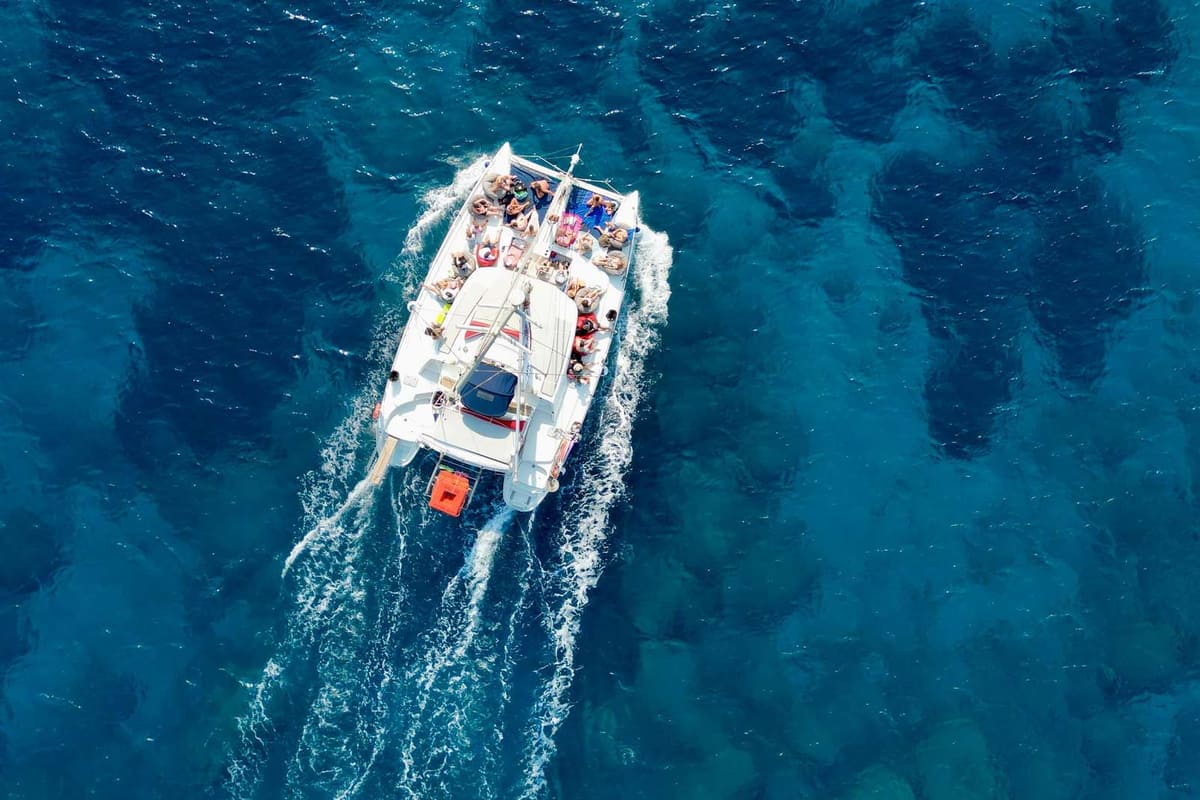
A Rhodes catamaran cruise sails from the largest Dodecanese island along its bays, capes and nearby islets. It is one of the catamaran cruises in Greece on Greece VIP.
This post covers what a Rhodes catamaran cruise includes, its harbours and why two hulls feel steady. It also covers the east and west coasts, sea history, lighthouses and islands within reach. Sea life, depth, winds, sea traffic, the best season and common questions come last.
Each section ends with a Rhodes catamaran cruise or a nearby cruise that can be booked online.
What does a Rhodes catamaran cruise include?
A Rhodes catamaran cruise puts guests on a twin-hulled boat. It has a saloon, deck nets and a swim platform. The boat is either a sailing or a motor catamaran. Greek law fixes its route, ticket and paperwork.
A sailing catamaran moves mainly under sail. Its low-power engine serves for docking and harbour moves. A motor catamaran has no mast, which frees interior space.
On a Rhodes catamaran cruise, sails give silent drive, while high-power engines add noise and vibration. Motor catamarans also burn significantly more fuel than sailing ones.
A saloon is a social lounge on a passenger ship. A cruising catamaran places it on the bridgedeck, with berths and toilets in the hulls.
On a Rhodes catamaran cruise, the cockpit and trampolines form the main outdoor areas. Performance designs steer from the cockpit, with twin tillers or wheels.
The Central Port Authority of Rhodes is a Coast Guard unit, led by a Coast Guard captain. The Coast Guard answers to the Ministry of Maritime Affairs and Insular Policy.
Under Greek Law 4926/2022, the boat on a Rhodes catamaran cruise makes sightseeing or swimming trips. It sails circular routes between ports, bays and beaches.
- Route: Each trip starts and ends at one point.
- Paperwork: The schedule reaches the Coast Guard with the boat’s safety papers.
- Daily cap: The harbour master can limit boats at a bay each day.
On a Rhodes catamaran cruise, guests can stay on a beach if the boat returns for them.


Which harbours does a Rhodes catamaran cruise use?
A Rhodes catamaran cruise starts from Rhodes town or from coastal ports. The town offers Kolona, Mandraki and a newer marina. On the east coast, Kolymbia has a small harbour, Pefkos a jetty and Lindos Bay an anchorage.
Kolona is the middle harbour of Rhodes town, just outside the Old Town walls. Its eastern terminal serves excursion boats, such as a Rhodes catamaran cruise.
Mandraki harbour has depths of 4 to 8 metres, with shallow water and reefs north of its entrance.
A newer marina south-east of Mandraki has 5 to 6 metres of water. It first took yachts in July 2015, with 382 berths in stage one.
The Municipal Port Fund of South Dodecanese has its seat on Akti Sachtouri. Its Tourist Port and Akandia can take up to five cruise ships daily.
The east coast village of Kolymbia has a small boat harbour, almost ringed by volcanic rock. Italian occupiers founded it as San Benedetto in the mid-1930s.
In Lindos Bay, a Rhodes catamaran cruise anchors in 5 to 10 metres of water. The bay shelters boats from south-west to north winds, not east winds.
- Pefkos: Boats leave from a jetty at the end of Boat Trip Road.
- Customs: Yachts clear customs at the eastern terminal of Kolona.
- Moles: Outer and inner moles shield the town’s harbours from the east.
Lindos Bay’s sand and rock bed gives a Rhodes catamaran cruise mainly good holding.
Why does a catamaran feel steady on a Rhodes catamaran cruise?
A Rhodes catamaran cruise feels steady because its two hulls sit far apart on a wide beam. That spacing gives far more righting force than a single hull. Sailing references call multihull sailing much less tiring for crews.
Beam is the width of a vessel at its widest point. A Rhodes catamaran cruise boat draws its stability from the distance between its two hulls.
A naval comparison sets a monohull of one beam beside two hulls half as wide, two beams apart. The catamaran resists initial heeling seven times better.
The righting force of sailing monohulls on yacht cruises around Rhodes grows until about 90 degrees of heel. It turns negative near 110 to 120 degrees.
Hulls set three metres from the centreline give six times the righting force of an equal-weight monohull. Sailing references call multihull sailing well suited to families.
In 1697, explorer William Dampier described catamarans on the Coromandel coast of India. The smallest carried one man, whose legs stayed in the water.
Callixenus of Rhodes first described the tessarakonteres, a giant galley built for Ptolemy IV. Sources describe it as a very large catamaran, with two hulls.
- Fijian drua: These double-hulled boats reached 30 metres and carried over 200 people.
- Windward hull: A drua always sails its smaller hull to windward.
- Logs: Dampier’s catamarans were built from one or two logs.
On a Rhodes catamaran cruise, beam, hull spacing and righting force explain the steady ride.
Which bays does a Rhodes catamaran cruise reach on the east coast?
A Rhodes catamaran cruise on the east coast passes Afantou bay and the Traganou caves. Further south lie Vlicha, Glystra, Lardos, Kiotari and Gennadi. These beaches face northeast to south. State beach profiles record the seabed and depth of each one.
Afantou beach runs about 2,300 m, with pebbles on shore and sand on the seabed. A Rhodes catamaran cruise finds 5 m depth about 110 m out.
The state profile also names Traganou beach Spilies, Greek for caves. A cave opens at its north end, and boat trips from Rhodes explore the narrow passages.
A Rhodes catamaran cruise passes Vlicha beach, where sea daffodils grow. The Council of Europe lists this plant as rare and threatened.
Lardos beach sits on the west side of Katsouni Bay, which runs about 1,600 m. The Fonias stream flows all year and meets the sea mid-beach.
Kiotari beach runs about 930 m and faces southeast, with sand and pebbles. A Rhodes catamaran cruise passes the Asklipinos river mouth near its southern end.
Gennadi beach runs about 4,500 m inside an open bay about 12,500 m long. Pebbles and rocks cover its seabed, and the Kolonitis river ends nearby.
- Glystra: This east-facing beach has sand on shore and seabed.
- Refuge: Lardos beach lies inside the Chortis wildlife refuge.
- Gennadi: The village had 1,224 residents in 2021.
The coastal water along this shore holds a good ecological status in state records.
What capes and rocks mark a Rhodes catamaran cruise?
A Rhodes catamaran cruise passes Cape Vagia, Tsambika hill and Mavros Kavos on the east coast. The coast’s rocks range from old limestone and flysch to young marine sediments. Fossils and terraces show this coast has risen hundreds of metres.
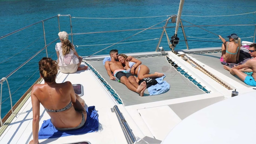
On a Rhodes catamaran cruise, Cape Vagia exposes the fossil-rich Lindos Bay Formation. Studies there and at three other sites found up to 700 m of uplift.
At Lindos Bay, the formation records open-sea mud from about 1.9 to 0.8 million years ago. A volcanic layer in it is 1.85 million years old.
A Rhodes catamaran cruise passes the Archangelos coast, where a hill slope shows 17 marine terraces. They are cut into Cretaceous carbonate rock, and faults offset them.
The limestone of the Archangelos unit formed in shallow seas from the Late Triassic to the Middle Eocene. Higher up, it passes through red mudstone into flysch.
Radiocarbon dates from raised old shorelines point to one earthquake of magnitude 7.7 or more. It struck between about 2000 BC and 200 BC and lifted the coast.
A Rhodes catamaran cruise sees Tsambika hill, topped by the Panagia Tsambika monastery. A monk rebuilt it in 1770, on a site once sacred to Artemis.
- Fourni headland: Ancient people used caves there as burial chambers.
- Mavros Kavos: The name means Black Cape in Greek.
- Extremes: Armenistis is the far west point, Vodi the far east.
Raised shorelines, terraces and fossil beds make this coast a record of how far Rhodes has risen.
What does a Rhodes catamaran cruise see on the west coast?
A Rhodes catamaran cruise on the west coast passes Kamiros Skala, Cape Kopria and two hilltop castles. Offshore lies Alimia, while Apolakkia and Fourni sit further south. Natura 2000 sites protect its mountains, islets and an artificial lake at Apolakkia.
Despite its name, Kamiros Skala lies about 14 km from ancient Kamiros. Its small port shelters fishing boats in every season.
A Rhodes catamaran cruise passes Kopria beach, just east of Cape Kopria. It lies about 1 km from Kamiros Skala, faces north and takes northerly winds.
Kritinia castle stands on a hill 131 m high. Its rectangular walls carry two towers on the east side.
A Rhodes catamaran cruise sees Monolithos castle on its lone rock. A chapel of Agios Panteleimon stands inside the walls the Knights Hospitaller built.
Alimia rises to 274 m, and its Emporio and Saint George bays give boats safe shelter. Its saltwater lake is one of 37 natural wetlands in the Dodecanese.
Apolakkia beach, also called Limni, runs 3,500 m and is 35 m wide. A Rhodes catamaran cruise also reaches Fourni, a small pebbly beach below Monolithos.
- Kritinia views: The castle overlooks Chalki, Alimia and Strongyli.
- Natura 2000: Kopria lies inside site GR4210005, which covers 27,696.22 hectares.
- Kopria size: The beach there is only 40 m long.
Alimia itself belongs to Natura 2000 site GR4210026, which also covers Chalki. Site GR4210030 covers the Attavyros and Akramytis mountains and four islets.
What sea history surrounds a Rhodes catamaran cruise?
A Rhodes catamaran cruise crosses waters full of naval history. Rhodes held off sieges from the sea in 305 BC and 88 BC. Its Knights sailed carracks from 1478. In 1943, warships and aircraft fought over the Dodecanese.
The hemiolia, a fast warship, appeared in the early 4th century BC. Pirates favoured it in the eastern Mediterranean, where a Rhodes catamaran cruise sails.
In 305 BC, Demetrius Poliorcetes brought 200 warships and 150 support vessels against Rhodes. Over 1,000 traders followed for plunder. He never took the harbour.
In 88 BC, Mithridates VI brought a ship-borne tower, the sambuca, against Rhodes. It collapsed near the temple of Isis. Admiral Demagoras led the defence.
Six Rhodian ships sought a captured Rhodian quinquereme, and Mithridates sent 26 ships after them. At sunset the Rhodians turned, attacked from the rear and sank two Pontic ships.
From 1478, the Hospitallers’ flagship was a Great Carrack. In 1507 it helped seize the Mamluk carrack Mogarbina. Their Santa Anna had basic iron armour.
On 18–19 June 1480, Ottoman galleys with siege towers neared St Nicholas fort as a decoy. Cannon fire sank their pontoon bridge across Mandraki bay.
- Laiazzo: In 1510 Hospitaller ships routed a far larger Mamluk fleet.
- Airfields: Rhodes held three military airfields in 1943.
- Allied losses: Six destroyers, two submarines and ten smaller vessels sank.
The 1943 Dodecanese campaign ran from 8 September to 22 November. Rhodes was the main objective for both sides.
Which lighthouses mark a Rhodes catamaran cruise?
Four lights mark a Rhodes catamaran cruise: Agios Nikolaos, Prasonisi, Strongyli and Kandelioussa. Three of them first shone under Ottoman rule. Strongyli, off Kastellorizo, holds the easternmost building in Greece. Kandelioussa lies about 15 kilometres south-west of Nisyros.
The Agios Nikolaos light ends the main breakwater on the east side of the harbour. Its round tower of unpainted stone is 6 metres tall.
A Rhodes catamaran cruise returning at night sees two long white flashes every 12 seconds. Each lasts 1.3 seconds. Its first fourth-order light reached 14 miles.
Over the years, the tower’s lower part decayed. For a time, a skeleton beacon carried the old lantern. The lighthouse is closed to the public.
Prasonisi lighthouse flashes white four times every 30 seconds. On a clear night, a Rhodes catamaran cruise can see its beam from 17 nautical miles.
Prasonisi first burned acetylene and switched to oil in 1952. Since 1986 it has run automatically on solar power. Below stands a four-bedroom keeper’s house.
Strongyli lies about 4 kilometres south-east of Kastellorizo, within reach of a Rhodes catamaran cruise. Its 1917 light flashes every 5 seconds from 107 metres.
- Strongyli tower: It is a round concrete tower, 7 metres tall.
- French build: It rose during the French occupation of Kastellorizo.
- Kandelioussa: Its 1890 beam reaches 17 miles from 55 metres up.
Kandelioussa’s 10-metre tower joins a one-storey keeper’s house. A Rhodes catamaran cruise near Nisyros after dark can see its white flash every 10 seconds.
Which islands can a Rhodes catamaran cruise reach?
A Rhodes catamaran cruise can reach Chalki, Alimia, Tilos, Karpathos and Kastellorizo. By ferry, Chalki lies 39 nautical miles from Rhodes, Tilos 51, Karpathos 79 and Kastellorizo 83. The small islet of Alimia had no residents in 2021.
A Rhodes catamaran cruise to Chalki reaches a municipality of 37.043 square kilometres, islets included. Alimia is its largest islet. Chalki peaks at 601 metres.
Ancient texts called Alimia Eulimna. The Roman writer Pliny spelled its name Evlimnia.
Tilos, reached on a Rhodes catamaran cruise, claims the poet Erinna, said to equal Sappho. Around 200 BC it became part of the Rhodian confederacy.
Karpathos, within reach of a Rhodes catamaran cruise, counted 6,567 residents in 2021. Its municipality covers 324.8 square kilometres. An earthquake split Saria islet away.
Kastellorizo covers 11.98 square kilometres, and its 594 residents in 2021 all lived in Megisti town. Its population peaked at an estimated 9,000 in 1908.
A Rhodes catamaran cruise to Nisyros covers 66 nautical miles, longer than day trips to Symi. A 1st-century BC poem ties Nisyros millstones to early watermills.
- Eclipse: Only Kastellorizo, in the EU, saw the 29 March 2006 eclipse in totality.
- Venetian rule: The Cornaro family held Karpathos from 1306 to 1538.
- Pigadia: The capital and main port sits in south-east Karpathos.
A Rhodes catamaran cruise to Kastellorizo reaches an island French warships occupied on 28 December 1915. Seaplanes stopped there in the 1930s.
What sea life does a Rhodes catamaran cruise meet?
A Rhodes catamaran cruise shares its sea with striped dolphins, sperm whales and Cuvier’s beaked whales. Red Sea fish and an alien seagrass also gained first Greek records here. Loggerhead and green turtles strand on the island’s coasts.
A Rhodes catamaran cruise crosses waters rated rich in whales and dolphins. Sighting rates toward Karpathos were high, possibly due to upwelling east of Rhodes.
Striped dolphins prefer deep water. In those Aegean surveys, 89% of their sightings came from water deeper than 200 m. None came from the Cyclades.
From 1991 to 1996, Rhodes, Kos and Leros logged 51 cetacean strandings, 22 of them striped dolphins. Eighteen of those came during a 1991–1992 morbillivirus outbreak.
Cuvier’s beaked whales stranded eight times across those six years. A stuffed one, found on Rhodes in 1960, is kept in the Rhodes aquarium museum.
The subtropical sea met on a Rhodes catamaran cruise helps Red Sea species spread, researchers believe. The bullseye cardinalfish got its first Greek record there in 2002.
Halophila stipulacea, an Indian Ocean seagrass, was first recorded in the Mediterranean on Rhodes. One sample grew 2 m deep, within reach of snorkeling tours on Rhodes.
- Sperm whales: Greek groups rank among the Mediterranean’s key populations.
- Turtles: Rhodes logged 209 strandings from 1984 to 2011.
- Seabirds: Natura 2000 site GR4210030 in west Rhodes lists Audouin’s gull.
A Rhodes catamaran cruise sails where Iniistius pavo got its first Mediterranean record. The same study logged the Atlantic lesser amberjack’s first eastern Mediterranean record.
How deep is the sea around a Rhodes catamaran cruise?
A Rhodes catamaran cruise sails beside a very deep sea. East of the island, the Rhodes Basin forms a trough about 4,400 m deep. Hellenic Arc trenches and a spinning current, the Rhodes Gyre, shape the sea beyond.
Beyond a Rhodes catamaran cruise, the basin marks where the Hellenic and Cyprus Arcs meet. Unlike much of the eastern Mediterranean, it lacks Messinian salt layers.
The floor of the basin once sank fast. Along its margins, the seabed dropped about 555 to 740 m per million years in the middle Pliocene.
Three trenches, Ptolemy, Pliny and Strabo, split from the eastern leg of the Hellenic Trench. Strabo, the outer one, reaches farthest east, toward the Rhodes Basin.
The Pliny–Strabo fault zone, 30 to 50 km wide, extends into the western Rhodes Basin. Researchers match it to the Burdur–Fethiye fault zone in southwest Turkey.
The sea around a Rhodes catamaran cruise also holds the Rhodes Gyre, a permanent spinning current. It lies southeast of Rhodes and east of Crete.
Cold winter winds there cool salty surface water in February and March. It then sinks about 130 to 400 m deep, forming Levantine Intermediate Water.
- Plankton: Gyre production runs about 13% above nearby waters.
- Uplift: Northeast Rhodes rises up to 1 mm yearly.
- Tsunami: The 1303 quake between Crete and Rhodes caused one.
The island where a Rhodes catamaran cruise begins felt an intermediate-depth quake on 26 June 1926. More than 3,000 houses collapsed, 600 in Archangelos alone.
How do the winds shape a Rhodes catamaran cruise?
Wind shapes where a Rhodes catamaran cruise finds calmer water. HCMR wave data show storms differ between the western and eastern ends of the northwest shore. Airport records give a year-round average wind speed of about 9 knots.
Ialysos, on the windward northwest coast, is known for windsurfing. A Rhodes catamaran cruise on the west faces shore winds and, at times, rough water.
An HCMR study checked 26 km of north and northwest coast, from Cape Mylon to Fanes. It used atlas wave data from 1995 to 2004.
The western stretch saw the larger share of storms, with waves arriving from the west. Only 2% ranked as extreme, against 1% in the east.
Near Rhodes Town, the strongest storms came from the southeast. Extreme storms there averaged wave heights of 2.9 m, against 2.0 m to the west.
Kremasti, with mild slopes, faces a flood threat when extreme storm waves top the beach berm. Waves climbed up to 1.33 m at the studied beaches.
A storm meant waves in the top 5% of heights for at least six hours. More than half ranked as weak, the lowest of five classes.
- Gusts: Airport gusts average 18 knots.
- Flood risk: The rougher eastern end showed none.
- East coast: A Rhodes catamaran cruise there meets only moderate winds.
The east coast lies in the island’s lee, out of the west’s shore winds. That makes it the more sheltered side for a Rhodes catamaran cruise.
How busy is the sea around a Rhodes catamaran cruise?
A Rhodes catamaran cruise starts on an island that handles millions of travelers each year. Rhodes airport counted 6,142,813 passengers in 2023. That year, 371 cruise ship calls brought 453,832 passengers. Ferries and other non-cruise ships carried around 510,000 more.
Among the 14 regional airports run by one operator, Rhodes ranked second for passengers in 2023. Only Thessaloniki airport, with 7,029,957 passengers, handled more traffic.
Greek civil aviation data place Rhodes third in Greece for international arrivals in 2023. Its 2,488,992 arrivals from abroad trailed only Athens and Heraklion airports.
A Rhodes catamaran cruise leaves a port ranked fifth among 51 Greek cruise ports for passengers in 2023. By ship calls, it came fourth in Greece.
Cruise calls at Rhodes dipped from 381 in 2022 to 371 in 2023. Yet cruise passenger numbers still rose, climbing from 370,343 the year before.
EU maritime data split that Rhodes ferry figure into 252,000 passengers landing and 258,000 boarding. The 2023 total trailed the 654,000 passengers counted in 2019.
By cruise calls in 2023, only Santorini, Piraeus and Mykonos topped Rhodes. Santorini led with 800 calls, Piraeus had 761 and Mykonos 749.
- Flights: Rhodes airport logged 43,077 flights in 2023.
- Growth: Rhodes airport traffic rose 4.9% from 5,857,036 passengers in 2022.
- Symi: The nearby island logged 32 cruise calls in 2023.
Domestic flights at Rhodes carried 850,925 passengers in 2023, up 20.0% on 2022.
When is the best season for a Rhodes catamaran cruise?
A Rhodes catamaran cruise fits late spring to October, when international arrivals topped 260,000 a month in 2023. August was the peak month for air arrivals. Wave energy in Greek seas falls to its yearly low in summer.
Greek civil aviation data show 555,175 air arrivals at Rhodes in August 2023. July followed with 526,151, yet handled more passengers in total, at 1,095,597.
Planners of a Rhodes catamaran cruise or tours of Lindos face the same summer peak. Each month from June to September brought over 475,000 arrivals in 2023.
In 2023, October still brought 296,159 air arrivals on Rhodes, and November only 34,933. Aircraft landings and take-offs fell from 4,837 to 1,075 between those months.
A marine research study used 1995–2004 wave data for Greek seas. It found peak wave power in winter, with lower values in spring and autumn.
In summer, the strait between Karpathos and Rhodes is a Greek wave hot spot. Mean wave power there was 5 kilowatts per metre of wave front.
Mean autumn wave power in that strait is 5 to 6 kilowatts per metre. Spring reaches 7, matching the top spring value in the Aegean.
- Low month: February 2023 brought only 24,517 air arrivals.
- Late spring: International arrivals reached 325,592 in the last spring month of 2023.
- August total: Passenger movements reached 1,081,453 that month.
A summer Rhodes catamaran cruise meets peak arrivals and the year’s lowest wave energy.
What do travelers ask about a Rhodes catamaran cruise?
For a Rhodes catamaran cruise trip, public buses link the airport and Rhodes town. EU health cards cover public care, and a police line for tourists runs in four languages.
How do guests reach the harbour from the airport for a Rhodes catamaran cruise?
A municipal bus links the airport with the city of Rhodes. Its stop sits between the old and the new terminal. The municipality posts west coast timetables for weekdays, Saturdays and Sundays. A taxi stand faces Arrivals at Terminal 1.
What help do travelers with reduced mobility get before a Rhodes catamaran cruise?
Rhodes airport follows EU Regulation 1107/2006 for air travelers with reduced mobility. Passengers request help from their airline or travel agency at least 48 hours before departure. At the airport, they go to the assistance point or airline check-in desk.
Does a European Health Insurance Card work during a Rhodes catamaran cruise trip?
Yes, for care on a Rhodes catamaran cruise trip that cannot wait until home. The card works only at public providers, under local rules. It does not cover private care or emergency transport back home.
Who helps tourists with a problem during a Rhodes catamaran cruise holiday?
The Hellenic Police list 1571 as a phone line for tourists. Calls run in Greek, English, French and German. The line exists to solve problems that Greek and foreign tourists face. The same police page lists 1156 for missing persons.
What happens to items lost at the airport before a Rhodes catamaran cruise?
Items found at Rhodes airport go to a lost property office run by the police. That covers the terminal and the airport grounds. Items left on board an aircraft and delayed bags go to the airline’s lost and found instead.
Do international flights reach Rhodes for a winter Rhodes catamaran cruise?
In January and February 2023, Rhodes logged no international air arrivals. All 28,914 January arrivals came on domestic flights. International arrivals returned in March with 10,848, and December brought only 303. Air travelers from abroad connected through another Greek airport.