
A Santorini hiking tour follows the island on foot, along the caldera rim from Fira through Firostefani and Imerovigli to Oia, out to Skaros Rock, up to Profitis Ilias and Ancient Thera, and down to the villages and beaches of the south. This post covers what a Santorini hiking tour includes, the Fira to Oia route, Skaros Rock, the caldera seen from the trail, Profitis Ilias, Ancient Thera, Akrotiri, Pyrgos and Emporio, Oia, Red Beach and the best season. It is one of the hiking tours in Greece on Greece VIP.
Each section ends with a Santorini hiking tour that can be booked online.
What does a Santorini hiking tour include?
A Santorini hiking tour follows paths along the rim of the caldera, on foot and with an expert tour leader. The route links the cliff-top villages, passes the ruins of a medieval castle and looks down on the flooded crater and its volcanic islands.
Santorini closes the Cyclades in the south and forms the largest part of a small ring of islands around the caldera. The flooded basin spans about 12 by 7 kilometres, and steep walls 300 metres tall surround it on three sides. A Santorini hiking tour uses the top of the western wall, where the villages stand on the edge of the drop and the water of the basin lies far below.
A walk along the caldera rim differs from the crater walk on Nea Kameni, which belongs to a Santorini volcano tour. That tour crosses the water by boat to the lava island at the centre of the caldera. A Santorini hiking tour stays on the high ground, and Nea Kameni and Palea Kameni appear from the path as dark lava shields in the middle of the water.
The setting draws scientists as well as walkers. The high walls, draped with whitewashed villages, and good observation conditions have made the caldera a magnet for volcanologists. The volcanic complex is the leading centre of activity in the South Aegean Volcanic Arc, which also includes Methana, Milos and Nisyros. A Santorini hiking tour passes through that setting, and each village and ruin on the rim ties back to it.
- Setting: The route follows the western rim of the caldera.
- Villages: The path links Fira, Firostefani, Imerovigli and Oia on one cliff line.
- Ruins: The rock of Skaros carries the remains of a Venetian castle.
- Leader: On a Santorini hiking tour, an expert tour leader names the landmarks along the path.
A Santorini hiking tour therefore reads the island from its edge. The caldera wall supplies the height and the view, the rim villages supply the stops, and the ruins on Skaros Rock supply the medieval history. The paths run along the top of the cliff wall, so a Santorini hiking tour sees the villages from within, while a boat on the water below sees them only from a distance.


Which route does a Santorini hiking tour follow from Fira to Oia?
A Santorini hiking tour follows the caldera path from Fira north through Firostefani and Imerovigli to Oia. The route keeps to the rim of the caldera and passes churches, narrow lanes and cliff-edge viewpoints, with the volcanic islands in view at every stage.
Fira, the modern capital, is the first stop on a Santorini hiking tour. Its whitewashed houses stand on the edge of the caldera, and a zigzag footpath climbs to the town from the port below. The Three Bells of Fira, an Eastern Catholic church with a blue dome and three bells, stands directly above the cliffs. The present building dates from 1757 and occupies a site where two cave churches were cut into the cliff face in the mid-17th century.
Firostefani follows. It lies north of Fira, and the capital has since absorbed it as a neighbourhood. Its name refers to a crown above Fira, because the village stands higher than the rest of the town. Imerovigli comes next. Narrow paved paths cross the village, which stands on the rim of the caldera, and all of its churches are built in the Cycladic architectural style. The church of Ai-Stratis stands at the village centre, and the path that links Imerovigli with Fira passes the Monastery of Saint Nikolaos.
The path ends at Oia, on the northwestern tip of Santorini. Oia stretches along the northern lip of the caldera for just under two kilometres, on ground 70 to 100 metres above sea level. Its main street, Nikolaou Nomikou, is a cobbled trekking path that winds up the hill around the caldera. Sunlight lasts longer in Oia than in Fira.
A Santorini hiking tour ends in a village that rebuilt itself. The earthquake of 9 July 1956 destroyed part of Oia, and emigration followed, leaving only 306 inhabitants in 1977. In 1976 the village entered a preservation programme of the Greek National Tourism Organisation, which restored houses typical of traditional Greek architecture. That organisation received the Europa Nostra Prize in 1979 for its work in Oia.
- Fira: The capital looks across the caldera to Nea Kameni and Thirassia.
- Firostefani: Traditional houses and narrow lanes line the village, which faces the volcano.
- Imerovigli: The village had 469 permanent inhabitants at the 2021 census.
- Oia: The village had 1,087 inhabitants at the 2021 census.
The rim route strings four settlements along one cliff line. A Santorini hiking tour starts in the capital, passes through a village of 469 residents and ends in one of 1,087 residents. Paved paths, cobbled streets and Cycladic churches mark the way, and the caldera stays in view along the whole route from Fira to Oia.
What does a Santorini hiking tour show at Skaros Rock?
A Santorini hiking tour shows Skaros Rock, a promontory near Imerovigli that carries the ruins of a medieval castle. The rock was fortified in the early 13th century, and a town grew around the fortress before eruptions drove the residents away.
Skaros Rock is a large promontory on the western side of Santorini. Volcanic activity of the nearby caldera created the formation, and an eruption dated to 68,000 B.C. is linked to it. Erosion and earthquakes have shaped the rock since. Sailors call it Cape Skaros. A Santorini hiking tour reaches the promontory through the village of Imerovigli, which stands on the caldera rim beside it.
The fortress dates to the early 13th century, when the Byzantine Empire employed the Venetian architect Giacomo Barozzi to build it around the promontory. The first structure, La Roka, meaning Upper Castle, was completed in 1207. Marco I Sanudo then gave Barozzi control of Santorini. The settlement grew to include homes and businesses, while the Chapel of Panagia Theoskepasti and a small harbour went up at the base of the rock. The ruins seen on a Santorini hiking tour are what remains of that settlement.
When Venice took over the island in 1336, the settlement counted more than 200 homes, and the fortress was in practice the capital of Venetian Santorini. Ottoman rule began in 1566, and a garrison stayed in Skaros while Fira and Oia gained importance. The eruption of 1650 sent part of the town into the sea. The eruptions from 1701 to 1711 pushed residents toward Fira and Imerovigli, and only weathered ruins were left by the early 19th century.
- Rock: The promontory is also called Fortress Skaros or Castle Skaros.
- Castle: La Roka means Upper Castle and was completed in 1207.
- Chapel: The Chapel of Panagia Theoskepasti stands on the cliffs below the rock.
- Access: A Santorini hiking tour approaches the ruins through Imerovigli.
Skaros Rock gives a Santorini hiking tour its clearest view of how the island changed. A fortress town once held the rim, and volcanic eruptions and the move of power to Fira and Oia emptied it. The chapel at the foot of the rock remains in use, and the ruins above it are a destination for hikers and photographers.
What does a Santorini hiking tour show of the caldera?
A Santorini hiking tour shows the caldera from the rim: cliffs on three sides, lava and pumice layers in the walls, lava islands in the water, and the youngest crater, which the Minoan eruption formed about 3,600 years ago.
Not all of the wall is volcanic. Thera sits on a small non-volcanic basement, the remnant of an older island about 9 by 6 kilometres in size. The basement rock is primarily metamorphosed limestone and schist from the Alpine orogeny. It is exposed at Mesa Vouno, Pyrgos, Monolithos, the Gavrillos ridge and Mikro Profitis Ilias. A Santorini hiking tour on the rim passes these older rocks next to the lava.
The Minoan eruption was a Plinian eruption of rhyodacite. Its scale compares with the 1815 eruption of Mount Tambora and the 1257 eruption of Samalas. Magma met the shallow sea of an embayment and set off violent phreatomagmatic blasts. The northern part of the caldera was then refilled with ash and lava, and it collapsed again. A Santorini hiking tour on the rim looks across the water where that collapse took place.
An older eruption, about 520,000 years ago, dwarfed the Minoan one and is the largest eruption known from the geologic record. It breached the sea surface and covered three nearby islands in volcanic deposits. Its pyroclastic deposits held more than six times the volume of those from the Minoan eruption. A Santorini hiking tour on the rim looks over a volcano with a record of eruptions on that scale.
- Seafloor reach: Pyroclastic flows from the older eruption covered the seafloor up to 70 kilometres from the vent.
- Deposit thickness: The pyroclastic deposits reached 150 metres.
- Deposit volume: The deposits totalled 90 cubic kilometres.
The Minoan eruption also redrew the coast. Before it, the island was smaller, and its southern and eastern coastlines had regressed. In places the coastline vanished under thick tuff, and in others it grew out towards the sea. In the middle of the water, the lava islands Nea Kameni and Palea Kameni mark where later, smaller eruptions built new land, the first of them under the sea. A Santorini hiking tour on the rim looks down on them.
Can a Santorini hiking tour climb Profitis Ilias?
A Santorini hiking tour can climb Profitis Ilias, the highest mountain on the island at 567 metres. A monastery dedicated to the prophet Elijah and two small chapels stand on the mountain, and the summit rises above the caldera cliffs.
Profitis Ilias means Prophet Elias, after Elijah of the Hebrew Bible. The caldera cliffs reach 300 metres on three sides, and the summit stands above them. Mesa Vouno, the ridge of Ancient Thera, is a foothill of the mountain and stands 396 metres above sea level. A Santorini hiking tour on Profitis Ilias works on the highest ground of Santorini.
The church of Panagia Episkopi stands in the northern foothills of the mountain. The east coast at Kamari lies about 2 kilometres from it, and Fira, the capital, lies 5 kilometres to the north-west. On the upper grounds of the church, which include the peak and two small chapels, two brothers on the island founded the monastery of the Prophet Elijah. A Santorini hiking tour that reaches the peak reaches that monastery.
A legend recorded in 1701 says that the Byzantine emperor Alexios I Komnenos, who lived from 1048 to 1118, gave the church a deed to all the land outside the former villages of Gonia and Pyrgos Kallistis, up to the top of the highest mountain of the island. His wife Irene Doukaina is said to have donated a large sum. No such deed or seal has been found to date. A Santorini hiking tour on the summit stands on the land that the legend describes.
- Neighbour ridge: Mikro Profitis Ilias lies in the northern part of the island, between Cape Kolumbo and Cape Skaros.
- Ridge peaks: The northern peak stands at 319.6 metres, the southern peak at 318.
- Ridge rock: A Santorini hiking tour on that ridge crosses non-volcanic rock that predates the Minoan eruption.
In April 1822, news of the massacres of the Greek population of Chios left islanders fearful of Ottoman reprisals, and two villages stated that they were prepared to surrender. Sixteen monks of the Monastery of Profitis Ilias, led by their abbot Gerasimos Mavrommatis, declared their support for the revolt in writing. Commissioners arrived in July 1822 to investigate the issues on the island. A Santorini hiking tour on the mountain reaches a monastery with a documented role in the revolt.
What does a Santorini hiking tour show at Ancient Thera?
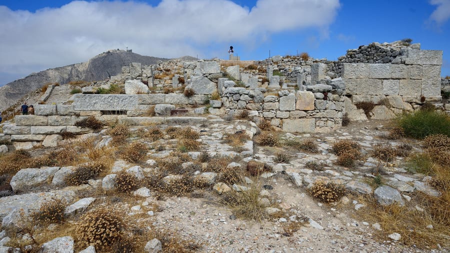
A Santorini hiking tour shows Ancient Thera as a limestone city on the ridge of Mesa Vouno: a garrison headquarters at the highest point, an agora open to the sea, a stoa, peristyle houses of fleet officers, and rock inscriptions that record competitions.
A Santorini hiking tour reaches Ancient Thera by footpaths from both sides of Mesa Vouno, and a winding road also climbs from Kamari. A short cul-de-sac branches off the main street at a right angle. At its end, at the highest point of the city, stood a building that was presumably the headquarters of the fleet commander. The courtyard next to it is thought to have been the gymnasium of the garrison. Local limestone supplied the stone for every building.
In the agora, the public buildings stand on the western side, toward the slope, and the view east to the sea is completely free because the private houses were built below its level. The Basilike Stoa marked the centre of public life. This portico measures 46 by 10 metres. It was completely rebuilt in the 1st century, and a separate room at its north end held statues of the imperial family. A Santorini hiking tour that crosses the agora stands beside the stoa.
The officers of the fleet lived in peristyle houses with colonnades, built on terraces of the eastern slope below the main street. From there the sea lies more than 300 metres below. The wider population lived on the plateau, in houses around a small central courtyard, with a cistern underneath as an essential source of water. Houses had two levels in places, and the terrain allowed small basements. A Santorini hiking tour on the plateau stands among the remains of these houses.
- Garrison: The Ptolemaic garrison began with only three officers and about 300 soldiers.
- Egyptian mercenaries: Their share grew rapidly, and their gods influenced the religious cults of the city.
- Roman province: From the middle of the 1st century BCE the city belonged to the province of Asia, and Therans twice held the office of provincial high priest.
Rock walls around the forecourt of the gymnasium carry inscriptions that record competitions and sacred acts. One heavy stone bears the name of the contestant who threw it the farthest. The limestone is coated with a dark grey-blue crust that knocks off easily to expose white stone, so anybody, not only a stonemason, was able to cut a text. A Santorini hiking tour that reaches the spur passes these rock walls.
What does a Santorini hiking tour show at Akrotiri?
A Santorini hiking tour at Akrotiri shows the village with its ruined Venetian castle, the Bronze Age city that volcanic ash buried in the 16th century BC, and the lighthouse on the western tip of the island. A signposted footpath runs from the village down to the excavation.
The village of Akrotiri is built on the slopes of a hill above the caldera cliffs, and it had 515 permanent inhabitants at the 2021 census. The ruins of the Castle of Akrotiri lie at its centre. The castle is also called Goulas and La Ponta, and much of the village is built around its ruins. Venice occupied Santorini in 1207, and its engineers built the castle in the 13th century on top of a Byzantine watchtower. A Santorini hiking tour passes these walls on foot.
The excavation lies 2 km southeast of the village. A path descends from the first houses of the modern settlement to the car park of the dig. It was signposted and reopened in September 2012, and it suits hiking and mountain biking. International volunteers maintain the path, and the local population supports the work. A Santorini hiking tour that follows it reaches the Bronze Age city on foot.
The city was a Cycladic settlement, but inscriptions in Linear A and close likenesses in artifacts and frescoes tie it to the Minoan world. The fresco of the Blue Monkeys came to light in 1969 in Room Beta 6, and the rocks that the monkeys climb copy the volcanic rocks near the site today. Moulds and crucibles show that copper was processed there, and a loom workshop points to textile weaving for export. A Santorini hiking tour at the dig meets a trading port.
- Castle: The castle surrendered to the Ottomans in 1617, and the earthquake of 1956 reduced it to a ruin.
- Reopening: The site was closed to visitors between 2005 and April 2012.
- Shrine: Excavators found a small shrine with a marble figurine of a woman in October 2018.
- Lighthouse: A French company built it in 1892, and it is one of the oldest lighthouses in Greece.
A Santorini hiking tour reaches the lighthouse on the westmost tip of Santorini, west of the village. The lighthouse ceased operating during World War II, and the Greek Navy recommissioned it in 1945. The headland is known for its sunset views. The ground around Akrotiri has a volcanic past as well: lava vents near the village started volcanism on Thera about 2 million years ago.
Which villages does a Santorini hiking tour cross on foot?
A Santorini hiking tour crosses Pyrgos Kallistis, a hill village crowned by a ruined Venetian castle, and Emporio, a village with the old Goulas Castle. Both are among the five kasteli, the fortified settlements that islanders built against pirate raids in the 15th and 16th centuries.
Pyrgos Kallistis stands 7 km from Fira, on a hill that rises in tiers with views in almost every direction. Pyrgos means tower in Greek. The Venetian castle on the hilltop is a ruin today, but it was once the administrative centre of the island. The village is a typical example of medieval architecture, and it is one of the villages of Santorini least spoiled by tourism. A Santorini hiking tour crosses it on foot.
The hill of Pyrgos is one of the places where the old non-volcanic island shows through the volcanic cover. Its rock is metamorphosed limestone and schist, folded around 60 million years ago during the Alpine orogeny. That island measured about 9 by 6 km, and volcanism on Thera began only about 2 million years ago. A Santorini hiking tour in Pyrgos therefore walks on rock far older than the volcano. Monolithos is another place where the same basement is exposed.
Emporio lies 12 km from Fira and keeps the old Goulas Castle. A goulas, from the Turkish word kule for tower, was a rectangular, multi-storey tower with thick walls, parapets, iron gates, murder holes and embrasures. The island had four of them, and islanders used them as observatories and as places of refuge. A Santorini hiking tour in Emporio reaches one of the five kasteli, which were large, fortified, permanent settlements.
- Pyrgos: On a Santorini hiking tour the lanes are narrow and labyrinthine, and fortified walls and hidden passages line them.
- Emporio: The church of Saint Nicholas Marmaritis is one of the churches of the village.
- Viglio: Small coastal watchtowers kept a permanent garrison to raise the alarm when a pirate ship appeared.
Pirate raids explain the layout of both villages. Raiders plundered harvests and enslaved men and women, and the small bays of the island served them as hideouts. Islanders built at the highest and least accessible points, close to or on top of each other. Their outer walls had no openings and formed a protective perimeter. A Santorini hiking tour across Pyrgos and Emporio follows that defensive design on foot.
How does a Santorini hiking tour end in Oia?
A Santorini hiking tour ends in Oia at the ruined castle on the highest point of the village and at the steep stairs that descend to Ammoudi Bay on the western side. The castle is a lookout with an all-round view, and the stairs reach the harbour.
A Santorini hiking tour follows Nikolaou Nomikou, the cobbled main street of Oia, which is the main trekking path of the village and winds up the hill around the caldera. Oia covers the northwesternmost part of Santorini. Phinikia lies immediately to the east, and Tholos lies about 500 m to the north. The earthquake of 9 July 1956, of magnitude 7.8, destroyed part of the town. Emigration followed, and in 1977 Oia had only 306 inhabitants.
The ruined castle that a Santorini hiking tour reaches stands at the pinnacle of Oia and carries the name Fort Londsa. It was the seat of the Argyri family under the Venetians and once ranked among the strongest fortresses of the island. Under the da Corogna family, the castle settlement of Agios Nikolaos, also called Apanomeria, was one of five local citadels. Santorini stayed under the Crispo family until 1566, and after the death of Joseph Nasi in 1579 it passed to the Ottoman Empire.
Steep stairs north of Fort Londsa lead down to the harbour of Ammoudi on the western side of the village. The descent counts 300 steps. The harbour has tavernas and a pebble beach, and the ferry to Therasia leaves from there. The small island of Agios Nikolaos lies to the south-west. A Santorini hiking tour that goes down to Ammoudi returns to the village by the same steps.
- Castle: The fortress belonged to the same Venetian defence system as Pyrgos.
- Armeni: The fishing village below Oia to the south is reached by steps.
- Boatyard: The bay of Armeni was once an important boatbuilding centre.
A Santorini hiking tour ends when the route ends, at the castle ruins above or at the harbour stairs below. A Santorini sunset tour is built the other way round, with the sunset as the fixed point and the stops arranged around it. Sunset viewing is a popular attraction in Oia, and the village fills with people at that time.
Which beaches does a Santorini hiking tour reach on foot?
A Santorini hiking tour reaches the Red Beach below Akrotiri and the black beaches of Kamari and Perissa, which lie on either side of Mesa Vouno. Red sand, black pebbles and an Aegean shoreline give the three stops very different surfaces underfoot.
Walkers reach the Red Beach, a stretch of volcanic sand, from the village of Akrotiri on the south side of the island. Oxidised iron gives the sand its red hue, and the beach ranks as a popular tourist attraction. Beach colour on Santorini follows the geological layer exposed at each shore, and that is why the Black Beach, the White Beach and the Red Beach have colour names.
Kamari takes its name from a small arch at the south end of its beach. The arch is what remains of an old customs house built between 1537 and 1650, and the village was once an agricultural and fishing settlement. A Santorini hiking tour that reaches Kamari walks along a beach of black pebbles, the longest on the island, which runs to the foot of Mesa Vouno.
Perissa counted 725 permanent residents in the 2021 census, and the community of Emporio includes the village. Its beaches face the Aegean and include Perissa Beach itself. The village lies near the Messa Vouno rock, so the mountain stands between Perissa and Kamari. Kamari lies 8 km from Fira, while Perissa lies 13 km from the capital.
Black sand found on beaches near a volcano consists of tiny fragments of basalt. When lava meets water, it cools rapidly and shatters into sand and debris. Black sand absorbs more solar radiation than white or green sand, so walking barefoot on it can result in burns. Perivolos beach on Santorini appears among the black sand beaches of Europe. On a Santorini hiking tour, the dark shores call for shoes, not bare feet.
- Landslides: The area around the Red Beach is prone to landslides, and parts of the beach have been inaccessible since 2013.
- Epiphany: The arch at Kamari hosts the yearly Epiphany and Blessing of the Water tradition.
- Sanctuary: An archaic sanctuary dedicated to Achilles was discovered at Kamari in 2002.
The three beaches lie south and southeast of Fira, away from the caldera cliffs, where the ground slopes outwards to smooth, shallow shores. Kamari adds a thriving tourist industry with accommodation, restaurants, cafes, bars, night clubs and water sports, so a Santorini hiking tour that ends there finds services beside the beach.
When is the best season for a Santorini hiking tour?
A Santorini hiking tour meets a hot, dry summer, a wind season from the second half of spring to mid-September and a wetter winter. The records of Oia show an absolute high of 40 °C in June and an absolute low of 0 °C in December.
Summer on Santorini is hot and dry, and the island has a sunny climate. The Cyclades hold the driest area in Greece, on the island of Schoinoussa, and Santorini shares their hot semi-arid climate. The village of Oia receives much longer sunlight hours than Fira, so a Santorini hiking tour that ends in Oia finishes where the daylight lasts longer.
The meltemi is a dry north wind, and unlike a monsoon it has no opposite wind in winter. A trough of low pressure over the Eastern Mediterranean strengthens it, and the deep continental depression over southwest Asia is its chief cause. Its direction varies with local topography between north-east and north-west. Mal tempo, the Italian for bad weather, is thought to be the source of the Modern Greek name. A Santorini hiking tour in the wind season walks under that dry northerly flow.
Wind belongs to the whole Cyclades, and climate records note very windy days on the islands and around them. In Oia the climate is temperate and mild, with a wet winter and a hot, dry summer. Wind speed there varies between 56 km/h in August and 98 km/h in October and February, so the recorded wind is stronger in the cooler months than at the height of summer.
- Summer: The air is hot during the day and pleasantly warm at night.
- Wind season: The etesians peak in frequency in July and August, and the season runs on into October.
- Winter: Winter is the wet season at Oia, and the rain of that season can be persistent.
The etesians have a long record. Writers have described them since ancient times, and Philip II of Macedon timed his military operations so that the powerful southern fleets failed to reach him, because their ships sailed north only very slowly while the etesian winds blew. A Santorini hiking tour in the wind season walks in the same wind that once slowed fleets on the Aegean.
What do travelers ask about a Santorini hiking tour?
A Santorini hiking tour follows cobbled streets, stone steps and caldera paths in a hot, dry climate, and it links Fira, the transport terminus of the island, with Oia, a village 11 km away on the northwest edge of the island.
What footwear suits a Santorini hiking tour?
Closed shoes with a firm sole suit the route. The main street of Oia is cobbled, the way down to Armeni Bay runs over steps, and the soil of the island is largely volcanic ash. Open sandals grip that mix of stone and ash less well than shoes with a sole made for walking.
How do water and sun affect a Santorini hiking tour?
Santorini has only one spring, and its desalination plants supply running water that is not potable. Summer temperatures on the island are high. Walkers on a Santorini hiking tour therefore carry drinking water and sun protection, since the dry climate offers little relief along the route.
Can cruise passengers join a Santorini hiking tour?
Cruise passengers reach the old port of Skala by transfer in a local boat, because the ships stay at anchor offshore. From the pier, the cable car lifts up to 1,200 passengers an hour to Fira, where the route begins. The other ways up are on foot or by mule.
What is the difference between a private and a group Santorini hiking tour?
A private hike belongs to one party, so that party sets the pace and the stops along the rim. A group hike joins other travelers on a set route led by a tour leader. The paths of Oia are very narrow and become congested in the tourist season, so the size of the party shapes how freely it moves.
Can a Santorini hiking tour run from Oia to Fira?
The rim path joins Fira and Oia on one cliff line, so a Santorini hiking tour can start at either end. Oia sits at the northwest end of the island, while Fira occupies the western edge of the caldera. A walk that starts in Oia ends in Fira, the transport terminus of the island.
How do walkers return from Oia to Fira after a Santorini hiking tour?
Oia has a bus station of its own, and the central bus station of the island in Fira serves routes to tourist spots on the island. Fira also has a taxi station on its main square. The two villages lie 11 km apart, and the rim path joins them.
Can wheelchairs or strollers join a Santorini hiking tour?
A Santorini hiking tour that begins in Fira can use the cable car from the old port, which takes wheelchair users. A wheelchair must be no wider than 58 cm and no longer than 120 cm to fit a gondola. The cable car is not always suitable for strollers or pets. Riding early or late in the day avoids the crowds at the lift.
Featured photo: Christopher Down, CC BY 4.0, via Wikimedia Commons.