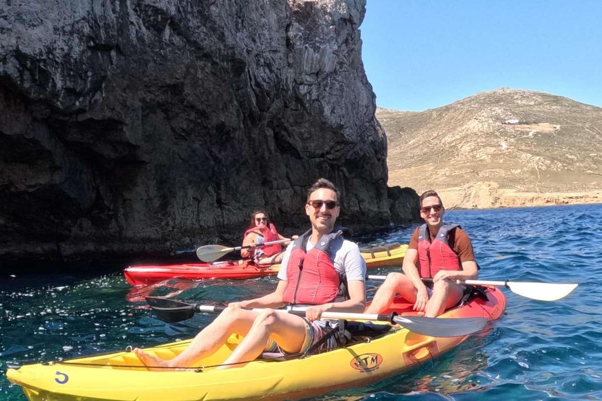
A Mykonos kayak tour paddles along the rocky coast of Mykonos, into quiet bays, coves and sea caves. It is one of the sea kayak trips in Greece on Greece VIP.
This post covers what a Mykonos kayak tour includes, where it launches and the kayaks it uses. It also covers bays, coves, sea caves, rocks, protected areas, sea depth, sea life, sea temperature and winds. Effort, safety, coastal history, the best season, clean water and common questions come last.
Each section ends with a Mykonos kayak tour or a nearby sea trip that can be booked online.
What does a Mykonos kayak tour include?
A Mykonos kayak tour can include paddling gear, snorkel kit, 1.5 litres of cold water and a snack. Trained leaders run the trips. Certain routes add hill walks or a Greek lunch. Group caps run from 10 to 16 paddlers.
One Mykonos kayak tour starts and ends at Panormos beach on the north coast. The route follows the shore past Agios Sostis toward small rocky islets.
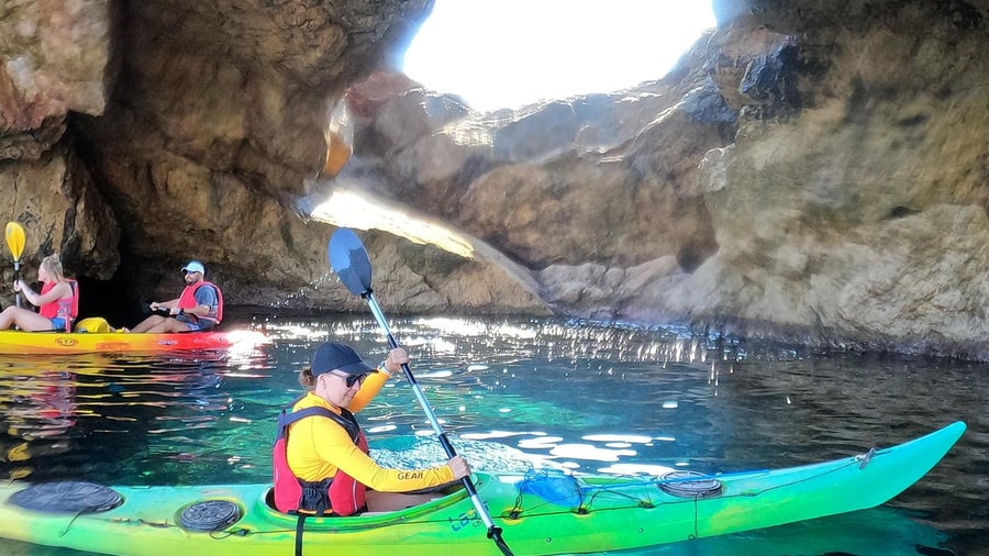
Paddlers on that route can enter a large sea cave. Stops add snorkelling, hill walks, herb picking, a Greek lunch or an archery taster, weather permitting.
A Mykonos kayak tour packs 1.5 litres of cold water in a cooler. Its light local snack tends to be dried figs, with snorkel gear included.
Its leaders are British Canoe Union trained, backed by first aiders and sea kayak coaches. That union was founded in 1936 and is now Paddle UK.
A paddle-and-hike Mykonos kayak tour takes up to 16 people aged 10 and over. It covers 4 to 6 km and is rated beginner to intermediate.
Free photos from that Mykonos kayak tour arrive by email. A smaller trip caps its group at 10. It is not suited to children under 10.
Inn-to-inn trips circle the island. A support van meets the group at beaches and lunch stops. One such trip adds a sunset walk to Cape Tarsanas.
- Private option: One north coast operator also sells a private session.
- Pickup: Hotel pickup can be arranged for one Panormos trip.
- Camera: The 10-paddler trip hands out an action camera.
The Panormos Mykonos kayak tour leaders explain how kayak types change speed and stability. Engine power makes boat trips around Mykonos faster.


Where does a Mykonos kayak tour launch?
A Mykonos kayak tour launches from sandy beaches at Ornos, Platis Gialos, Kalafatis and Agios Ioannis. State profiles list sand on the shore and seabed at the first three. All four are reached by road from the main town, Chora.
As a Mykonos kayak tour launch, Ornos beach runs 340 m and averages 20 m wide. It faces south-west inside a closed bay 1,500 m long.
The Ornos seabed slopes steeply to 5 m depth about 40 m out. This Mykonos kayak tour launch lies about 2 km south of Chora, with public transport.
A Mykonos kayak tour from Platis Gialos crosses a gently sloping seabed. Its first sampling point holds about 1,000 bathers, and the shore rents motorised water gear.
A second Platis Gialos sampling point faces west and joined the register in 2018. Rocks in its water carry seaweed. The village counted 317 residents in 2021.
A Mykonos kayak tour from Kalafatis starts east of Cape Tarsanas, with Divounia to the south-west. The beach averages 30 m wide, faces south-east and slopes gently.
Kalafatis became a bathing water in 2004 and holds up to about 500 bathers. Its facilities include access aids for disabled visitors and space for sports.
Agios Ioannis, a Mykonos kayak tour launch, has no state bathing profile. A Greek travel register lists fine sand, a sand seabed and shallow water there.
- Ornos: The beach joined the register in 2001 and holds about 1,300 bathers.
- Agios Ioannis: Its settlement, Agios Ioannis Diakoftis, counted 190 residents in 2021.
- Shelter: All three state profiles rate the shore sheltered from prevailing waves.
Ornos keeps a small private boat mooring about 20 m from its bathing area.
Which kayaks does a Mykonos kayak tour use?
A Mykonos kayak tour on the north coast uses double sit-on-top kayaks. In a tandem, the front paddler sets the pace. One maker’s paddle chart runs from 210 to 250 cm. EU recreational craft rules exempt human-powered kayaks from design requirements.
The ancient Aleut name for an Aleutian kayak is iqyak. Their baidarka had two or three cockpits, built for hunting and for carrying people or goods.
Kayaks were adapted for military use in the Second World War. British commandos used them, and Royal Marines paddled them in a raid on Bordeaux harbour.
On a Mykonos kayak tour tandem, the rear paddler matches the front paddler’s rhythm. Strokes in unison avoid clashing blades. Tandems are longer and faster than solo kayaks.
A Mykonos kayak tour tandem can be paddled solo. One seat comes out, and the other moves to the middle. Traditional fishing kayaks reach beams of up to 1.1 m.
Skin-on-frame kayaks now swap seal skin for canvas or nylon cloth, sealed with paint or polyurethane. Whitewater racing kayaks use epoxy or polyester reinforced with glass or carbon fibre.
High-angle paddling is fast, with more vertical strokes and a shorter paddle. Low-angle paddling is relaxed, with flatter strokes and a longer paddle for long days.
One maker’s low-angle blade measures 45 cm long and 17 cm wide, with 619 square cm of surface. A high seat needs a paddle 5 cm or more longer.
- Wing blades: Spoon-shaped wing paddles are popular in kayak racing.
- Twin hulls: Two long, narrow hulls spread the buoyancy far from the centre line.
- Arctic use: Arctic peoples hunted rather than fished from kayaks.
ISO 12402-8 sets safety requirements and test methods for flotation device accessories.
Which bays shelter a Mykonos kayak tour?
On the north coast, a Mykonos kayak tour meets Panormos bay, Ftelia, Agios Sostis and Houlakia. Panormos bay is protected from south and east winds but open to the north. Pilot notes mark two anchorage coves inside it: Agios Sostis and Panormos.
The name Panormos joins the Greek words for “all” and “port”. A 1930 study of Mykonos place names says small boats can anchor there “in any weather”.
On a Mykonos kayak tour, Panormos beach shows golden sand about 7 km from town. A bus links it with the Old Port of Mykonos Town.
Pilot notes for yacht cruises along Mykonos warn of a reef with rock heads near Agios Sostis. Boats keep it to starboard before turning into the cove.
Agios Sostis takes its name from a bright-white chapel. Near the chapel, a Mykonos kayak tour is exposed only to north-east or very strong south-east winds.
The sandy beach stretches for about 250 metres. A reddish rock marks its right side, and a second small beach lies next door. No bus serves it.
Ftelia takes its name from the Greek word for elm, gone from the spot by 1930. A Mykonos kayak tour finds much of its beach bare sand.
A small road, sandy near its end, leads to the beach. Rocks lie near the shore in the middle and at the end of the bay.
- Name: Houlakia comes from a local word for a shore of large granite stones.
- Shore: Two small neighbouring coves hold large pebbles.
- Swimming: The protected shore suits swimming only in a small cove behind the rocks.
A Mykonos kayak tour past Houlakia sees a shore named from kochlax, ancient Greek for pebble or shingle.
Which east coast coves does a Mykonos kayak tour reach?
A Mykonos kayak tour on the island’s east side reaches Fokos, Mersini, Tigani, Lia and the Divounia area. Fokos and Mersini lie less than 1 km apart. Lia is the farthest beach from Mykonos Town on the south coast.
Fokos lies about 13 km from town, past a turn in Ano Mera and the Marathi reservoir. Its sandy, wide shore has no umbrellas or sunbeds.
On a Mykonos kayak tour, Fokos bay offers deep, sheltered water for swimming. Horse riding trips also visit the beach, and one seafood taverna overlooks the sand.
Mersini forms a gentle sandy arc. Rocks split it into two beaches, and its water is shallow and turquoise. No taverna, bar or restaurant stands nearby.
Mersini, a cove on a Mykonos kayak tour, takes its name from the myrtle shrub. A 1930 place-name study files it with Mykonos names drawn from plants.
Pano and Kato Tigani lie in the Profitis Ilias area, with coarse golden sand. A long dirt road reaches the beaches, and no houses stand around.
Tigani is Greek for frying pan. The 1930 study groups it with names drawn from the land’s shape. The same name exists on Samos and Kalymnos.
Lia, about 13 km from town, has white sand below arid hills. Rocks at the water’s edge make it a snorkelling spot on a Mykonos kayak tour.
- Divounia: This small fishing settlement has whitewashed houses that overlook the sea.
- Name: Divounia names two small hills beside Tarsanas, a south cape and bay.
- Beach: The small beach has pebbles, deep blue water and two fish tavernas.
Below a Mykonos kayak tour off Lia, divers explore a reef to about 24 metres.
Which sea caves does a Mykonos kayak tour enter?
A Mykonos kayak tour on the east side faces the caves of Tragonisi. The force of the sea carved a system of caves into this islet. On the main island, Agia Anna beach has a sea cave of its own.
The 1930 place-name study ties the name Tragonisi to a large cave big enough to pen billy goats. A British Admiralty chart names it Drakonisi, dragon island.
On a Mykonos kayak tour, the caves of Tragonisi show blue-green water. Scuba divers explore them as a cavern dive, always keeping the entrance in view.
The 1930 study records Fokospilia, or Seal Cave, facing Tragonisi, where seals were plentiful. It also lists the cave names Spilia and Mavri Spilia, the Black Cave.
A Seal Cave dive at Tragonisi runs only on request, for experienced divers. A Mykonos kayak tour meets bare cliffs, sharp stones and slippery pebbles there.
Monk seal caves in Greece are dark, and their entrances can lie underwater. A long corridor leads to a dry beach where seals rest and nurse pups.
Seal pups wear dark brown to black hair, 1 to 1.5 cm long. Their white belly stripe differs between males and females.
A sea cave at Agia Anna, reachable on a Mykonos kayak tour, takes the beach’s name. A seafood restaurant has operated inside it since the early 1990s.
- Moult: After six to eight weeks, pups grow short adult hair.
- Weaning: Monk seal pups are weaned at around 18 weeks of age.
- Setting: Seal caves tend to lie along remote, rugged coasts.
Adult seals met on a Mykonos kayak tour moult yearly, so their coat colour changes through the year.
What rocks does a Mykonos kayak tour paddle past?
A Mykonos kayak tour paddles past monzogranite and the rocks of the Mykonos detachment. Zircon dates the granite to 13.5 million years ago. In the east, the fault lays sandstone and conglomerate over granite and greenschist. Barite dikes cut every layer.
The granite along a Mykonos kayak tour is a monzogranite. In 2008, Brichau and colleagues dated its zircon to 13.5 million years, plus or minus 0.3 million.
Hornblende in the granite gave an argon age of 12.7 million years, and biotite gave 10.9 million. The study puts cooling above 100 °C per million years.
Granite on a Mykonos kayak tour lies below the Mykonos detachment. That fault slipped at an average 6 km per million years, about 30 km in all.
In eastern Mykonos, Lecomte and colleagues mapped the fault dipping 12° north-east. A 50 cm layer of orange crushed rock, called gouge, holds the fault plane.
Above the fault lie near-flat Miocene sandstones and conglomerates. Near the fault, they grade into a breccia 10 m thick. Slumps show the fault moved during deposition.
Clays that grew inside the fault rock give potassium-argon ages. Zuccari and colleagues found faulting lasted from 13.5 to 6.5 million years ago, in repeated slip events.
Mykonos holds large barite-iron deposits but little skarn, the reverse of Serifos. Sulfur isotopes in its barite sit near seawater values, so seawater buffered those fluids.
- Tafoni: This term for weathering pits dates in print to 1882.
- Tors: Free-standing tors survive where granite joints sit far apart.
- Ores: Mykonos subsoil holds manganese-rich iron, copper and galena, still unmined.
A Mykonos kayak tour follows part of this 89 km coastline.
Which protected areas does a Mykonos kayak tour cross?
A Mykonos kayak tour sits beside one Natura 2000 bird area, classified in 2002. The EEA maps it at 185.16 km² of land and sea. On the island, six wetlands appear in a 2006 inventory. Tinos holds two more Natura sites.
This bird area is a Special Protection Area under the Birds Directive. Its EEA record lists birds, not habitat types. A 2009 record gives a 58.5 km perimeter.
The highest ground in the zone beside a Mykonos kayak tour reaches 160 m. Its data form cites BirdLife’s Important Bird Areas in Europe, from 2000.
For the islands near a Mykonos kayak tour, the data form counts 150 breeding Eleonora’s falcons. It adds 20 breeding Audouin’s gulls and 30 resident pairs of shags.
North-east Tinos and its islets form a second bird area, mapped by the EEA at 50.6 km². Like the Mykonos zone, it is a Special Protection Area only.
A habitat site on Tinos runs from Myrsini to Cape Livada, over 19.97 km². Its form lists 18.91 ha of reefs and 1.95 ha of sea caves.
Small wetlands also touch the Mykonos kayak tour coast. A 2006 WWF Greece inventory listed six, including the Panormos stream mouth, Choulakia marsh and airport marshes.
The inventory gave the Cyclades the lowest wetland share among island groups: 0.03 to 0.1 percent. The inventory also covers Naxos, the island of kayak tours on Naxos.
- Fokos: The Maou stream and Fokos outlet share one inventory entry.
- Delos: The same inventory logged one marsh on Delos, coded DEL01.
- Swifts: The data form also lists Alpine swifts as a gathering species.
NECCA, the Greek nature agency, manages the bird area beside a Mykonos kayak tour.
How deep is the sea around a Mykonos kayak tour?
Close to shore, the water under a Mykonos kayak tour is shallow: 9 m off Agios Ioannis. The Delos narrows reach 48 to 54 m, and the strait toward Tinos 111.7 m. North-east of the island, a basin drops past 900 m.
Depth figures for a Mykonos kayak tour come from EMODnet, a European marine data network. Near shore, it uses Greek surveys; farther out, a global grid.
Off Agios Ioannis beach, the grid reads 9 m within 200 m of the shore. About 600 m out, it reads 15 m, then falls toward Delos.
Across the narrows between Delos and Mykonos, the deepest grid readings are 48 to 54 m. Just north and south, they reach 60 and 66 m.
A straight line from the Tinos shore to Cape Armenistis bottoms out at 111.7 m, mid-strait. About 1.5 km off Tinos, it already passes 75 m.
North-east, far beyond Mykonos kayak tour waters, the seabed falls into a basin. The grid reads 622 m within 8 km of shore, and 982 m within 20 km.
For the Mykonos kayak tour area, EMODnet’s seabed map marks sandy mud off the south coast. Toward Tinos, it marks sandy silt. The Hellenic Centre for Marine Research supplied both.
At the last ice age peak, Aegean sea level stood 130 m lower than today. The Delos narrows, no deeper than 66 m, then lay above water.
- Map scale: EMODnet draws that seabed map at 1:1 million.
- Revision: The sediment layer was modified for EMODnet in 2014.
- Chart source: The sediment map draws on the IBCM-Sed chart of the Mediterranean.
Off Agios Ioannis, a Mykonos kayak tour floats over less than 1% of that basin depth.
What sea life does a Mykonos kayak tour see in shallow water?
A Mykonos kayak tour crosses seagrass meadows and algae-covered rocks in clear, shallow water. Purple sea urchins dig hollows in soft rock with their spines. Alien dusky spinefoots graze beside native parrotfish, and bath sponges grow from 1 metre down.
Surveyors found over 25 square kilometres of Posidonia around Mykonos and two nearby islands. A Mykonos kayak tour on the south-west coast passes wide underwater meadows.
Scientists estimate these meadows make over 380 million litres of oxygen each day. The survey also logged Halophila stipulacea, a small seagrass found among the meadows.
Surveys at 180 sites on 18 Cyclades islands counted grazing fish and urchins. The alien dusky spinefoot made up 17% of them, but 90% of Santorini’s grazing fish.
Cyclades sites with more spinefoots also held more native parrotfish. Mediterranean parrotfish breed mainly from July to September, spawning in pairs or groups around dawn or dusk.
Waters on a Mykonos kayak tour hold native purple and black sea urchins. The purple urchin grows to 7 cm wide and eats algae and seagrass.
The black sea urchin feeds on crust-forming red algae. Its spines are all of similar length and stay erect underwater. Warm water is thought to favour it.
The bath sponge lives 1 to 10 metres down, below a Mykonos kayak tour. Its range includes the Aegean islands. Aristotle described sponge fishing around 350 BC.
- Brown algae: Small rocks in Kalo Livadi bay carry brown algae.
- Green algae: At Agrari, green algae grow on small rocky outcrops.
- Green alga: Caulerpa prolifera also turned up in the Mykonos seagrass survey.
The Posidonia mapping project also recorded alien lionfish off Paros, home of kayak tours on Paros.
How warm is the sea for a Mykonos kayak tour?
Sea water for a Mykonos kayak tour averages 22.1°C in June, 24.1°C in July and 24.0°C in September. March has the coldest average, at 15.8°C. Marine heatwaves have pushed Aegean water over 5°C above normal. Low plankton keeps bays like Kalo Livadi clear.
A Mykonos kayak tour in April meets water averaging 16.5°C, from ten years of satellite and direct readings. The October average is 21.7°C, and November’s is 19.2°C.
For a Mykonos kayak tour, August readings span 22.4°C to 27.3°C, and July peaks at 27.2°C. December averages 17.4°C, and February dips as low as 14.1°C.
A Copernicus study of satellite data from 1982 to 2023 found the Mediterranean warming 0.41°C per decade. The eastern basin warms fastest, about 0.6°C per decade locally.
That study ranks the Aegean among the Mediterranean’s highest-risk seas for heatwaves. A second satellite study measured Aegean warming of 0.3°C per decade, 1982 to 2021.
A marine heatwave gripped the Aegean from 18 June to 2 July 2021. In places, surface water ran over 5°C above normal for the season.
A Mykonos kayak tour paddles in the central Aegean, the heatwave’s strongest area. There the event began on 20 June and lasted 10 to 15 days.
In open, low-nutrient Aegean water, the sunlit zone reaches 90 to 129 metres. It shrinks to about 35 metres offshore in richer water, and 7 metres inshore.
- Ornos water: Its state profile calls the bathing water clear and clean.
- Secchi depth: 1890s eastern Mediterranean disk readings sat 8.85 m deeper than today’s.
- Hot spot: From 2008 to 2021, northern Aegean heatwaves outnumbered south-eastern ones.
Heatwave counts and lengths rose sharply in 2018 to 2021, and summer 2021 ran hottest.
How do winds affect a Mykonos kayak tour?
Mykonos airport records give a northerly mean wind direction in all twelve months. For a Mykonos kayak tour, June averages 13.3 knots and August 16.8 knots. State profiles call south-west-facing Ornos and south-east-facing Kalo Livadi bays sheltered from those winds.
A Mykonos kayak tour in April meets an airport mean of 11.8 knots. September averages 13.7 knots and October 12.8. Winter months range from 11.3 to 11.9.
On a Mykonos kayak tour in August, average gusts reach 31.6 knots. June and September gusts average 29.3 and 29.5 knots. October drops to 28.1 knots.
For a Mykonos kayak tour, north winds fill 48.2% of 167,911 airport readings. North-north-west adds 13.4% and north-north-east 7.8%. Together, these three directions make up 69.3%.
On a Mykonos kayak tour, winds from south-east round to south-west make up 17.3% of airport readings. Due south alone covers 5.9%. Due east takes just 1.3%.
Ornos faces south-west, away from the north winds that dominate the airport readings. Its state profile also reports no strong currents or tides in the bay.
A Mykonos kayak tour at Kalo Livadi uses an open bay 520 m long, facing south-east. Its water reaches only 5 m depth about 180 m out.
The wave buoy near Mykonos was built in Norway. An anchor of about 800 kg holds it in place. Its checked data feed Copernicus Marine and EMODnet.
- Korfos: This beach 2 km north of Ornos suits windsurfing, not swimming.
- Currents: The Kalo Livadi profile also reports no strong currents or tides.
- Calm spells: Readings under 4 knots fill 5.2% of September records.
Agrari also faces south-east, and its profile notes shelter from prevailing winds and waves.
How hard is a Mykonos kayak tour?
A Mykonos kayak tour at a calm pace counts as light to moderate effort. The Compendium of Physical Activities ties paddling energy to boat speed. Sea kayak groups average 2.5 knots with rests, by one sea kayaking manual.
The Compendium rates canoeing at 2.0 to 3.9 mph at 2.8 METs, a light effort. At 4.0 to 5.9 mph, the rating climbs to 5.8 METs.
Competition paddling above 6 mph rates a vigorous 12.5 METs. Flat-water slalom kayaking rates 9.0 METs. Leisurely swimming on a Mykonos kayak tour break rates 6.0 METs.
Speeds on a Mykonos kayak tour use knots of 1,852 metres per hour. An experienced paddler in a classic sea kayak can hold 4 knots, says one manual.
Elia fills an open cove 650 metres long. Agrari’s bay spans just 230 metres. At 2.5 knots, a group crosses that bay in under 3 minutes.
Depth near shore varies on a Mykonos kayak tour. Paradise hits 5 metres at an average 35 metres out. Kalafatis reaches that depth 360 metres out.
A study of 10 elite flatwater kayakers compared water paddling with a paddling machine. On water, the triceps and latissimus dorsi worked harder than on the machine.
A second study tracked eight sprint kayakers. Their rectus abdominis, external obliques and thigh muscle rectus femoris worked together. Less lower-trunk rotation went with higher peak speed.
- Paddleboard: The Compendium rates general stand-up paddleboarding at 6.5 METs.
- Lake trips: An Aristotle University course gives 3 to 5 km per hour.
- Fitness: That course says tolerable fitness suits ages 8 and up.
At 4 knots, a Mykonos kayak tour covers about 7.4 km in an hour.
What safety rules apply to a Mykonos kayak tour?
Article 14 of General Port Regulation 20 governs canoes and kayaks on a Mykonos kayak tour. For hired craft, it bars kayak use under 18 and canoe use under 15. Renters must brief every hirer on safe use.
By legal definition, kayaks on a Mykonos kayak tour have hulls narrower than 1.1 metres. Both ends are pointed, and each passenger has one paddle without an oarlock.
Canoe users aged 15 to 17 stay in the renter’s sight up to 100 metres out. Beyond that, unaccompanied minors get a staff escort. Paddleboards match this.
On a Mykonos kayak tour, yellow spherical buoys mark the swimmers’ limit. Presidential Decree 71/2020 spaces them 10 metres apart. Entry channels are at least 5 metres wide.
Motor-craft renters must mark a launch corridor 7 to 20 metres wide. Its yellow buoys stand 3 metres apart. Seen from open sea, cones mark its right side and cylinders its left.
Any licensed renter behind a Mykonos kayak tour keeps an orange rescue boat able to reach 12 knots. A folding stretcher and resuscitator stay on hand.
When a Mykonos kayak tour uses hired craft, the renter stays on site while they are out. Staff refuse anyone drunk or on drugs. A hirer list records names and ages.
On Mykonos, the Council of State suspended a port master’s jet-ski rental approval at Platys Gialos. Its interim decision 65/2022 cited bathers’ safety as public interest.
- Visibility: All recreational craft are banned in restricted visibility.
- Hull rule: Craft with hulls 1.1 metres wide or more fall outside the kayak definition.
- Spacing: Rental posts stand at least 300 metres apart.
Port authorities run checks at sea and from land, above all in summer.
What history lines the coast on a Mykonos kayak tour?
A Mykonos kayak tour passes shores with remains from prehistory to the Roman period. Above Ornos, Angelika holds the largest Mycenaean tomb in the Cyclades. Western Mykonos keeps ancient farm towers, while Ftelia’s hill hid a prehistoric village.
Ftelia’s hill sits mid-beach at the head of Panormos bay. It was first taken for the tomb of Ajax the Lesser of Locris. Excavation found four building phases.
A Mykonos kayak tour off Chora passes a town with prehistoric layers. Excavations at the Mavros school in the 1980s found decorated pottery with Minoan and Mycenaean influences.
Ftelia’s homes were rectangular or curved, with hearths. People farmed, herded, gathered food and fished. A clay figurine 18 cm high is called the Lady of Mykonos.
Angelika’s tholos tomb stands on a height above the Korfos and Ornos harbours. Earthworks monitoring revealed it. A Mykonos kayak tour in Ornos bay passes below.
Its round chamber measures 5.80 metres across, with a 14-metre passage. The walls stand 3.70 metres high. It dates to the late 15th to 14th century BC.
Farm towers sheltered islanders, watched the sea and signalled raids. Remains survive at Halara, Lino, Kosomitis, Portes, Agios Lazaros, Ornos and Glastros. Coins showed grapes and barley.
An Early Cycladic settlement stood at Diakofti. A Mykonos kayak tour meets the Dimastos peninsula between Kalafatis and Kalo Livadi. Clues hint at another prehistoric town.
- Vessels: Angelika yielded goblets, alabastra, stirrup jars and kraters.
- Prestige goods: Rock-crystal seals, gold and glass-paste beads, and steatite buttons surfaced.
- Missing items: The tomb held scant human bones and no bronze objects.
The Angelika grave goods now sit in the Archaeological Museum, a stop on tours of Mykonos island.
When is the best season for a Mykonos kayak tour?
June and September suit a Mykonos kayak tour best on the official numbers. Both months have lifeguards on the busiest beaches. Air arrivals in both run well below the July peak. Cruise ship calls stay heavy through summer.
Greek civil aviation records name July as last year’s busiest month at Mykonos airport. It brought 193,710 arriving passengers. August came close behind with 187,761 arrivals.
February was the quietest month, with only 2,161 arriving passengers. December brought 3,067 and January 3,515. Flights fell in step, to 124 landings and take-offs in February.
A Mykonos kayak tour in June shares the island with 130,614 air arrivals. September brought 113,040. June sat about a third below July, September about two fifths.
The Hellenic Ports Association logged 762 cruise calls at Mykonos last year. Only Piraeus had more. The island behind kayak tours on Santorini came third, with 728.
Cruise traffic runs past August. A parliamentary question counted 502 calls by late August in one season. The season closed at 768. So over a third came later.
For a Mykonos kayak tour, lifeguard cover builds through early summer. Greece’s lifeguard schools union puts early June coverage at 30% of beaches and mid-July at 90%.
Mykonos hires its own lifeguards for the busiest beaches. In 2023, a municipal contract placed 17 lifeguards on 14 beaches. It covered June, July, August and September.
- Spring rise: Air arrivals climbed from 6,546 in March to 25,022 in April.
- Domestic flights: Domestic airlines carried 41,575 July arrivals.
- Cruise opening: The current season’s first cruise ships arrived in early April.
A Mykonos kayak tour in June or September gets lifeguard cover and lighter air traffic.
How clean is the sea for a Mykonos kayak tour?
Lab tests show very clean water at the bathing beaches of a Mykonos kayak tour. Last full season, 53 of 72 samples held zero counts of both test bacteria. Greek beach litter runs far above the EU threshold.
Greek labs test each official bathing point for two bacteria: E. coli and intestinal enterococci. Samplers also check by eye for tar, glass, plastics and rubber.
Each Mykonos kayak tour beach on the list gets six sampling rounds a season. Rounds ran about four weeks apart last season, from late spring to mid-October.
Only Platys Gialos has two sampling points. The rest cover Agios Stefanos, Agrari, Elia, Paradise, Kalafatis, Kalo Livadi, Ornos, Paraga, Super Paradise and Psarou. Panormos has none.
The last full season’s highest E. coli reading was 56 per 100 ml, at Elia in late June. The top enterococci count was 11, at Platys Gialos.
This season’s top reading so far came from Super Paradise: 140 E. coli per 100 ml in July. August fell to 18, and September read zero.
Long records favour a Mykonos kayak tour. Paradise rated good in 2011 and sufficient in 2012, then excellent in every listed year since. Agios Stefanos dipped to good only in 2012.
The island’s wastewater plant sits at Alogomandra. Its operating contract demands full compliance with approved environmental terms. The utility also ordered remote control for sewage pumping stations, citing summer population growth.
- Beach litter: A five-year survey of 204 Greek beaches averaged 428 items per 100 metres.
- Microplastics: Sand from nine beaches, at least one in the Cyclades, held 323 particles.
- Floating litter: A current model found litter gathering at times over the Cyclades plateau.
Plastic made up about 80% of that litter. The EU threshold is 20 items per 100 metres.
What do travelers ask about a Mykonos kayak tour?
A Mykonos kayak tour day draws on island buses, taxis, lifeguards, pharmacies and official contacts. Buses leave from the Old Port and Fabrika. The port police take email at mykonos@hcg.gr. Pharmacies sit in Ornos and Ano Mera.
How do travelers reach a Mykonos kayak tour beach by bus?
Buses for Kalo Livadi and Panormos leave from the Old Port. Super Paradise has buses from both the Old Port and Fabrika. The Fabrika stop sits on Agios Loukas Square. The island fleet counts 26 buses, and tickets also sell online.
How do travelers contact the port police during a Mykonos kayak tour?
The Hellenic Coast Guard lists a Port Authority office for Mykonos. Its official email is mykonos@hcg.gr, with postcode 84600. The Coast Guard calls marine environment protection a high-priority goal. Greece has 16,000 km of coastline and about 3,000 islands and islets.
Which beaches had lifeguards near a Mykonos kayak tour?
The 2023 municipal contract listed Psarou, Platys Gialos, Paradise, Super Paradise, Paraga, Agios Stefanos and Ornos. Panormos, Agrari, Agios Ioannis and Agia Anna were also covered. Elia, Kalo Livadi and Kalafatis each had two lifeguards. Motor boats and lifeguard stands supported the teams.
Where are pharmacies near a Mykonos kayak tour beach?
The municipality lists a pharmacy in Ornos on 22890 77359. Ano Mera has two, on 22890 71112 and 22890 72242. Another pharmacy serves the Health Center area in Argyraina, on 22890 23800. The Health Center call centre answers on 22893 60000.
How do travelers book a taxi for a Mykonos kayak tour?
The municipality lists two taxi lines: 22890 23700 and 22890 22400. Both cover dispatch and the town stands. For bus questions, the island bus office answers on 22890 26797 and 22890 23360. That office sits in Fabrika, under postcode 84600.
Who handles sewage leaks seen on a Mykonos kayak tour?
The municipal water utility handles water and sewage network faults. Reports go to 22890 24250, 22890 24910 or 22890 23494. An online form takes the fault area, a description and a photo. Urgent cases go to the utility by phone.