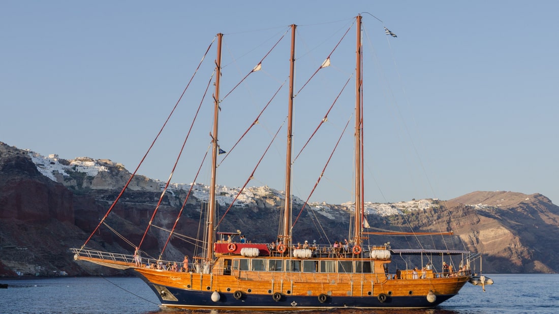
A Santorini boat tour sails the flooded caldera of the island on a catamaran, a tall wooden ship, a sailing yacht or a private motorboat, past the volcanic islands at its centre, the red and white beaches of the south and the cliffs below Oia at sunset. This post covers what a Santorini boat tour includes, the boats, the ports they leave from, the caldera, Nea Kameni and Palea Kameni, Thirasia, the beaches, the sunset, swimming stops, food and wine on board and the best season. It is one of the boat tours in Greece on Greece VIP.
Each section ends with a Santorini boat tour that can be booked online.
What does a Santorini boat tour include?
A Santorini boat tour sails the flooded caldera of the island, past the lava islands of Nea Kameni and Palea Kameni, the island of Therasia and the cliff villages of the west coast. Catamarans, sailing yachts, caiques and motorboats run these routes by day or at sunset.
The Santorini caldera is mostly submerged, so the visible part is a circular island group. The main island, Therasia and Aspronisi make up the periphery, while the Kameni islands stand at the centre. The International Union of Geological Sciences describes the caldera as one of the largest in the Mediterranean Sea, formed by Plinian eruptions. Every Santorini boat tour sails on the water inside this ring.
Three kinds of route cross this water. The caldera route stays inside the ring, the volcano route heads for the lava islands at the centre, and the sunset route ends below Oia, which looks out over the caldera at sunset. A Santorini catamaran cruise covers one type of boat, while a Santorini boat tour can also run on a sailing yacht, a caique or a motorboat.
Boats have worked these waters for centuries. In 1810, Santorini possessed 32 ships, the seventh largest fleet in Greece. Oia built its wealth on a merchant fleet that plied trade in the Eastern Mediterranean, until steam and the concentration of shipping at Piraeus collapsed that trade. Magazines and travel sites now rank Santorini as the world’s top island. The same waters carry every Santorini boat tour today.
- Caldera route: A Santorini boat tour sails inside the ring of islands.
- Volcano route: Tour boats leave Skala for Nea Kameni.
- Sunset route: Oia faces the sunset over the caldera.
A Santorini boat tour therefore joins three settings: a ring of islands, a flooded volcanic crater and a coast of cliff villages. Day routes cross the water to the lava islands near the centre. Evening routes face Oia, where a Naval Maritime Museum keeps models of old and new Thiran ships and shows how closely the village is tied to the sea.


Which boats does a Santorini boat tour use?
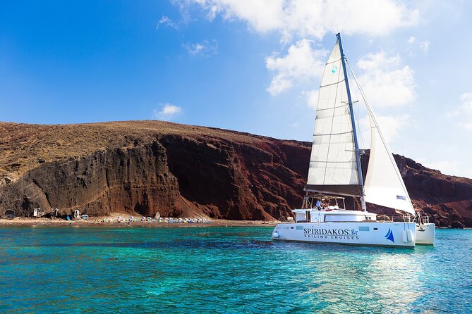
A Santorini boat tour uses catamarans with two hulls, sailing yachts driven by sails, traditional wooden caiques and motorboats driven by engines alone. The hull shape decides how each boat sits in the water, how far it heels and how much water it draws.
William Petty designed the first documented twin-hulled sailing craft in Europe in 1662. The design then stayed relatively unused in the West for almost 160 years. A cruising catamaran does not heel more than 10 to 12 degrees, and it carries two engines and two rudders. The boat takes up more space in a marina. A Santorini boat tour on a catamaran therefore combines a level deck with a larger berth in port.
The history of sailing yachts begins in Europe at the start of the 1600s, with a pleasure vessel built for the son of an English king. Wood was the traditional material for the hull, and fibreglass became prevalent in the 1960s. A cruising yacht carries an auxiliary diesel engine, so on a Santorini boat tour the sails give the primary propulsion and the engine supplements them.
The widest part of a caique lies toward the stern, and the bow is long and sharp. Wooden steering arms at the stern are sometimes carved in the shape of a dog or other animal face. The name of the boat is painted or carved on a tablet on the planking below the bow. Builders work from craft and memory, not from plans, and plastic and fibreglass boats now supersede the wooden type.
Only a motor drives a motorboat, never wind or human power. Gottlieb Daimler and Wilhelm Maybach tested the earliest petrol-engined boat on the Neckar River in 1886. The Priestman Brothers of Hull, England, began trials of the first successful motor boat in 1888, with a kerosene engine. A Santorini boat tour on a motorboat crosses the caldera on engine power alone.
- Catamaran: Two hulls carry two engines and two rudders.
- Sailing yacht: Sails drive the boat, and a diesel engine assists.
- Caique: Its broadest part lies toward the stern, under a long, sharp bow.
- Motorboat: Wood, reinforced fibreglass or metal forms the hull.
The four boats come from different eras: pleasure yachts under sail from the 1600s, the first European twin-hulled sailing craft from 1662 and the first petrol-engined boat from 1886. The caique grew out of the fishing of the Ionian and Aegean seas. Each of them carries a Santorini boat tour across the same caldera.
Where does a Santorini boat tour depart from?
A Santorini boat tour departs from Skala, the old harbour under Fira, and from the bays below Oia, Armeni and Ammoudi. Vlychada holds a fishing port, and Athinios serves as the ferry port, 10 km south of the capital.
Boats on tour routes to Nea Kameni and the other destinations of Santorini leave from Skala, the old port below Fira. Large cruise ships anchor in the small harbour between Nea Kameni and Fira, so the lava island lies ahead of the port and the capital stands behind it. A Santorini boat tour from Skala therefore begins with the lava island in view.
Ormos Armeni, a small fishing village below Oia to the south, is reached by steps. The bay was an important centre of boatbuilding, and small repairs now take place on a single wharf. Excursion boats for trips around the island leave from Armeni. Ammoudi, on the western side of the town, has a ferry connection to Therasia. A Santorini boat tour on the caldera is available from either Oia or Fira.
The harbour at Vlychada appears under the name Vlychada Fishing Port. The Tomato Industrial Museum there records a factory that once pumped sea water in from the nearby bay, and the tsunami of 1956 reached 2 metres at Vlychada. Regular passenger ferries to Rhodes, Crete, the Cyclades and Piraeus call only at Athinios, the main ferry port. A zigzag road climbs the steep volcanic cliffs around it.
- Skala: Tour boats leave the old harbour under Fira.
- Armeni and Ammoudi: Excursion boats and the Therasia ferry serve Oia.
- Vlychada: A fishing port and an industrial museum share the place.
- Athinios: The ferry port stands 10 km south of the capital.
Skala serves the trips from Fira, Armeni and Ammoudi serve Oia, Vlychada keeps a fishing port, and Athinios handles the ferries. The harbours are older than the trips: the Oia of ancient Greece was one of the two harbours of ancient Thera, in the southeast where Kamari now stands. Today a Santorini boat tour sets out from harbours that served fleets and fishing boats long before tourism.
What does a Santorini boat tour show of the caldera?
A Santorini boat tour shows the caldera from sea level: a mostly submerged volcanic basin measuring about 12 by 7 km, walled by 300 m cliffs on three sides, with a maximum depth of 385 m and whitewashed villages along the rim.
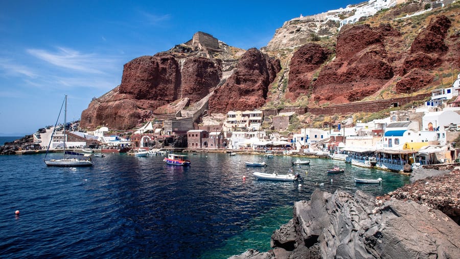
The inner caldera wall rises straight out of the water. Its fall exceeds 300 m at the highest point, and its face shows solidified lava in layers piled one over another. The main towns sit on the crest. A Santorini boat tour meets this steep face. Beyond the crest the ground slopes outward and downward to the outer perimeter, where the beaches are smooth and shallow.
Thera is built on the remains of a smaller non-volcanic island, about 9 by 6 km, made mainly of metamorphosed limestone and schist that date from the Alpine orogeny about 60 million years ago. Those older rocks show on the inner side of the wall, along the stretch from Cape Plaka to Athinios. A Santorini boat tour passes a cliff in which young volcanic layers rest on far older rock.
The record shows twelve or more large explosive eruptions, and four or more of them built calderas. During the last 360,000 years, two major cycles each ended in two caldera-forming eruptions. The erupted material runs from basalt to rhyolite, and the rhyolite goes with the strongest blasts. A Santorini boat tour sails inside the newest basin, which the Minoan eruption created about 3,600 years ago.
- Colour: House façades on the rim are whitewashed or limewashed, with volcanic ashes used as colours.
- Cellars: Rooms called hypóskapha are dug sideways or downwards into the pumice.
- Wreck: A cruise ship sank in the caldera after it ran aground in 2007.
The rim carries a record of the 1956 earthquake. The worst damage fell on the western side along the caldera edge. At Oia, the ground gave way and parts of it fell into the sea. The underground dwellings along the ridge were evacuated, because unstable soil made the damage worse. Much of the population emigrated to Piraeus and Athens. A Santorini boat tour looks up at a rim that people rebuilt.
Which volcanic islands does a Santorini boat tour visit?
A Santorini boat tour visits Nea Kameni and Palea Kameni, the two lava islands close to the middle of the caldera. Nea Kameni is the younger island, with an active crater, and Palea Kameni has a hot spring where the water is warmer than the sea.
Nea Kameni, whose name means New Burnt, is the younger of the two islands that a Santorini boat tour visits. In 1707 an undersea volcano breached the sea surface there, and that vent became the current centre of activity in the caldera. The twentieth century brought three more eruptions, and the last, in 1950, pushed out a lava dome. The island is nearly round and covers 3.4 square km.
Palea Kameni, whose name means Old Burnt, sits south-west of Nea Kameni and formed from 197 BCE to 47 CE. A series of eruptions piled up pumice and dacite lava to build the island. It is private land, inhabited until it was bought in 1899 and sold again in 1975. Because it lacks a good harbour, recreational watercraft rarely stop there, and tourists on a Santorini boat tour can swim across from nearby Nea Kameni.
Thermal water around the volcano runs warmer than the surrounding sea, and Palea Kameni has a hot spring. On Nea Kameni, steam and carbon dioxide rise from the active crater, and a sulfur vent named Jorgo, after King George I of Greece, is active. A Santorini boat tour with a stop at the islands is a different trip from a Santorini volcano tour, which is built around the walk up the 130 m crater.
- Ancient name: Writers of antiquity called the island that rose in 197 BCE Hiera.
- Plants: A carpet of red succulents covers the thin soil of Nea Kameni in summer.
- Animals: A herd of goats lives on Palea Kameni, along with a single inhabitant.
Roman writers recorded the first appearances. Cassius Dio wrote that in 47 CE a small islet, until then unknown, appeared close to Thera. Pliny the Elder reported the emergence of another island on 8 July, 19 CE. The next recorded activity came in 726, when pumice and lava erupted underwater, and new activity was reported in the 1570s. A Santorini boat tour therefore visits islands with a written record that runs back to Roman times.
What does a Santorini boat tour show on Thirasia?
A Santorini boat tour shows Thirasia, the second largest island of the Santorini group, across the caldera from the main island. It lies to the north-west of Nea Kameni, covers 9.3 square km and counted 249 residents in the 2021 census, spread over five villages.
A ring of land once closed the caldera almost completely, with a single gap between the islet of Aspronisi and Thera. The Minoan eruption broke that ring at two more points, one on each side of Therasia, and the sea now flows through the channels it opened. Thera is the largest island by far, and Aspronisi covers only 0.1 square km. A Santorini boat tour looks at Thirasia as a surviving part of that old ring.
Manolas is the largest of the five villages, with 140 residents, more than half of the island’s population. Potamos follows with 74, Agia Eirini has 28, Agrilia has 5 and Ormos Korfou has 2. Santorini itself had a population of 15,480 in the 2021 census. A cable connects the electrical distribution systems of Thirasia and Santorini. A Santorini boat tour crosses to an island where the villages hold between 2 and 140 residents.
According to George Cedrenus, a vapour rose for days in the summer of 727 from the depths of the sea between the islands of Thera and Therasia. The whole place burned like fire, and the vapour thickened little by little and turned to stone. The emperor Leo III the Isaurian read the event as a divine omen against the worship of icons.
- Area: The land area is 9.299 square km, set against 75.8 square km for the main island.
- Municipal unit: Thirasia falls within the municipal unit of Oia.
- Community: Oia is a community of the municipality, made up of the local subdivisions of Therasia and Oia.
The 2011 local government reform merged the old municipalities of Oia and Thera into the municipality of Thira. It covers all settlements on Santorini and Therasia, which are its two inhabited islands, and its total land area is 90 square km. A Santorini boat tour therefore crosses between two parts of a single municipality, while the lava islands sit in the sea between them.
Which beaches does a Santorini boat tour reach?
A Santorini boat tour reaches the Red Beach near Akrotiri, the White Beach and Black Beach named for their rock, the black pebbles of Kamari on the south-east coast, and the two pebble beaches of the islet of Aspronisi inside the caldera.
The Red Beach lies near Akrotiri. The earliest eruptions of Santorini took place on the Akrotiri Peninsula between 650,000 and 550,000 years ago, and a large share of them were submarine. Black and red crushed rock from the caldera makes up the sand, and oxidised iron explains the red. Since 2013 slides have blocked sections of the shore, and a Santorini boat tour looks at the red sand from the water.
Aspronisi lies inside the caldera and has no inhabitants. Its name means White Island, after the white pumice that forms part of it. The islet began as a submarine volcano, and the Minoan-era eruption pushed it above the surface. Dense layers of pumice and tephra then covered it and hardened into pale deposits. The submerged outer edge of the caldera joins Aspronisi to Therasia and Santorini. A Santorini boat tour passes a coast of pumice, tephra and lava.
Kamari has the longest beach on Santorini, a stretch of black pebbles. It runs from Monolithos to the foot of Mesa Vouno, a mountain about 400 metres high and the second highest peak on Santorini. A Santorini boat tour along the south-eastern part of the island reaches Kamari, 8 km from Fira. It takes its name from a small arch that survives from an old customs house built between 1537 and 1650. Ancient Oia, one of the two harbours of ancient Thera, stood where Kamari lies today.
- Names: The exposed geological layer sets the sand colour, and the colour names the Red, Black and White beaches.
- Aspronisi: Two pebble beaches and a small anchorage lie below steep cliffs that make landings difficult.
- Perissa: Beaches face the Aegean at the village, which stands 13 km from Fira beside the Messa Vouno rock.
Beach colour changes with the rock around the coast. Red sand lies near Akrotiri, black pebbles line Kamari, and white pumice marks Aspronisi. The base of that islet is black lava rock, and migratory birds nest on it. A Santorini boat tour therefore passes three kinds of shore on one island group: sand, pebbles and pumice cliffs.
How does a Santorini boat tour show the sunset?
A Santorini boat tour shows the sunset from the water below Oia, whose houses look out over the caldera, and from the western tip near Akrotiri, where a lighthouse built in 1892 stands at the westmost point of the island.
Oia lies along the northern edge of the caldera, and its houses and restaurants stand in niches carved into the slope on the seaward side. The houses are painted with white lime water so that rainwater runs down them and can be collected. The village has much longer sunlight hours than Fira and looks out over the caldera toward the sunset. A Santorini boat tour sees the white slope from below as the light fades.
Oia grew as a mariners’ town in the late 19th and early 20th centuries, when seaborne trade across the Mediterranean ran along the route between Russia and Alexandria. A wharf stood in the bay of Armeni, below the village to the south-west. The arrival of steam and the concentration of shipping at Piraeus then collapsed the seagoing trade, and wars, economic depression and overexploitation of fish resources weakened the economy. A Santorini boat tour now sails the water that once carried the ships of Oia.
Akrotiri Lighthouse stands at the far west of Santorini, on the westmost tip beyond the village of Akrotiri. The French Lighthouse Company built it in 1892. The tower is 10 metres high, and its light sits 100 metres above the sea. The headland is known for its sunset views, and a Santorini boat tour sees the tower from the water at the end of the island.
- Fuel: The light first ran on oil, and the lighthouse was electrified in 1983.
- Range: The beam carries 24 nautical miles.
- Automation: The lighthouse became fully automated in 1988.
Two points frame the sunset coast. Oia stands on the north-western edge of the island, and Akrotiri Lighthouse stands on its westmost tip. Both look out over water, one across the flooded caldera and the other across the Aegean Sea. A Santorini boat tour shows the white houses of the village and the tower on the headland from sea level.
Where does a Santorini boat tour stop to swim?
A Santorini boat tour stops to swim near Nea Kameni and the hot spring of Palea Kameni inside the caldera, and off the darker lava beaches of the coast, where the dark rock absorbs heat and the water turns significantly warmer.
Palea Kameni is the smaller of the two Kameni islands and holds a hot spring. Thermal water at the volcano is commonly warmer than the sea around it. The island has no good harbour, so recreational watercraft keep away from its shore, and tourists swim to it from Nea Kameni. A Santorini boat tour therefore treats the warm water of Palea Kameni as a swim from the larger island.
Summer temperatures of 19 to 24 degrees Celsius apply to the top 40 to 50 metres of the Aegean Sea. Intermediate water lies below it, down to a depth of 200 to 300 metres, at 11 to 18 degrees Celsius. The caldera of Santorini reaches a maximum depth of 385 metres. A swimmer at a Santorini boat tour stop therefore floats in a thin warm layer above deep, cooler water.
The Aegean Sea supplies grouper, sea bass, seabream, sardines and mackerel to Greek fishing boats. In the southern Aegean, where Santorini lies, boops dominate the catch of open-water fish, and pickerel (Spicara smaris) dominate the catch of bottom-living fish. No other country in Europe has a bigger fishing fleet than Greece. A Santorini boat tour swims in the same southern waters as those fishing boats on the same day.
- Dark lava: Lava holds heat, and the water off the darker beaches is significantly warmer.
- Fishing: Fish are the second-largest agricultural export of Greece.
- Grouper and seabream: Overfishing and habitat destruction threaten both fish.
Each swimming stop lies in the southern Aegean Sea, which covers about 214,000 square kilometres and reaches its greatest depth of 2,639 metres west of Karpathos. Santorini stands 120 km north of Crete, and its volcanic centre has the highest activity in the South Aegean Volcanic Arc. A Santorini boat tour swims in a deep sea beside an active volcano.
What food and wine does a Santorini boat tour serve?
A Santorini boat tour serves Greek food from the Mediterranean diet, which Greece added to the UNESCO Intangible Cultural Heritage Lists in 2013. The drinks list centres on Assyrtiko, the dry white grape of the island, and Vinsanto, its sweet amber dessert wine.
Food cooked on board a Santorini boat tour follows the Greek table. The horiatiki salad, the village salad, combines pieces of tomatoes, cucumbers, onion, feta cheese and olives, dressed with oregano and olive oil. Cheeses form a long list in Greek cuisine, headed by Feta, Kasseri, Graviera and Manouri, and feta topped with olive oil and oregano also serves as an appetizer.
Seafood fills the appetizer list of Greek cuisine. Sardeles psites are roasted sardines, and htapodi sti schara is octopus on the grill. Kalamarakia tiganita are fried squid slices with a lemon wedge on the side. Garides saganaki are shrimps sautéed, deglazed with ouzo, doused in tomato sauce and topped with crumbled feta. Marides tiganites are small whitebait fish, floured and fried.
The white grape Assyrtiko is indigenous to Santorini, where arid, ash-rich volcanic soil carries the vines, and it also grows on Paros, another Aegean island. Island bottles taste concentrated, with briny-fresh salinity, because the vines give low yields. Winemakers also blend the grape with Sauvignon blanc, Sémillon and Malagousia, and Retsina producers blend it with the less-acidic Savatiano grape.
- Strength: Santorini Assyrtiko averages 13.5% alcohol by volume.
- Vinsanto: The dessert wine carries overtones of nuts, honey and tea.
- Vine training: Kouloura vines kept a less-stressed water status than VSP vines in a Santorini study.
Wine and the sea are linked in Santorini’s past. Under Venetian rule, Santorini wines reached markets in the Mediterranean and in Europe, and buyers prized them because sweetness and high alcohol levels helped the wine withstand long sea voyages. A glass on a Santorini boat tour belongs to a trade that once left the island by ship, and Greek cooks flavour dishes with cumin, bay laurel leaves, dill, garlic and oregano.
When is the best season for a Santorini boat tour?
A Santorini boat tour sails in the dry months, when Aegean surface water reaches 19–24 °C. The meltemi, a dry northerly wind, blows between late spring and mid-September, so early spring and autumn trips fall outside that period, while summer trips depend on the day.
The meltemi sets the rhythm of the sailing year. Etesians run northeasterly to northerly across the northern Aegean and northerly across the central Aegean. Over the southern Aegean, which holds Santorini, they blow from the northwest. Strength changes within a day: the etesians blow hardest in the afternoon and ease at night, and a single spell can run for days without a pause.
Sea temperature follows the seasons on a Santorini boat tour. The Aegean surface water forms a layer 40–50 metres thick, and its summer temperatures sit at 19–24 °C. Winter readings span 8 °C at the northern end and 13 °C at the southern tip of the sea. The open water also keeps summer air temperatures in the Aegean below those of arid or semi-arid climates.
The Cretan and Peloponnesian mountains shield Santorini, which sits in their rain shadow, and rivers do not cross the island. In the high summer temperatures it holds very little surface water, so desalination plants now provide running water for residents that is non-potable. Hot semi-arid conditions mark the climate, with a dry summer and a relatively wetter winter. Water has been scarce on the island at least since the eruption.
- Origin: Low pressure in the Eastern Mediterranean region enforces the etesian winds in summer.
- Ferries: Up to 5 direct ferry crossings link Piraeus with the island in summer, and a daily service runs all year.
- Visitors: Annual tourist numbers on Santorini are estimated at 2 million, and tourism peaks in summer.
Each season brings a different set of conditions. Summer brings the warmest sea and dry weather, together with the etesian winds. Early spring and autumn fall outside the etesian period, so a Santorini boat tour then meets no meltemi. Winter brings the relatively wetter months and the coolest surface water of the year.
What do travelers ask about a Santorini boat tour?
A Santorini boat tour crosses the southern Aegean Sea, and the island sits about 200 km off the Greek mainland, to its southeast. The Aegean covers about 214,000 square kilometres, and its greatest depth, 2,639 metres, lies west of Karpathos.
Does a Santorini boat tour cause seasickness?
A Santorini boat tour can cause seasickness, since the rocking motion of a craft brings it on. Symptoms include nausea, dizziness and cold sweat. Fog worsens it, and seeking refuge below decks is the greatest contributor, because passengers there cannot relate themselves to the boat’s surroundings. Keeping the head still and focusing on the horizon eases it.
Can a Santorini boat tour run as a private charter?
A private Santorini boat tour follows the yacht charter model, which means renting a sailboat or motor yacht. Crewed charters carry a captain and professional crew, and skippered charters add a professional skipper. Bareboat charters leave navigation to the client, and the bulk of companies ask for a licence. Gulets hold 6 to 16 guests.
Can children join a Santorini boat tour?
Children can wear flotation gear made for them on a Santorini boat tour. Personal flotation devices come in sizes for different body weights, and buoyancy aids exist for children and youth. Adjustable understraps between the legs keep the vest from riding up in the water, and designs cover wearers from infants to adults.
What to bring on a Santorini boat tour?
Sun protection matters on deck. Sunscreen of SPF 30 or above prevents UV damage, and broad-spectrum products protect against both UVB and UVA rays. Water-resistant sunscreens first appeared in 1977, and sunscreen is reapplied after time in the water, with attention to the ears and nose. Minimizing UV damage is especially important for children and light-skinned individuals.
What happens when wind cancels a Santorini boat tour?
Wind strength decides whether a Santorini boat tour sails. On the Beaufort scale, which Francis Beaufort of the Royal Navy devised in 1805 to rate wind by sea conditions, etesian winds reach force 7–8, and they keep ferries between the islands, along with certain yachts, in port. Shipping forecasts still use Beaufort terms to describe such winds.
Can cruise passengers take a Santorini boat tour?
Cruise passengers land at Skala, where ships anchor offshore and local boatmen ferry passengers ashore. Santorini has two ports: Skala, the Old Port, and Athinios, the Ferry Port. Fira can be reached from Skala by cable car, by foot or by donkeys and mules.
Featured photo: Norbert Nagel, CC BY-SA 3.0, via Wikimedia Commons.