
A Zakynthos island tour drives around Zakynthos in the Ionian Sea, from the rebuilt harbour town and the castle hill of Bochali to the mountain villages, the cliff-top view over Navagio, the monastery of Anafonitria and the cliffs of Keri. This post covers what a Zakynthos island tour includes, Zakynthos town, Bochali and the castle, the Navagio viewpoint, the mountain villages, Keri, Anafonitria, the west coast viewpoints, Laganas bay, the history and culture of the island and the best season. It is one of the tours in Greece on Greece VIP.
Each section ends with a Zakynthos island tour that can be booked online.
What does a Zakynthos island tour include?
A Zakynthos island tour covers the island on land, by bus, jeep or private car. The route links Zakynthos town, the hill above it, the villages and the viewpoints, with mountains in the west and plains in the east.
Zante is another name for Zakynthos, an island of the eastern Ionian Sea in Greece. Venetian rule lasted until 1797, and the Venetians called the island Fiore di Levante, meaning Flower of the East. The 2021 census counted 40,508 people there. A mountainous plateau fills the west, while the east is a fertile plain broken by isolated hills. A Zakynthos island tour crosses both halves.
The name belongs to Greek myth. The island was said to be named after Zacynthus, the son of the Arcadian chief Dardanus, and it was called Hyrie before that. Homer mentions Zakynthos in the Iliad and the Odyssey. In the Odyssey, 20 nobles from the island are among the 108 suitors of Penelope. A Zakynthos island tour therefore visits an island whose record reaches back to Homer.
Boat trips are separate excursions. The Navagio shipwreck tour sails to a cove below high cliffs on the island’s northwest coast, and only boats reach it, while a land tour keeps to the roads. The Blue Caves and the turtle trips in Laganas Bay also run by sea. A Zakynthos island tour by land covers the town, the villages and the viewpoints instead.
- Bus tour: A Zakynthos island tour by coach crosses the eastern plain, where olive oil, currants, grapes and citrus fruit are the principal products.
- Jeep tour: A jeep climbs into the mountainous western half of the island.
- Private car tour: A private car follows a route set for one party, linking the town and the monasteries.
Zakynthos is a separate regional unit in the Ionian Islands region and has one municipality. The seat of administration is Zakynthos town, the island’s capital. The capital is also the first stop of a Zakynthos island tour, so the route begins there, with the main square and the patron saint.


What does a Zakynthos island tour see in Zakynthos town?
A Zakynthos island tour sees Solomos Square, the church of Saint Dionysios and the harbour front in Zakynthos town. The town links a national poet, the island’s patron saint and a rebuilding that followed the earthquake of 1953.
Solomos Square is the main town square, and it holds the statue of the poet Dionysios Solomos. Solomos was born on Zakynthos in 1798 and is considered the national poet of Greece. His Hymn to Liberty became the Greek national anthem in 1865. His family came from Crete and settled on the island in 1670, after the Ottoman conquest of Crete. A Zakynthos island tour stops here for the poet.
The church of Saint Dionysios honours the protector and patron saint of Zakynthos. Dionysios was born on the island in 1547 into a noble family from the south-east. He took the name Dionysios when he became Archbishop of Aegina and Poros in 1577, and he died in 1622. The Orthodox Church named him a saint in 1703. His feast days are 17 December and 24 August. A Zakynthos island tour includes the church for that reason.
The harbour front is the edge of the island’s main port, which stands in the capital. The town behind it is a rebuild, and a Zakynthos island tour passes through it. The earthquake of 12 August 1953 left only two buildings standing in the capital, and the rest had to be rebuilt. It destroyed the district of Neochori at the town’s southern edge. All buildings have been strengthened since.
- Poet: Solomos completed the Hymn to Liberty in 1823.
- Saint: Dionysios forgave his brother’s murderer, which earned him the epithet Saint of Forgiveness.
- Town: The 2021 census counted 16,996 people in the municipal unit.
The municipal unit of Zakynthos town covers 45.79 square kilometres in the easternmost part of the island. It has six communities: Zakynthos, Ampelokipoi, Argasi, Vasilikos, Gaitani and Bochali. Bochali is the hill community above the town, and it is the following stop of a Zakynthos island tour after Solomos Square, the saint’s church and the harbour front.
Why does a Zakynthos island tour climb to Bochali and the castle?
A Zakynthos island tour climbs to Bochali because the hill stands above Zakynthos town and carries a small Venetian castle. From the top, the view covers the town, the sea and the peninsula of Vasilikos in the northeast.
Bochali is a village and a community on a hill close to the Ionian Sea coast. It lies 1 km northwest of the centre of Zakynthos town and forms part of the municipal unit of the city of Zakynthos. The community also includes the villages of Akrotiri and Kydoni. The hill is one of the isolated hills in the eastern plain, so a Zakynthos island tour reaches it by a short climb out of the town.
The Venetian castle above Bochali is small. Venice took Zakynthos in 1482, when the Venetian governor of Methoni dislodged Antonio Tocco and his Catalan mercenaries. The island stayed in Venetian hands until the Venetian Republic fell in 1797. The castle therefore belongs to the long Venetian period, and a Zakynthos island tour climbs to the hill for that history.
The account of the war of 1499 names the Castle of Zakynthos. The Sultan’s representatives had protested to the Venetian ambassador in Constantinople about its reconstruction. The provveditore Nicolo Ferro wrote to the Senate three times in 1499 about the Ottoman threat and asked to spend money on strengthening the fortifications. Work on the castle continued, and Moro Bianco was appointed to lead the forces that guarded it.
- Position: Bochali lies 1.5 km east of Gaitani, another community of the same municipal unit.
- Defenders: 500 stradiotes under the leadership of Petros Bouas protected the island against the Ottomans.
- Garrison: After the Ottoman raid of 5 November 1479, a small garrison stayed in the Castle.
The island’s history also records the lion banner of St Mark hoisted on the Castle. Stradiotes and islanders twice defeated the Ottoman forces in battle around the Castle and the town below. The castle and the town appear together in those accounts, which is why a Zakynthos island tour climbs the hill to look down on both and on the sea.
What does a Zakynthos island tour see from the Navagio viewpoint?
A Zakynthos island tour sees Navagio from the high ground above the cove, looking down on the exposed bay, the cliffs that wall it in and the wreck on the beach. The cliffs isolate the cove from the land, so only boats reach the sand.
Navagio, known in English as Shipwreck Beach, is an exposed cove on Zakynthos. The wreck is the coaster MV Panagiotis, which went aground in a storm with bad visibility in October 1980, and the hull is still buried in limestone gravel. The spot is a tourist attraction on the northwest of the island, and a Zakynthos island tour views it from the cliff top.
The cliffs above Navagio stand in the western half of Zakynthos, a mountainous plateau, while the east is a fertile plain. Steep cliffs line the southwest coast. Zakynthos is shaped like an arrowhead, with its tip, Cape Skinari, pointing northwest, on the same side as Navagio. A Zakynthos island tour that climbs toward the viewpoint leaves the densely populated east behind.
Roads link this western side to the capital. Of the 20 provincial roads on the island, Provincial Road 20 serves as the main route in the west, and Provincial Road 6 goes from the capital up to Volimes. The network is dense in the flat east. A Zakynthos island tour follows these routes from the capital toward the cliffs above the cove.
- Fame: The beach is famous and photographed across the world, and thousands of people visit it every year.
- Screen: Descendants of the Sun, a television drama from Korea, used the location, and interest among Chinese and Korean tourists surged.
- Old name: Agios Georgios, after Saint George, was the original name of the cove.
Rock has fallen from these cliffs twice in recent years. A collapse in 2018 closed the beach for a time, and a landslide followed in September 2022, after a magnitude 5.4 earthquake between Kefalonia and Zakynthos. After a safety review on 8 March 2023, OASP, the earthquake protection organization, advised a ban on access, with boats still allowed near. A Zakynthos island tour keeps to the cliff-top view.
Which mountain villages does a Zakynthos island tour visit?
A Zakynthos island tour visits the mountain villages of the western hills, among them Volimes, Exo Chora and Maries in the former municipality of Elatia on the northwest side of the island, and adds Koiliomenos, a village southwest of Zakynthos town.
Elatia lies in the northwest of Zakynthos. The former municipality joined the single municipality of the island in the 2011 reform and is its largest municipal unit. Six communities make it up: Volimes, Anafonitria, Ano Volimes, Exo Chora, Maries and Orthonies. Volimes was the old municipal seat. A Zakynthos island tour in these hills moves from one community to the next.
Volimes stands in the mountainous northwest, 1 km west of Ano Volimes. Its community holds five villages, Korithi, Varvara, Askos, Elies and Agios Nikolaos, and the uninhabited islet of Agios Andreas. Korithi lies around 9 km northeast of Volimes, near the northwestern tip of the island, and had 39 inhabitants in 2021. A Zakynthos island tour in Volimes is 7 km from Cape Skinari.
Exo Chora sits near the rugged west coast, 2 km south of Maries and 19 km west of Zakynthos town. Its community has two villages, Exo Chora and Kampi. Maries is a mountain settlement named after Mary Magdalene and Mary of Klopas. Both belong to Elatia and stand in the hills of the west, away from the eastern plain and its sandy beaches.
- Church: A church of the 15th century with three aisles stands in Maries and honours Mary Magdalene.
- Tradition: Stories tell that Mary Magdalene anchored at Porto Vromi to preach the gospel, and a rock on the shore shows a footprint believed to be hers.
- Koiliomenos: The settlement, also known as Agios Nikolaos, lies 11 km southwest of the town and had 333 inhabitants in 2021.
The earthquake of 12 August 1953 struck these villages. Volimes, Keri, Machairado and Lithakia all suffered great damage, and all buildings on Zakynthos were strengthened afterwards. In 2006 the island recorded 366 of its 507 births in rural areas. A Zakynthos island tour in the hills sees villages whose buildings have been strengthened since 1953.
What does a Zakynthos island tour see at Keri?
A Zakynthos island tour sees Keri, a southern village built on a hillside near the Ionian Sea, and the Keri cliffs near it, which rise over 300 metres from the water and carry a lighthouse built in 1925.
Keri is a village and a community in southern Zakynthos, set on a hillside near the shore. Three villages belong to the community: Apelati, Limni Keriou and Marathias. Zakynthos reaches its southernmost point at Cape Marathia, which lies within the community. Keri lies 6 km south of Lithakia and 15 km southwest of the capital, so a Zakynthos island tour finds hills and sea together.
The Keri cliffs stand near the village. They rise over 300 metres from the Ionian Sea and are known for their sunset. A lighthouse 7 metres tall sits on top of them, and it dates from 1925. A Zakynthos island tour on the cliff top looks out over the sea, and the western shore running north to Skinari carries rock formations that include arches.
Keri also holds a place in ancient history. The Athenian commander Tolmides made an alliance with Zakynthos in the First Peloponnesian War, between 459 and 446 BC, and Athens gained a source of tar. Tar protected ship planking better than pitch, which is made from pine trees. The Athenian fleet needed protection from rot, decay and the teredo, so the new tar was valuable.
- Road: The island’s main road, EO35, ends in the south at Keri.
- Anchorage: In late 1531 ships of Charles V and Andrea Doria anchored near Keri.
- Earthquake: The village suffered great damage in the 1953 Ionian earthquake.
The tar of Keri came from the bottom of a lake, now known as Lake Keri. It was dredged up with leafy myrtle branches tied to the ends of poles and collected in pots. The tar was carried to the beach and swabbed onto ship hulls, or shipped to the naval yard at Piraeus. That tar trade gives a Zakynthos island tour a story beside the cliffs.
Why does a Zakynthos island tour stop at Anafonitria monastery?
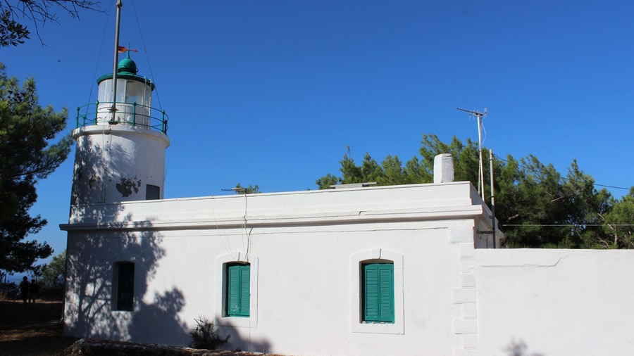
A Zakynthos island tour stops at Anafonitria monastery because the monastery in the north-west of the island is tied to Saint Dionysios, the patron saint of Zakynthos, who spent his final years there. The monastery also gave the nearby village its name.
Dionysios began his monastic life away from Anafonitria. In his early life he joined a monastery off the coast of Zakynthos, and his fellow monks encouraged him to be ordained as a priest. The Strofades islands, 44 km south-south-east of Zakynthos, hold a monastery built in 1241 where he lived among the monks. A Zakynthos island tour at Anafonitria therefore meets the place where that monastic path ended.
Dionysios was born Draganigos Sigouros and became fluent in Greek, Italian and Latin after an education by Orthodox priests. His family had roots in Venice, and its name appears in the Libro d’Oro because it fought on the Venetian side in the Venetian-Turkish wars. His nephew Marinos Sigouros was among the leaders of the Zakynthian sailors at Lepanto in 1571. A Zakynthos island tour that names the saint recalls a family bound to Venetian rule.
Dionysios decided to travel to the Holy Land by way of Athens. In Athens he was made Archbishop of Aigina, although he protested out of humility. In about 1589 the Patriarch of Constantinople made him Archbishop of Zakynthos, and he kept that post until a permanent archbishop arrived. He then returned to his island monastery. A Zakynthos island tour at Anafonitria follows that last step of his life.
- Name: Daniel was the name that he took as a monk in 1568.
- Ordination: He became a deacon two years later and a priest in 1577.
- Last monk: Father Grigorios settled on Strofades in 1976 and left in 2014 because of ill health.
The Church marks the transfer of the relics of Dionysios from Strofades to Zakynthos each year. A magnitude 6.6 earthquake in 1997 caused severe damage to the Strofades monastery, and its main tower is now in a precarious state. A Zakynthos island tour at Anafonitria thus links the final years of the saint to the island group where he lived among the monks.
Which west coast viewpoints does a Zakynthos island tour reach?
A Zakynthos island tour reaches the west coast viewpoints above the steep cliffs of the mountainous west of the island. Kampi, a village of the Exo Chora community near the rugged shore, is one of the stops on this side of Zakynthos.
Kampi is one of the two villages of the Exo Chora community, which lies near the rugged west coast. From this side of the island, a Zakynthos island tour looks out over the Ionian Sea, which connects to the Adriatic Sea in the north. The sea is an elongated bay of the Mediterranean. Southern Italy, southern Albania and the west coast of Greece bound it, and Greece holds all of its major islands.
The south-west offers a second village with sea views. Agalas stands near the south-west coast of Zakynthos, spread over hills that face the Ionian Sea. Its places of interest include the Damianos caves, the Venetian Antronios wells, the Plakaki coast, the Vau Canyon and the squares of the windmills. A Zakynthos island tour that reaches Agalas combines caves, wells and lookout points in one village.
The form of the name Agalas in widest use derives from agallio, the Greek word for rejoice. The name of the sea itself, Ionian, comes from the Greek word Ionion, and its etymology is unknown. Ancient Greek writers, Aeschylus among them, linked it to the myth of Io, who swam across the sea. A Zakynthos island tour on the west coast therefore looks at a sea with a name from myth.
- Depth: Calypso Deep, at 5,109 m, is the deepest point of the Mediterranean and lies in the Ionian Sea.
- Trench: The deep sits in the Hellenic Trench, 62.6 km south-west of Pylos.
- Earthquakes: The sea ranks among the areas of highest seismic activity in the world.
The first crewed descent into Calypso Deep took place on 27 September 1965 in a French bathyscaphe. A second crewed descent in February 2020 measured the bottom at 5,109 m and confirmed that the 1965 mission had reached the deepest point. A Zakynthos island tour on the west coast therefore faces a sea with a deep trench below it.
What does a Zakynthos island tour see at Laganas bay?
A Zakynthos island tour sees Laganas bay in the south of the island from the shore, where the National Marine Park of Zakynthos protects the loggerhead turtle nesting beaches. The turtles spend their lives at sea and come ashore only to nest.
The village of Laganas stands on the south-eastern coast of Zakynthos, in the community of Pantokratoras. Pantokratoras held the municipal seat, and the municipal unit is made up of six communities: Agalas, Kalamaki, Keri, Lithakia, Mouzaki and Pantokratoras. A Zakynthos island tour that reaches the bay by road therefore crosses ground that belongs to the same unit as Keri, the cliff village in the south-west.
Laganas was once a calm fishing village. Since the mid-1980s, Zakynthos has drawn tourists aged 18 to 30, and Laganas is now the island’s largest resort, with over 100 bars and clubs. The village is busiest in June, July and August, the same months in which loggerheads come to the bay to lay eggs. A large part of Laganas is a national park.
The turtles lay in sand above the high-tide line, in open areas or on top of dunes, close to dune grasses that camouflage the nest. The park holds on average eighty percent of the loggerhead nests of the Mediterranean. A Zakynthos island tour that visits the shore by day sees the sand, not the nesting, since the females lay their eggs after dark.
- Hatchlings: A hatchling measures about 4.6 cm and weighs about 20 g.
- Sex: Nest sand at 28 °C produces males, 30 °C gives an equal ratio and 32 °C produces females.
- Crossing: A hatchling can lose up to 20% of its body mass to evaporation on its way to the sea.
The park exists because speedboats and obstacles on the beaches put the turtles at risk. Coastal lighting and housing developments also disorient hatchlings as they emerge. On a Zakynthos island tour, the shore of Laganas bay therefore shows a coast where tourism and a protected nesting ground share the same stretch of sand.
What history and culture lie behind a Zakynthos island tour?
A Zakynthos island tour crosses an island shaped by Venetian rule, Ionian poetry and song, and the earthquake of 1953. The Venetians called the island Fiore di Levante, Dionysios Solomos wrote the verses behind the Greek national anthem, and kantades songs grew up in the same era.
The Venetians gave Zakynthos the nickname Fiore di Levante, which means Flower of the East. Their rule lasted until the Republic of Venice fell in 1797. French rule followed, then the autonomous Septinsular Republic in 1800 and a return to the French in 1807. The British seized the island in 1809, and the Union of the Ionian Islands with Greece came in 1864.
Venetian rule brought the island closer contact with Western literary trends than other Greek-inhabited areas had. The Heptanese School of poetry developed in the Ionian Islands, and Dionysios Solomos became its central figure. He was born on Zakynthos in 1798 and completed the Hymn to Liberty in 1823. Nikolaos Mantzaros set the poem to music, and its first two stanzas became the Greek national anthem in 1865.
The kantades are songs for choir and mandolins, and the repertoire developed in the Ionian Islands during Venetian rule. Choirs backed by mandolin players are common in the Ionian Islands, especially in the cities of Corfu, Zakynthos, Lefkada and Kefalonia. The Ionian school of modern Greek classical music, established in 1815, grew in the same islands, and Mantzaros belonged to it. The same Venetian influence shaped both the poetry and the music.
- Earthquake of 1953: A 7.3-magnitude earthquake struck on 12 August 1953 and destroyed the majority of the island’s buildings.
- Rebuilding: All buildings have since been strengthened to protect against further tremors.
- Poet from Italy: Ugo Foscolo, born on Zakynthos, wrote the sonnet “A Zacinto” dedicated to the island.
The record on Zakynthos begins long before Venice. Homer mentions the island in the Iliad and the Odyssey, and in the Odyssey 20 nobles from Zakynthos appear among the 108 suitors of Penelope. Rome finally conquered the island in 191 BC. A Zakynthos island tour therefore follows a place with a written history that runs from the age of Homer to the rebuilding after 1953.
When is the best season for a Zakynthos island tour?
A Zakynthos island tour follows the weather of a hot-summer Mediterranean climate: hot, dry summers and mild to cool, rainy winters. Spring and autumn lie between those two seasons, so the calendar decides how much heat and rain the hill roads of the island meet.
Zakynthos has a hot-summer Mediterranean climate, classed as Csa. The island receives sizeable amounts of precipitation in winter, while hot, sunny weather dominates the summers. The average annual temperature stands at around 18.5 degrees Celsius, and humidity stays fairly high throughout the year, even in summer. A Zakynthos island tour in any season therefore meets damp air as well as sun.
The island splits into two kinds of terrain. The western half is a mountainous plateau, and steep cliffs form much of the southwest coast. The highest point, Vrachionas, stands at 758 metres. The eastern half is a densely populated, fertile plain with long sandy beaches. A summer Zakynthos island tour pairs the heat with mountain terrain in the west, while the eastern plain offers level ground.
The mild Mediterranean climate and the plentiful winter rainfall endow the island with dense vegetation. The principal agricultural products of the island are olive oil, currants, grapes and citrus fruit. Freshwater resources on the island are limited, even though winter rainfall is plentiful. A Zakynthos island tour crosses this farmland and vegetation in every season of the year, from the coast to the western plateau.
- Summer: Tourists visit the wide sandy beaches of the northern and eastern shores in the summer months.
- Winter: The rainy season brings sizeable amounts of precipitation to the island.
- Spring and autumn: These seasons lie between the hot, dry summer and the mild, rainy winter.
The position of the island adds context for the choice of season. Zakynthos lies in the eastern part of the Ionian Sea, around 20 kilometres west of the Peloponnese mainland. Kefalonia lies 15 kilometres to the north. A Zakynthos island tour in any season therefore takes place on a sea-facing island close to the mainland.
What do travelers ask about a Zakynthos island tour?
A Zakynthos island tour raises questions about boats, roads, distances and turtles. The answers rest on island facts: Navagio and the blue caves need boats, the road network is dense in the east, and the whole island measures about 40 by 20 kilometres.
Can a Zakynthos island tour include a boat tour?
Land and boat tours cover different places. Navagio beach is accessible only by boat, and the blue caves around Cape Skinari are accessible only by small boats. A network of roads covers the island. A Zakynthos island tour on land and a boat tour on the sea therefore complete each other.
Does a Zakynthos island tour show Navagio from above?
Navagio beach is a cove on the northwest shore, isolated by high cliffs. Only boats reach its sand. The cliffs rise above the cove, so a Zakynthos island tour by road reaches the cliff tops, not the beach at sea level.
Which roads does a Zakynthos island tour follow?
The road network is dense in the flat eastern part of the island. The EO35 is the main road and runs between the capital and Keri in the south. Provincial Road 6 runs from the capital to Volimes in the north, and Provincial Road 20 is the main road of the western half.
How large is the area of a Zakynthos island tour?
Zakynthos is about 40 kilometres long and 20 kilometres wide, with an area of 405.55 square kilometres and a coastline 123 kilometres long. Only two Ionian Islands exceed it in area. The island has the shape of an arrowhead, with Cape Skinari at the tip pointing northwest.
Where do turtles fit into a Zakynthos island tour?
The Bay of Laganas is the site of the first National Marine Park and the prime nesting area for loggerhead sea turtles in the Mediterranean. Marathonissi islet, known as Turtle Island, lies near Limni Keriou. The largest resort on the island is Laganas.
Featured photo: kallerna, CC BY-SA 4.0, via Wikimedia Commons.